Kathmandu, May 19
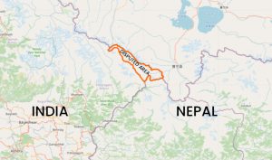
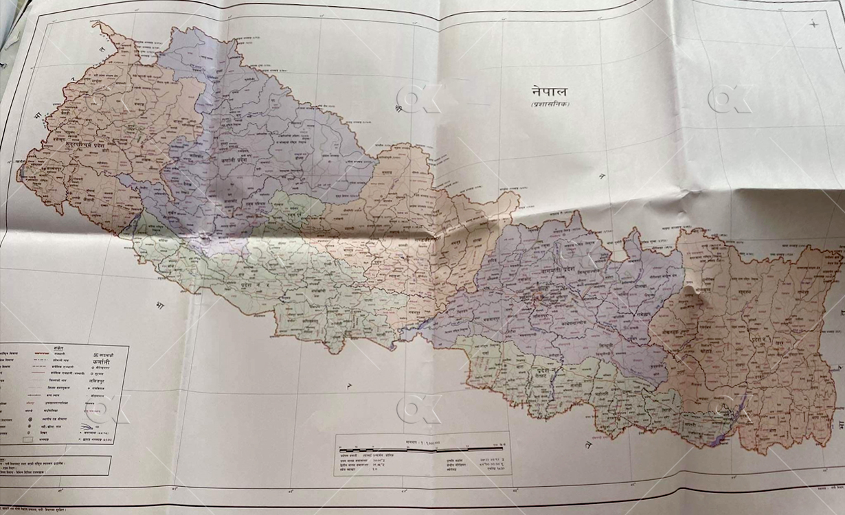
The government of Nepal on Monday has decided to issue a new political map of the country that incorporates the disputed Kalapani region up to Limpiyadhura, which India claims to be its territory.
The landmark decision comes six months after India issued its new political map incorporating the region, triggering a strong protest in Nepal. The dispute had come to the fore again earlier this month after Indian Defence Minister Rajnath Singh announced the inauguration of a link road to Manasarovar of Tibet that uses the disputed land.
Under pressure, the government in its annual policy and programme for the next fiscal year last week had assured to issue the new political map within the year. The government issued the new map in three days of the announcement.
The government spokesperson, Finance Minister Yuba Raj Khatiwada, told journalists after the cabinet meeting on Monday evening that the government would correct the maps used in other documents gradually. Minister for Land Management Padma Kumari Aryal had tabled a proposal in this regard as the ministry had already prepared the new map, but waiting for an appropriate environment to issue it.
The government also needs to amend the constitution as its schedule explains the coat of arms of the country that also shows a map, according to Khatiwada. Likewise, school textbooks will also be revised.