Curiously, it seems a humble little hill town just 135 km away, or a six-hour bus ride to the northeast of Kathmandu, never ceases to lure visitors. “I’ve been to the place four times,” shared a Newar resident of Kathmandu with me.
I met another, who seemed hung-up on driving his motorbike to the town, three years in a row. He sounded like a confirmed habitué of the town. That little quintessential but charismatic village town is Dolakha.
Travel minutiae
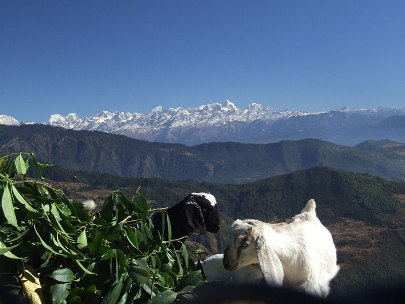
Traveling to Dolakha itself is a delight for the visitors who get the prospect of getting fleeting glances of busy highway towns such as Banepa, Dhulikhel, and Panchkhal. As the bus cruises past Dhulikhel, weather permitting, and if you happen to have a seat next to the window on the left, the north opens up to lofty snow-capped peaks towering above a deep river valley.
The bus pulls up for a routine stop at the bustling town of Dolalghat, tucked away at the confluence of two snow-fed Koshis (rivers) that have travelled down a considerable distance from the Himalayas, bounding and frolicking over huge boulders and rocks, across many a river valley—none other than, the Sunkoshi, and the Indrawati (a tributary of Sunkoshi).
The hawkers call out loudly, swarming the bus and flaunting before your window sundries from mineral water, wafer chips, and bananas to cucumbers. As the town is popular for fish, you cannot miss out on the sharp aroma of fried fish, which wafts in through the windows.
If you wish, the bus conductor can be generous enough to let you bound to one of those many roadside vendors, and grab some to savour later in the comfort of your seat. The fish, some 15 years ago, was caught from the two Koshis. Do not bet on it these days. Today, they are not.
Kholako machha
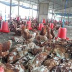
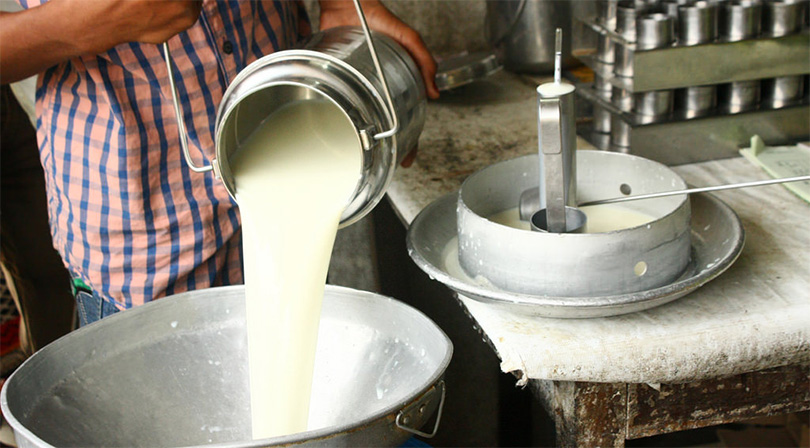
With the rapid flooding of roadside teahouses, soon, the burgeoning demand could not be met. To meet the urgency, the teahouses were supplied with pond-reared fish (from as far off as Janakpur), which easily passed for “local kholako machha” (river fish).
Story behind
The story some two decades ago was, however, different. Both the Koshis teemed with fish from snow trout, catfish, Bhote Gadelo (loach) to eels, and even the legendary Golden Mahseer (Tor putitora). As the demand soared, it led to the unethical method of fishing, such as blasting (using gelignite), poisoning, and electro-fishing by crude homemade gadgets.
The continued poaching at the massive scale virtually decimated the resident fish (especially the snow trout) all along the highway. In recent years, the riverine life has seen grave depletion, the length and breadth of our country all along the riverside highway-towns—a stark reality to reckon with.
After Dolalghat, the river Sunkoshi to your right provides you company with tranquil pools and white-water rapids as it drifts southward by the wooded hills. As the drive progresses, the town of Sukute slips by.
At Sukute, if you care to look out the window to your right, you will notice several resorts, large and small, by the boisterous Sunkoshi. In recent years, you will find those resorts crawling with holiday-makers, come weekends.
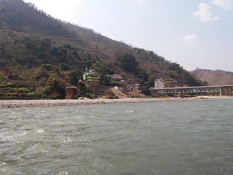
After some 15 km, the ride takes a pit stop for tea and refreshments at Khadichaur, half-way point to Dolakha. A subsidiary road links the Arniko Highway to its right, which heads south over an iron bridge across the river Sunkoshi. Some call the river Bhotekoshi, too. Named the Poiqu in Tibet, it is named Bhotekoshi after it flows into Nepal at Kodari but after the town of Barhabise, it is called Sunkoshi.
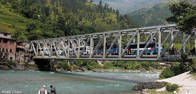
The narrower Swiss-engineered road after crossing the bridge is called the Lamoshangu-Jiri Marg (road), which takes you to Charikot, Dolakha, and Jiri. What strikes you most, once you board off the bus at Khadichaur, is the rows upon rows, of shops that flank the road selling Chinese goods from blankets, chinaware, and electronics to piano-keyboards. You name it, they have got it.
Hill country
After the bus rolls on the Jiri road, it’s hill country, all the way. The narrower road climbs along in a maze of twists, loops and hairpin bends. For those, who just had dal-bhat at Khadichaur, the ride could mean battling a brewing queasiness as the food gets mighty churned-up inside their bellies, to say nothing of the scary sights of sheer drops that compounds the misery.
For close to one hour, the bus lurches on the gut-wrenching switchbacks. Dense woods, terraced fields, and small Tamang settlements streak past. After villages like Sano Pakhar and Thulo Pakhar, the bus slides by a beautiful pine-studded hill.
Savoury potatoes
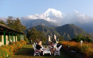
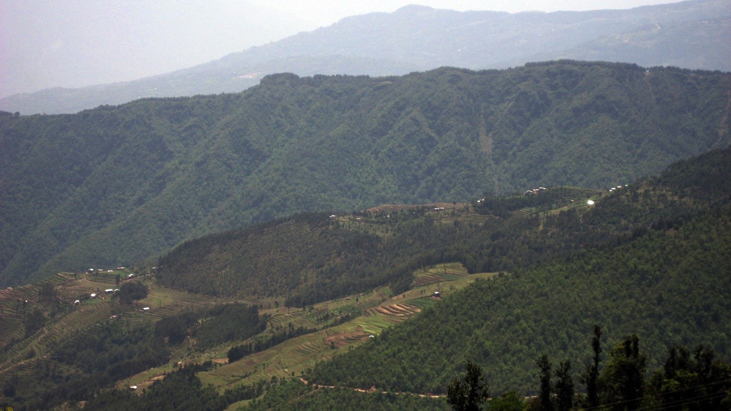
After another half-an-hour, the bus pulls up at Mude (2,500 m) for a tea break. The elevation affords a stunning view in the north of snow-clad peaks, including the Kalinchok ridge. The South opens to terraced fields that dramatically drop to a narrow river valley.
Mude is known for savoury potatoes, and if you happen to visit through the season, you cannot miss out on the sacks of potatoes stacked high by the roadside shop fronts. Also, you can see people making a beeline before the shops to buy them to take back home. The highland also happens to be a crossing-point to another pilgrimage site and a scenic location called Shailung Hills (3,150 m), some 20 km southeast.
Given the high elevation of Mude, a chill in the air and briskness in the atmosphere appears tangible. The place invites thick fogs in the wintertime, and constant mist and drizzle mark the monsoon months. After a brief respite, the bus leaves Mude.
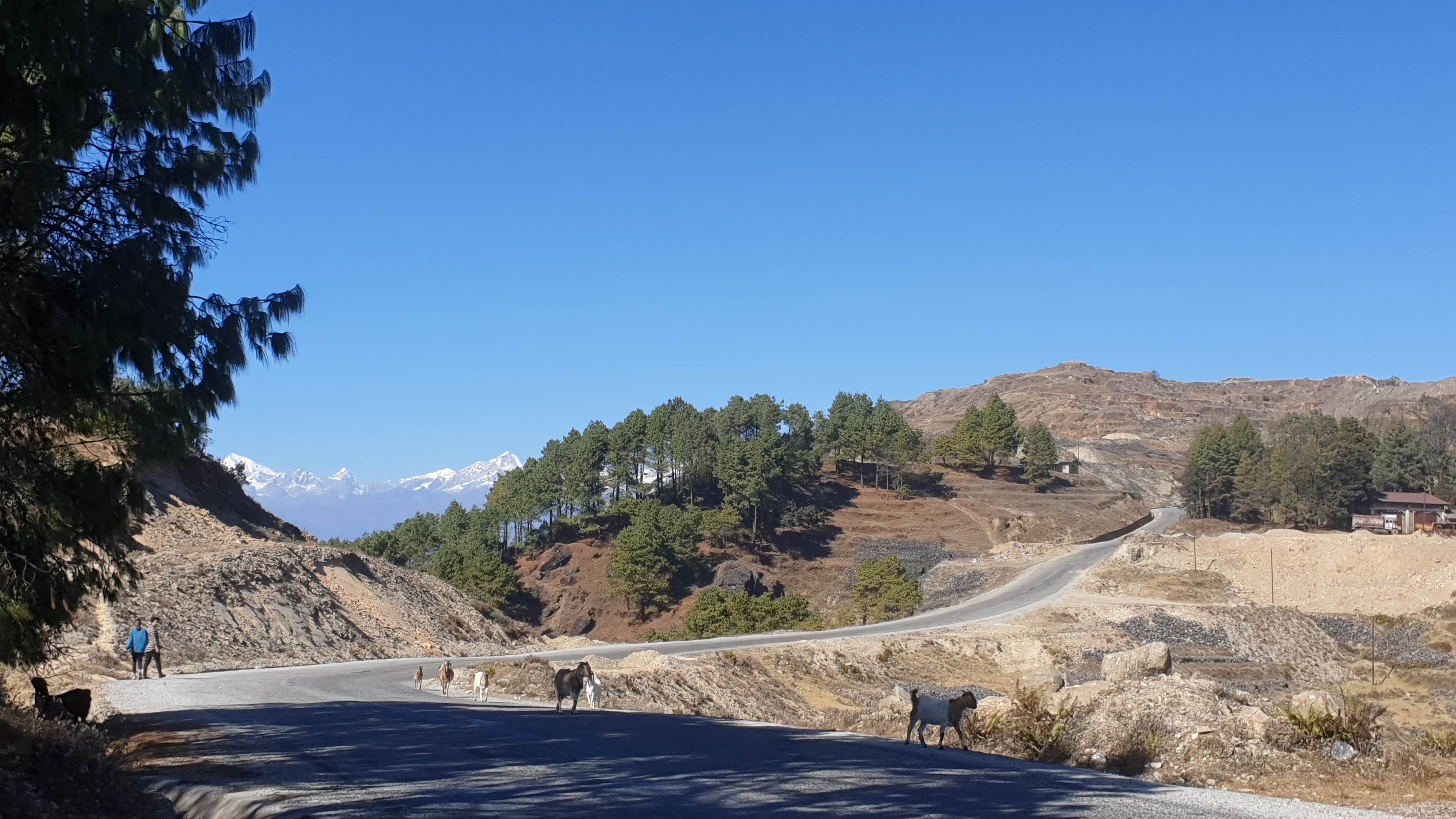
Within ten minutes, Kharidhunga (2,540 m), the site of an abandoned magnesite quarry and the highest point on the way to Dolakha, arrives. After this point, you leave behind Shindupalchok and enter the district of Dolakha.
At Kharidungha, the vista changes to a sub-alpine terrain with moorlands. Snowfall occurs each winter at Mude, and Kharidhunga, and lures merrymakers from as far away as Kathmandu. In recent years, Kharidhunga has rapidly turned into a touristy spot as more and more people are frequenting the high moorland.
The road, as it descends, involves more causeways, minuscule waterfalls, sheer drops, ravines, and the lovely countryside for its bucolic setting. The steep descent, thereafter, eases at a wooded gully with a cascade on the left. The water flows under a bridge to disappear into a deep ravine with a shrub forest. The scenic spot is called Boch, and the fast-tumbling stream, Charangé.
Before the roads
Before 1985, Dolakha had no access by motor road. People first travelled by bus to Barhabise, a small settlement then, located on the banks of the Bhotekoshi. Then, it took one night and two days, on foot, to Dolakha. The foot-trail traversed across tiny villages like Jaljale, Rol Khani, Boch, Makaibari, Charikot, and then the last leg of the journey to Dolakha. The present road is said to intercept those long-lost and forgotten trails at a few places.
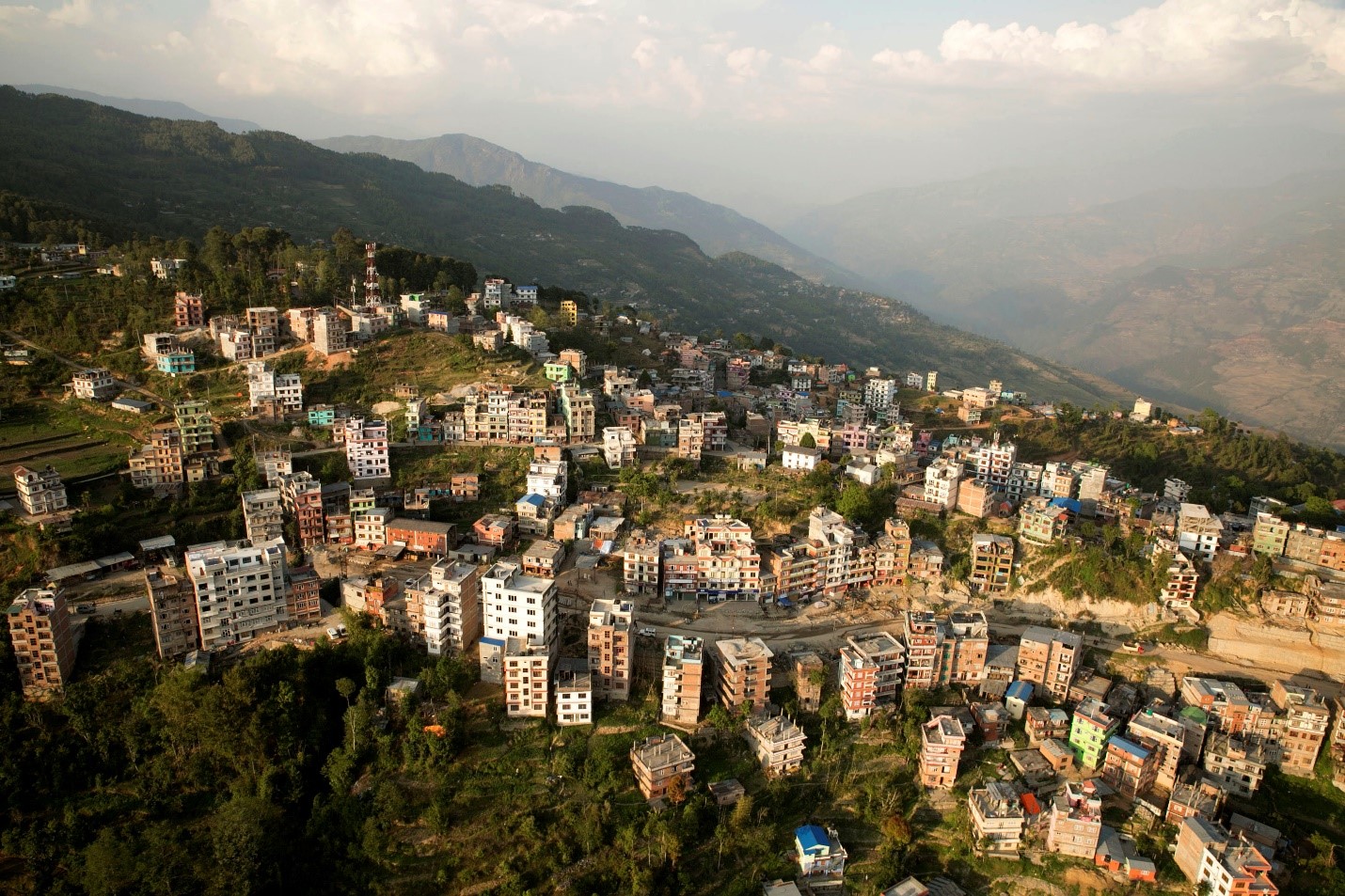
The bus ploughs on the incline, moving past terraced fields that ripple down as far as your eyes travel until an old village-town called Makaibari (meaning ‘cornfield’) appears. Fifteen minutes later, after a long quiet ride, you reach Charikot to find the town, abuzz with brisk life and movement, and, little surprise, with blasting music reminiscent of shanty Tarai towns as you enter the core bazaar area.
At almost 1800 m, Charikot, as the district headquarters of Dolakha, with tall roadside buildings, assumes the perfect picture of a booming highway town. Hotels, resorts, tea houses, lodges, shops, and more shops line the road. And big crowds and frenetic activities mark the main streets.
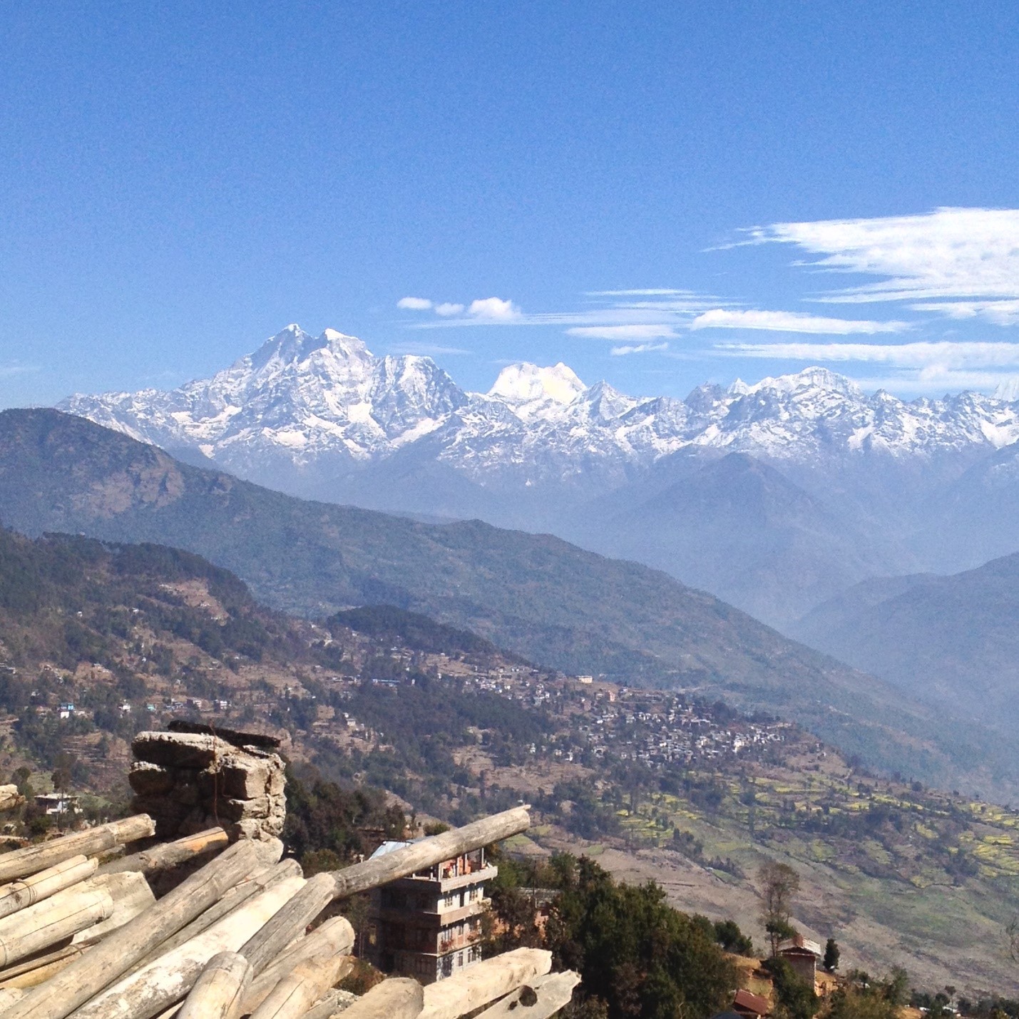
At the town square, the highway divides. As the main expressway runs to Jiri, a side road bears due east to Dolakha town, 4.5 km away. As the bus leaves the crossroads and heads towards Dolakha, you cannot fail to ignore in the eastern horizon the towering snow-clad massif with Mount Gaurishankar stealing the show.
Town without Fear
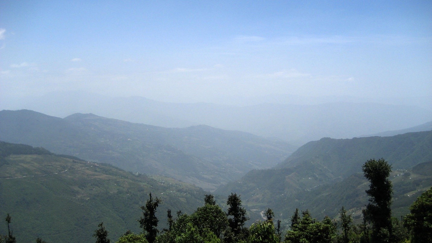
A 20-minute drive downhill takes you across sloping terraced fields and sparsely inhabited landscape. As you peer over the hillside, you can get the distant view of the river Tamakoshi, winding its course through a narrow gorge formed by the forested hills.
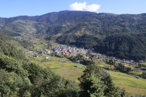
As you approach the town, the cluster of houses thicken, but nothing like Charikot; no fancy buildings, and none of that haphazard over-spilling of houses. At the tail-end of the paved road, the bus pulls up at the pit stop, Pakhalati, and Dolakha town, or going by its ancient name, ‘Abhayapur,’ the Town without Fear, greets you.
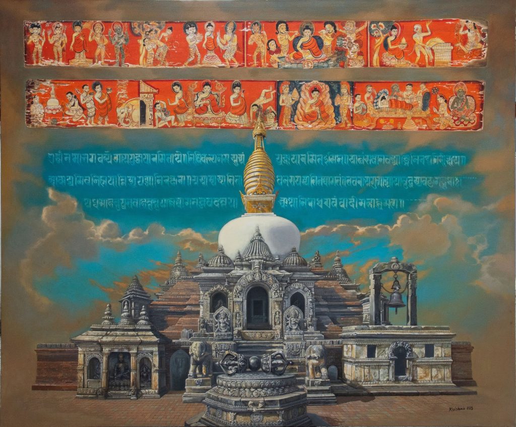
As the local folklore goes, Dolakha, in the olden times, was called Abhayapur—‘Abhaya,’ without fear, and ‘pur,’ a town. Ancient myth has it that since Dolakha and its inhabitants enjoyed the blessings, and patronage of God Bhimsen, the mythical hero of the epic Mahabharata, it was christened Abhayapur.
Abhayapur, with the elapsing of time, was renamed Dolakha. The word Dolakha is believed to have its origin in the Tibetan vernacular. Do in Tibetan stands for a stone, la translates to a temple while kha implies a house, as such signifying a town with many stone temples and houses.
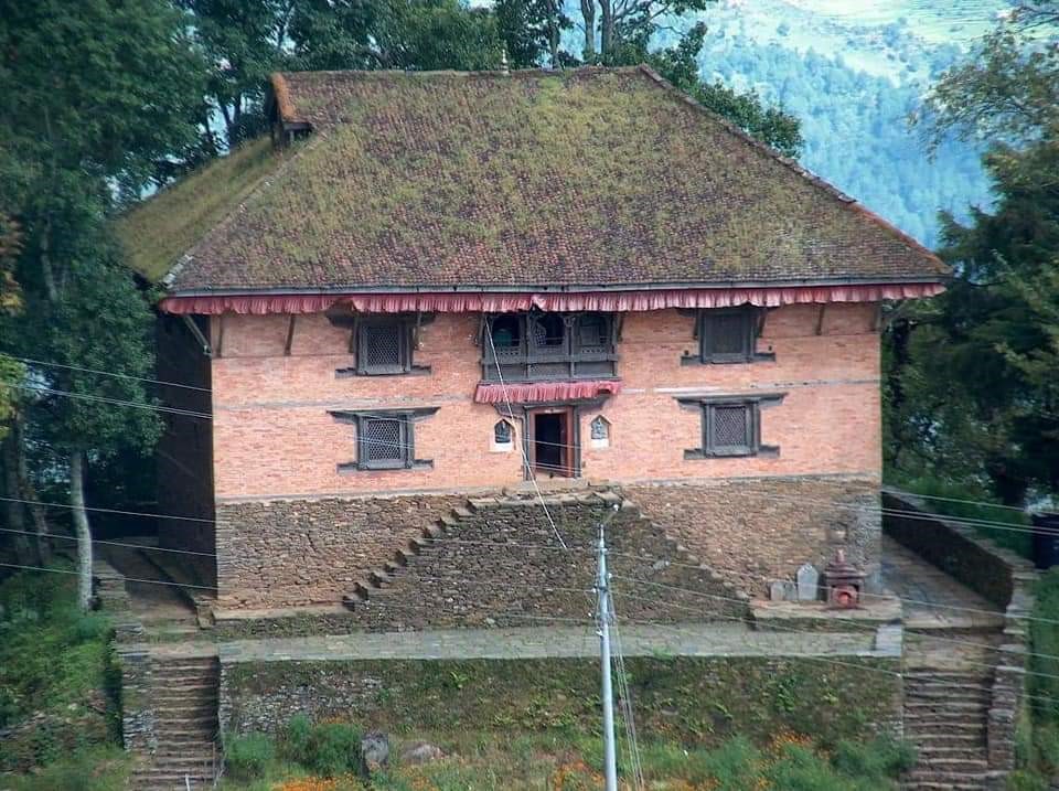
Quaint town
Upon arrival at Dolakha, what strikes the first-timer as strange is her unbelievable simplicity and that warm ambiance. In stark contrast to Charikot, Dolakha, seemingly impervious to rapid modernisation, impresses as a quiet and unassuming town with understated elegance.
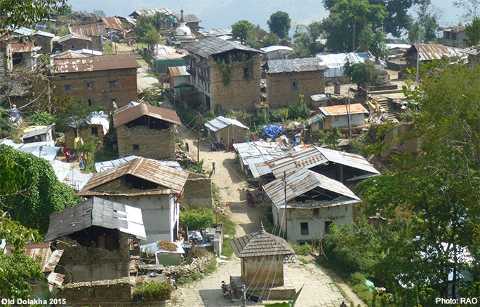
“Charikot, previously a drab village with a cluster of hamlets scattered around a hillside, shot to a burgeoning town with slipshod sprawling when the Lamoshanghu-Jiri Highway cut through the place. The highway did not converge with Dolakha town, and it remained a nondescript village town,” said Bikram Malla, a resident of Chamsali Tole, Dolakha. “A link road was built to access Dolakha after only two years. But all that proved a blessing in disguise, as our town was spared the trappings of haphazard development,” he further added.
After the unsightly urban sprawl of Charikot, Dolakha is like a sight for sore eyes. The place impresses you nothing short of a hill resort. The town hugs a wooded hillside that gradually descends into a ripple of fertile terraced smallholdings that drop abruptly way down to the Tamakoshi at the foothills of forested hills as the river snakes its course across a gorge.
The view of the river and the gorge is stunning. So is the eastern skyline as your eyes lock with the towering Gaurishankar Himal (7,134 m) in all its grandeur. The twin peaks synonymous with Lord Shiva (Shankar) and his consort Gauri (Parwati) is flanked by Melungste Himal (7,181 m) as the Rolwaling range undulates under an ocean-blue canopy. As the sun dips in the horizon and the sky turns a crimson hue, you hear a bell toll in the distance. That’s the Bhimeswor Shrine, the jewel in the crown of Dolakha, glowing in all its glory.
End of Part I