Kathmandu, September 20
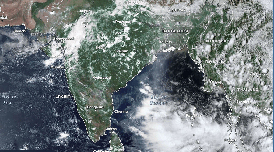
A low-pressure system developing over the North Andaman Sea and adjoining areas of the Bay of Bengal is expected to increase rainfall activity in Nepal from September 24 to 28, but its potential impact cannot yet be determined, according to the Department of Hydrology and Meteorology.
The department said it is continuously monitoring the system. While the system is expected to cause rainfall in Nepal, it said it is too early to determine the level of risk and the possible impacts.
According to the Meteorological Forecasting Division, the system is expected to strengthen and move west-northwest. Current projections suggest it could intensify into a depression around September 23 before moving inland near the coastal areas of southern Odisha and northern Andhra Pradesh.
The department said it will continue monitoring the system and issue further updates as necessary.
However, independent meteorologists have urged authorities and the public to remain alert, citing projections from various weather models.
Tribhuvan University hydrologist and meteorologist Dr Binod Pokharel said some models have projected between 400 mm and 741 mm of rainfall in Nepal between September 24 and 28.
He said the rainfall would not necessarily be uniform across the country and could be concentrated in certain areas. He stressed that information was being provided in advance to allow for preparations.
Meteorologist and environmentalist Ujjwal Upadhyay said the available models were indicating potentially serious conditions from September 24 to 27, with some models suggesting particularly significant risk on September 26.
He advised people, except those in Sudurpaschim, to consider postponing long-distance travel on September 24, 25 and 26. He also urged the public not to panic but to remain highly cautious.
Upadhyay said there was still a possibility that the system could weaken before reaching Nepal, similar to a cyclone system seen last year, but preparations should not be reduced.
Farmers urged to remain alert
Heavy rainfall could have a significant impact on the agricultural sector, particularly on mature paddy crops.
Meteorologists have urged farmers to remain alert as heavy rain could damage ready-to-harvest paddy.
The system, which has moved from the northern Thailand and Myanmar region, is currently progressing towards the central Bay of Bengal. If it develops into a cyclone, it would become the first tropical cyclone of 2026 in the North Indian Ocean region.
According to the World Meteorological Organization’s naming list, the system would be named Arnab, a name proposed by Bangladesh, if it develops into a cyclone.