On Friday, May 24, 2024, around 3 am local time, a massive landslide struck Kaokalam, a remote village in northern Papua New Guinea within Enga Province. The acting director of the PNG’s National Disaster Centre reported that potentially over 2,000 people were buried alive—significantly higher than the 670 estimated by the United Nations over the weekend. The last census in Papua New Guinea was conducted in 2000, complicating accurate predictions and estimates. Local authorities have evacuated more than 7,900 people to prevent further loss of life as the landslide remains active and rockfalls continue. The landslide occurred just 20-30 kilometres (12-19 miles) from the Porgera gold mine.
Papua New Guinea, responsible for just 0.11 per cent of global greenhouse gas emissions, is ranked as the world’s 16th most at-risk country to climate change and natural hazards according to the 2022 World Risk Index. Like other developing nations, it faces more environmental challenges than it contributes to. Small-scale landslides triggered by rainfall in the fragile geology of PNG are common.
However, a landslide of this magnitude, one of the most devastating in recent decades worldwide, causing such a tragic loss of life in Enga, is rare. Enga Province is one of several mountainous highland regions in Papua New Guinea that form part of the third largest rainforest on Earth, following the Amazon and the Congo Basin rainforests. Landslides of this scale have long been a tragedy, but within this dire situation lies an opportunity: the chance to predict and develop early warning systems for similar events in the future. A detailed technical study is essential for this, but based on existing facts, some potential causes and solutions can already be identified.
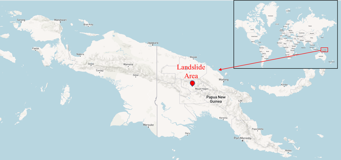
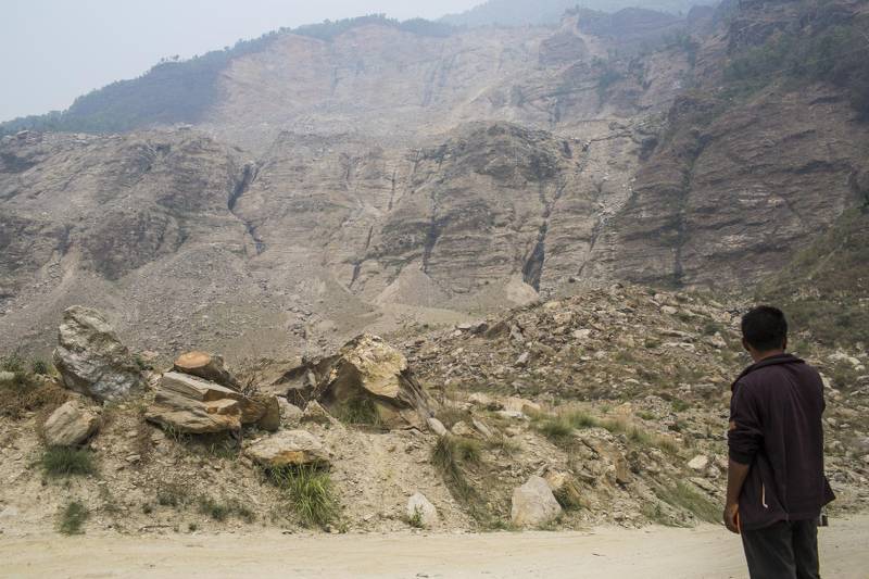
Photo: PNG’s 2024 deadliest landslides, Credit – UNDP Papua New Guinea
The Prime Minister, as well as local officials and reporters, have attributed the mountain’s collapse to weeks of heavy rain and other wet conditions in the area. Papua New Guinea, located at the convergence of the Pacific and Australian Plates (70 mm/year), experiences frequent strong to mega-scale earthquakes. While recent landslides are not directly correlated with earthquakes, past fractures and vibrations may contribute to mountain instability. The gold mine, located about 20-30 km (12-19 miles) from the landslide, may have a direct effect on the stability of the ground along the road.
This event is less or more similar to the 2014 Jure, Nepal, landslides. From events like these, Nepal and other regions with similar fragile territories can learn sufficient lessons without costing their citizen’s lives or millions of dollars in property.
Nepal’s fragile geologies
Nepal, a country highly vulnerable to the effects of climate change, faces continual losses from environmental disasters each year. Among these, landslides cause the highest number of fatalities, owing to a combination of factors including the monsoon climate, steep and unstable topography, and a sizable, often highly vulnerable rural population.
Nepal’s global significance is staggering, as it accounted for 10 per cent of rainfall-induced landslide fatalities, despite its tiny land area of less than 0.1 per cent of the Earth’s surface. Ninety per cent of the annual precipitation falling during the monsoon worsens the situation.
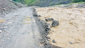
The Jure landslide, one of the deadliest in Nepal’s recent history, struck a densely populated area in Sindhupalchowk, located 80 km northeast of Nepal’s capital, Kathmandu, on August 2, 2014. It resulted in a death toll of 156. The landslide, spanning 1.26 km in length and 0.81 km in width at its base, obliterated everything in its path, including land, houses, properties, and infrastructure. It also formed a 55-metre-high dam in the Sunkoshi River, leading to the inundation of houses, farms, and a hydropower plant by a three-kilometre-long lake.
The Araniko Highway, Nepal’s sole road link to China, suffered severe damage, with nationwide consequences. Additionally, the river flow halted completely for nine hours following the landslide. The Jure landslide occurred following two days of heavy rainfall (141 mm), which infiltrated cracks and gullies on the mountain surface, leading to the buildup of pressure within the mountain.
However, geological factors and heavy rainfall are not the sole contributors to landslide risk. Unsustainable land management, inadequate water drainage systems, and limited alternative options for locals also played a significant role in the Jure landslide’s occurrence and severity.
Over the past decade, the frequency of natural disasters such as landslides, wildfires, heatwaves, droughts, and extreme rainfall has been steadily rising. Recently, places like Dubai and Oman have experienced unprecedented events like extreme rainfall. While popular opinion points to the influence of climate change, regardless of the cause, the upward trend in disasters underscores the urgent need for early warning systems and effective mitigation measures.
Lessons from past experiences have taught us that Nepal needs a separate ministry to deal with natural disasters. Forming an executive body under any ministry will not serve any purpose of disaster preparedness, rescue, relief, or rehabilitation of the affected communities.
In Nepal, events like landslides are perceived as natural hazards, leading to the prevailing mentality that mitigation is not possible and the only response is rescue efforts. However, what truly matters in addressing such natural hazards is the allocation of funds by the central and other governmental bodies for studying vulnerability and implementing potential mitigation measures.
Even after the Jure landslides, affected families remain without permanent alternative settlements, enduring prolonged suffering for circumstances beyond their control. The situation remains challenging in Melamchi as well, following the debris flow events, with the affected community still pleading with the government for assistance. The National Disaster Risk Reduction and Management Authority, established in 2019 to address such events, has faced challenges in its effectiveness due to budget constraints and limitations in expertise.
As we are just entering the monsoon season, events like these are not far off. Nepal could and should employ experts for landslide susceptibility mapping, particularly around settlement areas, before the heavy monsoon starts.
Things to do
This would help identify where immediate early warning systems are needed. A warning system could be developed with three key components, each of which can operate simultaneously: (1) a network of rain gauges that records hourly rainfall; (2) a weather-mapping system that identifies centres of high-intensity rainfall within storm areas and frequently plots these locations about the gauges, ensuring accurate transfer to slope or topographic maps; and (3) an administrative and communications network that compiles the data, detect when critical thresholds are exceeded in specific areas, and notifies the residents. Such a system is likely well within the capabilities of current technology.
Preventing and mitigating landslides in countries like Nepal is challenging, but low-cost techniques like bioengineering and affordable early warning systems can help. As a short-term measure for this year, before the real monsoon starts, Nepal should employ experts for landslide susceptibility mapping, particularly around settlement areas, to identify where immediate early warning systems are needed.
For the long term, the government should allocate a sufficient budget, keeping in mind that climate change-induced disasters like landslides in Nepal’s fragile geology are increasing each year. Only a few studies have been conducted, mostly by independent researchers.
Overall, mapping and identifying susceptible settlement areas should be an immediate priority.