Kathmandu, September 3
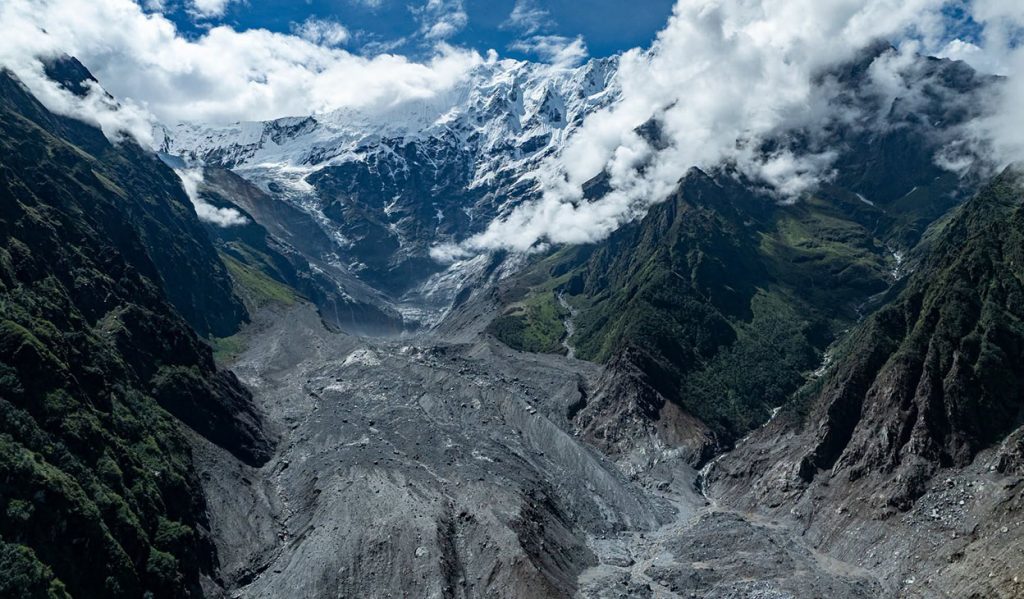
A glacier on the northern face of Langtang Lirung had been moving at an unusually high rate in recent years, according to a preliminary study by a Chinese research institute.
The Institute of Tibetan Plateau Research under the Chinese Academy of Sciences in Beijing found that the upper and middle sections of the glacier had moved relatively rapidly over the past two years.
Researchers analysed data from Sentinel-2 satellites and detected unusual movement in the glacier, along with changes in the slope. Their analysis suggests that cracks may have developed in the ice and that sections of the slope may have become increasingly unstable.
The findings, however, are preliminary. The researchers have not concluded that the glacier’s movement was a definite warning sign of the disaster.
‘There was activity before the landslide’
The study identified unusual signals at around 6:04am, 6:50am and between 8:15am and 8:19am Nepal time. Researchers classified these as seismic signals.
Some of the signals corresponded with the timing of landslide and dust activity reported by people in the area.
Rather than a single, sudden landslide, the researchers suggest that smaller-scale ice-rock movements may have begun before the major event.
But they have cautioned that there is not enough evidence to describe the signals as a “definite precursor” to the disaster.
The Chinese Academy of Sciences has also concluded that last week’s event cannot be explained simply as a conventional landslide or avalanche.
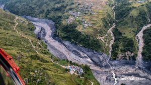
Researchers say an ice-rock avalanche that fell from Langtang Lirung, at an elevation of around 5,200 metres, caused much greater destruction further downstream than at the initial impact site.
The disaster grew as it moved downstream

The area where the glacier and rock fell is around 22 kilometres from Rasuwagadhi and about 3,400 metres higher in elevation, according to the study.
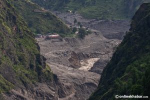
Researchers say the initial mass of ice and rock gathered river water, soil, sediment and other loose material as it moved downstream, increasing both its volume and destructive power.
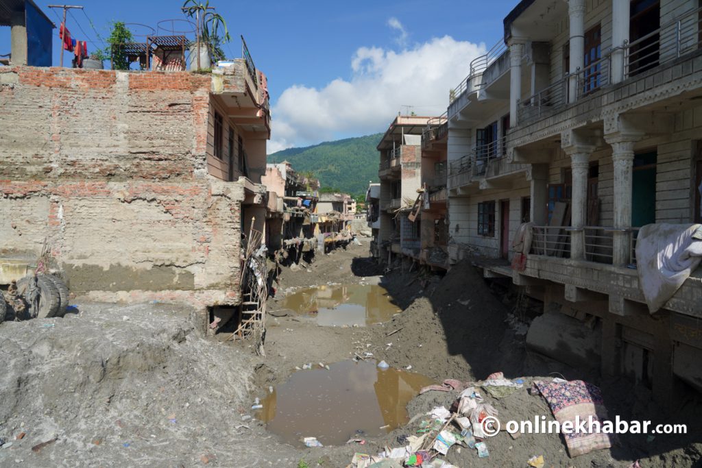
By the time it travelled around 22 kilometres, the size and force of the flood had increased substantially.
The researchers say the key question is therefore not simply how large the initial avalanche was, but how much additional material it picked up on its way to Rasuwagadhi.
“The amount of ice and rock that initially fell was not the main factor determining the final scale of the disaster,” the report says. “The disaster grew progressively as soil, sediment, river water and unstable material from the riverbanks were incorporated along the way.”
The Institute of Tibetan Plateau Research is studying how an ice-rock avalanche in the high Himalayan region transformed into a destructive flood. Researchers used satellite imagery, seismic data and weather information in their analysis.
‘It was not caused by heavy rain’
The study found no evidence that rainfall triggered the ice-rock avalanche.
Researchers said rainfall in the area had been limited during the 72 hours before the event, with only 8.8 millimetres recorded during that period.
They therefore found no evidence to support the conclusion that heavy rainfall immediately before the disaster had triggered the avalanche.
At the same time, temperature data showed that the area had experienced warmer-than-average conditions.
The average temperature during the winter of 2026 was 0.38 degrees Celsius higher than the average, while the increase reached 0.58 degrees Celsius during the summer.
The study identifies climate change, long-term warming and glacier instability as important background factors. However, it does not conclude that climate change was the direct cause of the disaster.
Instead, researchers raise a question for further study: whether long-term warming is gradually destabilising the ice-rock system in the Langtang region.
Multiple factors may have triggered the avalanche
Researchers have identified six possible processes that may have contributed to the event and say there is not enough evidence to attribute it to a single cause.
Among the factors they identified are rapid glacier movement, cracks developing within the ice and meltwater entering those cracks.
They also point to weakening permafrost — permanently frozen ground — and the possibility of ice and rock falling from the upper slopes.
As temperatures rise, repeated cycles of freezing and thawing may have expanded cracks in the rock, the study suggests. Researchers also say ice and rock weakened by an earthquake a decade ago may have contributed to the collapse.
The study describes the disaster as a chain of processes rather than the result of one isolated trigger.
Above Rasuwagadhi, the Lhende River begins after the confluence of the Purepu Glacier and Chhochen Khola. The ice-rock mass that fell from an elevation of around 5,200 metres travelled about eight kilometres before striking the upper section of the Lhende River.
The avalanche then broke apart and transformed into a flood that travelled another 13 to 14 kilometres to Rasuwagadhi, where the Lhende and Kerung rivers meet.
Part of the powerful flow then entered another small valley along the Kerung River, around two to three kilometres upstream.
Even at that point, researchers found, the debris-laden flood still carried substantial energy and remained highly mobile.