Kathmandu, August 27
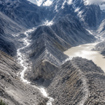
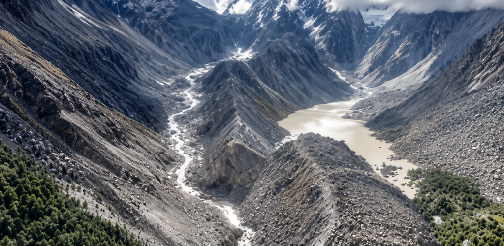
A large lake has formed below a massive avalanche in the northern part of Langtang Lirung, raising concerns about another flood in Rasuwa.
Chinese media and experts who have analysed satellite images have concluded that the lake formed at the confluence of two small mountain streams.
Here is what is known so far about the new lake, how it formed and the potential risk it poses downstream.
How did the lake form?
A massive avalanche occurred in the northern part of 7,234-metre Langtang Lirung on Wednesday morning.
Water resources expert Santosh Nepal estimates that a mixture of ice, snow and rock fell from around 5,500 metres to about 3,000 metres.
“It appears that a mass of snow and ice fell from around 5,000 metres to an elevation of around 3,000 metres,” Nepal said. “Because it came crashing down from such a height, we estimate that it generated enormous energy.”
Experts believe the mass of snow and ice flowed downhill and turned into a flood, while a large depression was created below the avalanche site. Water then accumulated there, forming a lake.
According to Chinese media, the lake has formed below the Chhochen Khola and Purepu Tsangpo rivers, whose waters eventually flow into the Lhende Khola. The Lhende Khola joins the Kerung Khola at Rasuwagadhi.
How large is the lake?
Citing China’s Ministry of Water Resources, China’s Global Times reported that around 2 million cubic metres of water had accumulated in the depression by Thursday.
Water has already begun flowing out of the lake.
Chinese state television has warned that another 1 million cubic metres could accumulate over the next two to three days, potentially bringing the volume to around 3 million cubic metres.
Chinese authorities have warned that the natural dam holding the lake could break.
Nepal’s National Disaster Risk Reduction and Management Authority (NDRRMA) has also confirmed the formation and expansion of the lake.
According to NDRRMA, Planet Labs and Landsat satellite images show that the flow of the Lhende Khola has been blocked around 18 kilometres north of the Rasuwagadhi border crossing.
The lake covers approximately 0.11 square kilometres.
Could the lake cause another flood?
There is a risk.
NDRRMA said the natural dam could break and trigger another major flood downstream. The authority has urged residents in downstream areas and all concerned agencies to remain alert and take necessary precautions.
“The risk of the natural dam breaking and causing another major flood remains,” the authority said.
But experts say a possible flood from this lake would not necessarily be as large as Wednesday’s disaster.
How dangerous is it?
Ranjan Kumar Dahal, a professor at Tribhuvan University’s Central Department of Geology, said the expanding lake has increased concerns about another flood.
However, he said the lake is relatively small.
“If the lake bursts, the flood from there will not be like Wednesday’s,” Dahal said.
Binod Parajuli, chief of the Flood Forecasting Section under the Ministry of Energy, Water Resources and Irrigation, said the Chinese side had informed Nepal that water was accumulating in the upper reaches of the Lhende Khola and that the lake was growing.
“The Chinese side appears to be monitoring the area closely. They may have issued the warning that it could burst after filling up based on their assessment,” Parajuli told Onlinekhabar.
“That is why we have urged people in the affected areas to remain alert.”
Parajuli said people in areas affected by the Bhotekoshi and Trishuli floods should remain cautious but did not need to panic.
According to him, the amount of water currently accumulated in the lake is only around 10 percent of the water involved in Wednesday’s flood.
“Even if all of it flows out, it does not appear capable of causing more damage than yesterday’s flood,” he said.
However, he stressed that the warning should not be ignored.
“That does not mean rescue workers can enter the riverside areas without concern. That is why we have asked them to remain alert,” Parajuli said.
Why is the lake still being closely monitored?
The lake is continuing to fill, and the natural dam holding it back remains a concern.
A Chinese team has been conducting continuous drone surveillance of the suspected source area of the Bhotekoshi flood since Thursday.
The team has been monitoring the avalanche area and the lake from close range.
Climate expert Ujwal Upadhyay said the continued flow of snow and muddy debris from the area was increasing the risk.
Upadhyay, who is also a visiting faculty member at Kathmandu University, wrote that water was continuing to accumulate in the natural reservoir, increasing the possibility of a sudden surge of water and further cascading disasters.
What does Nepal know about the site?
Professor Dahal said the Lhende Khola forms the Nepal-China border and that the lake is developing close to the border.
He said Nepal currently has limited possibilities for conducting a close aerial assessment of the site by helicopter.
Chinese teams, however, have been able to continuously monitor the area using drones.
“The Chinese team has provided information that has allowed us to learn that the lake is growing and that there could be another risk,” Dahal said.
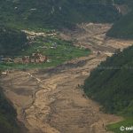
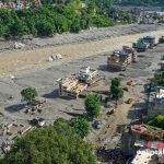
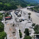
For now, authorities are urging people along the Bhotekoshi and Trishuli river corridors to remain alert.
Experts say there is no need for panic, but the possibility of a sudden release of water cannot be ruled out while the lake continues to grow and its natural dam remains unstable.