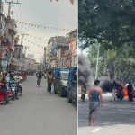

Google Maps officially launched Street View in Nepal on August 15. During the Digital Nepal Conclave 2025, Google Maps’ Head of Street View Nishant Nair announced that people around the world can now explore Nepal’s beautiful landscapes and culture, sparking wide discussion about the feature. Nepalis have also started uploading photos and videos to Google Street View.
Nishant Nair claims that Street View allows people to virtually experience Nepal’s breathtaking landscapes and rich culture.
He says, “Street View will take you into a different world, offering a closer look at Nepal’s rich architectural history, ancient temples and palaces, as well as its bustling markets and vibrant traditions.”
According to him, to view Nepal’s latest sceneries, users simply need to open Google Maps on their phone or computer and access the 360-degree view.
Here is an interview of Google Street View’s South Asia Head, including Nepal, Nishant Nair, with Onlinekhabar.
Excerpt:
What was the primary motivation behind launching Street View in Nepal, and why was this particular time chosen for the launch? Was there a specific catalyst, a long-term strategic plan for the country, or did the Digital Nepal Conclave 2025 play a significant role in its timing and announcement?
Google Maps is a product built to help users explore and navigate the world. Google Street View is an essential part of creating a digital representation of the real Nepal for our users in Nepal and across the globe. Given the growing number of smartphone users and corresponding digital maps usage in Nepal it became important for us to work with a local partner to start collecting street level imagery in 2023. The collection was completed earlier this year. The Digital Nepal Conclave 2025 was an excellent platform to announce this milestone. As the country’s pre-eminent event on digital transformation, it provided a great opportunity for us to launch this service alongside the very people and organizations who are driving Nepal’s digital future. This launch is not just about technology; it’s about empowering people and enabling economic growth through a more complete digital representation of the country.
How does the introduction of Street View in Nepal fit into Google’s global strategy for expanding mapping services in emerging markets, particularly within South Asia?
Nepal is an important emerging market with a young and tech savvy population making it imperative for us to ensure we provide an accurate digital map with fresh imagery for the country. This fits well into our strategy for expanding mapping services in emerging markets.
How long has Google been working on bringing Street View to Nepal, and what was the timeline for this project?
Google Maps has been available in Nepal for several years and our users have been contributing their own street view imagery for many years. We started working with a local partner in 2023 to collect terrestrial imagery. Before this we had collected imagery from Everest base camp back in 2014.
What is the broader vision of Google Street View, and how do you see its contribution to Nepal’s digital ecosystem, tourism, and economy?
Google Street View, integrated with Google Maps, significantly impacts the economy by enhancing business visibility, boosting sales, and facilitating efficient navigation. It provides virtual tours of areas outside businesses, aiding customer decision-making and driving traffic to physical locations. Additionally, it allows for detailed analysis of neighborhoods and informs urban development strategies. Here are some Nepal specific use cases:
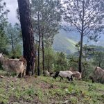
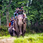
- Visual Exploration People worldwide can now virtually explore cities like Kathmandu, historical landmarks like Patan Durbar Square, the birthplace of Buddha in Lumbini, or even breathtaking natural landscapes in the Himalayan foothills – all without leaving their homes. This not only sparks interest but also preserves and promotes Nepal’s unique cultural heritage digitally
- Improved Mapping and Navigation: With Street View imagery, Google Maps can provide more accurate and detailed information for users throughout Nepal. Street View is an essential tool for planning routes, accurately adding new businesses and addresses on Maps.
- Empowering Local Businesses and Digital Economy: For the small and medium-sized enterprises (SMEs) that form the backbone of Nepal’s economy, Street View provides great visibility. It helps local shops, guesthouses, restaurants, and artisans to be discovered more easily online. This enhanced online presence is crucial for their growth in the digital age, connecting them with a wider customer base both domestically and internationally.
- Tourism boost: Nepal is a country blessed with immense tourism potential. Street View imagery allows tourists to virtually explore Nepal’s hidden gems. Also, we anticipate Street View would help attract more visitors and boost the tourism industry. We have seen numerous examples globally where the imagery around tourist spots on Street View leads to a measurable increase in physical visits. Street View can also be widely used in promoting specific events or routes, such as cultural festivals or even potential marathon routes, bringing Nepal’s unique experiences to a global audience.
How was the data for Nepal’s Street View collected? Can you describe the technical methods and elaborate on the technology used, such as Street View cars, trekker backpacks, vehicle-mounted cameras, lightweight rigs, or even drones, given Nepal’s diverse geography?
Nepal has a mix of narrow roads in densely populated cities and windy roads that cover the mountainous areas. Using different types of cars based on the area of collection is something we tried in Nepal.
What specific areas and routes were prioritized for initial coverage? For example, were areas like Kathmandu, the Terai region, and Himalayan viewpoints prioritized, and how was this imagery processed and integrated into Google Maps?
We prioritize areas that change frequently and have a high volume of visitors. So we started with Kathmandu where the population density is highest and then expanded to 60 other cities over time.
How do you ensure accuracy and image quality, particularly in areas with poor road conditions or dense urban landscapes, and consistency across different terrains?
Once we’ve collected photos, we use a technique called photogrammetry to align and stitch together a single set of images. These images show us critically important details about an area–things like roads, lane markings, buildings and rivers, along with the precise distance between each of these objects. All of this information is gathered without ever needing to set foot in the location itself.
Photogrammetry is not new. While it originated in the early 1900s, Google’s approach is unique in that it utilizes billions of images, similar to putting a giant jigsaw puzzle together that spans the entire globe. By refining our photogrammetry technique over the last 10 years, we’re now able to align imagery from multiple sources–Street View, and satellite imagery.
How often are images updated, and what is the refresh plan for Nepal’s cities and remote areas to keep the imagery current, especially given Nepal’s rapid urban development and post-earthquake reconstruction?
We update Street View imagery periodically as part of our effort to provide people with the most up-to-date map possible. Additionally, anyone can purchase a Street View compatible 360 camera and contribute imagery to Street View. We have a list of compatible cameras on the Street View website.
How does Google handle challenges like narrow alleys, rural roads, and Himalayan terrains where vehicles cannot go, and were any areas deemed too difficult or dangerous to capture?
We used smaller cars to collect imagery in narrower alleys. As for the more dangerous areas, the safety of our operators is paramount so we avoid collecting areas which are deemed too dangerous.
How much imagery have you covered across the country and which areas were prioritized?
We have covered 65,000 kilometers of imagery across 60 major cities in the country prioritising most areas that have a significant population density.
What measures have been taken to ensure the privacy of individuals, vehicles, and private property in the Street View imagery, especially in smaller communities where people might be more easily identifiable?
Street View cameras take photographs as an operator drives down publicly-accessible roads. Once the photographs have been taken, we use computer processing and a technique called photogrammetry to make them ready to see on Google Maps. This includes cutting-edge face blurring technology, which helps make sure that passers-by in the photographs can’t be identified. It’s also designed to blur legible license plates.
To protect our users’ privacy, we provide easy-to-use reporting tools so that people can ask for images of their house, car or themselves to be obscured in Street View. Simply click on “Report a problem” on the bottom left-hand side of the Street View image, submit a request, and we’ll blur the image in accordance with our policies.
Did Google take permission from the Government of Nepal for this launch? How did Google coordinate with the Government of Nepal regarding data security, regulation, permits, and permissions for capturing these images?
We worked with a local partner who obtained the necessary permissions before capturing the imagery in Nepal.
Nepal has strict sensitivities regarding security and strategic locations (e.g., near military bases, government buildings). How is this handled in Google’s imagery pipeline?
Our local partner is well aware of sensitive locations in the country and has avoided collecting imagery in any sensitive areas.
What are the benefits of uploading photos to Maps, especially compared to posting photos mostly on social media?
Photos help us extract and add information to Google Maps that directly has an impact for businesses
Do you foresee Street View being integrated into education, disaster response (e.g., earthquakes, floods), or urban planning efforts in Nepal? Can you share any global examples?
We have already done some work in the flood forecasting space though this is more based on satellite imagery rather than street view imagery.
Can you share any projected metrics or early indicators of user engagement with Street View in Nepal since the launch?
We have seen strong engagement in Nepal in the first week after the street view launch. Anyone can purchase a Street View compatible 360 camera and contribute imagery to Street View. We have a list of compatible cameras on the Street View website.
Beyond just tourism, how can Street View be a tool for cultural preservation? Are there plans to capture imagery of significant heritage sites, temples, or cultural events to document them for future generations?
As of now the imagery collected is of areas outside most of these sites so people can look before they go. We can explore collecting these sites in future.
Does copyright apply to photos uploaded to Google Maps?
Google owned photos and imagery are our own copyright.
How can Nepali users access Street View, and what devices or internet speeds are required?
Users can access street view on mobile devices and on computers/tablets. A regular broadband or decent (3G/4G) mobile connection should be good enough.
Are there plans to make Street View more accessible for people with disabilities or those in low-connectivity areas?
Google Maps has various features to help the specially abled users.
How can the Nepali community provide feedback or suggestions for improving Street View coverage or report issues?
We have a “ report a problem “option on Google Maps using which Nepalis can report issues.
Are there plans to launch Street View in other South Asian countries that don’t currently have it?
Yes there are plans to launch in other countries around the world, bringing Street View’s benefits to more economies and people.
What has Google learned from the Nepal launch that can be applied to other developing countries or regions with similar geographical and infrastructural challenges?
Nepal has a mix of narrow roads in densely populated cities and windy roads that cover the mountainous areas. Using different types of cars based on the area of collection is something we tried in Nepal that can be replicated in other South Asian countries.
What has been the most surprising or memorable moment for your team while capturing Nepal’s Street View imagery?
The most memorable moment for our team has been the warm reception our imagery in Nepal has received. This is really heartwarming and motivating for our future collection.
Lastly, are there opportunities for Nepali tech enthusiasts or organizations to collaborate with Google on future mapping projects?
We have already been approached by various organisations about potential collaborations. We are currently engaging with these organisations.