Kathmandu, October 8
El Niño is expected to strengthen further towards the end of 2026 and reach its peak around December, potentially affecting temperature and rainfall patterns in different parts of the world.
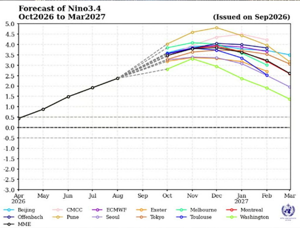
According to the World Meteorological Organization (WMO), sea surface temperatures in the central and eastern tropical Pacific are likely to remain unusually high between October and December, increasing the likelihood of a strong El Niño event.
Sea surface temperatures in the Niño-3.4 region were about 1.6 degrees Celsius above average in June and rose to around 2.5 degrees Celsius by August. They are forecast to reach an average of up to 3.7 degrees Celsius above normal between October and December. If temperatures rise further in December, the event could become one of the strongest El Niño episodes on record.
The WMO said El Niño is likely to persist until February 2027.
A strong El Niño could raise global temperatures and increase the risk of extreme heat, drought, heavy rainfall and flooding. While some regions, including the eastern and central Pacific, parts of the Greater Horn of Africa, Central Asia and coastal East Asia, could receive above-normal rainfall, below-normal rainfall is expected in the western Pacific and the Indian subcontinent.
The reduced rainfall outlook for the Indian subcontinent could affect agriculture, water resources and related economic activities in South Asia.
The WMO has also noted unusually warm conditions in the Indian and Atlantic oceans, which could further complicate global weather patterns. However, local weather systems and other climate factors will also influence actual conditions, and individual extreme events cannot be attributed to El Niño alone.