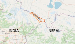
On March 4, 1816, Nepal signed the Sugauli Treaty with the East India company. The treaty is considered the defining document about the border between India and Nepal. The Sugauli Treaty clearly designates the Kali river (also known as Sharada in India and Mahakali in downstream Nepal) as Nepal’s western frontier.
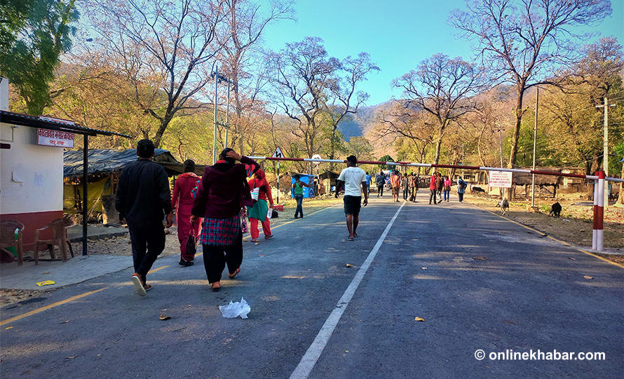
While everyone agrees that Kali is the border between the two countries, there has been a perennial dispute over the origins of the Kali. The dispute surfaced yet again after New Delhi issued a new Map of India on November 2 to demarcate the new union territory of Ladakh.
The new map shows Nepali territories on the eastern banks of the Kali in India. While India says that the map makes no changes to the sovereign territory of India, academics such as Narendra Raj Khanal, a professor of geography in Nepal, state that India has overtime manipulated its maps to lay claim over Nepali territory east of the Kali.
“India states that it has not tampered with the map and the border with Nepal is the same as it was in its old map. But what it doesn’t realise is that even its old map isn’t in accordance with the Treaty of Sugauli,” he shares.
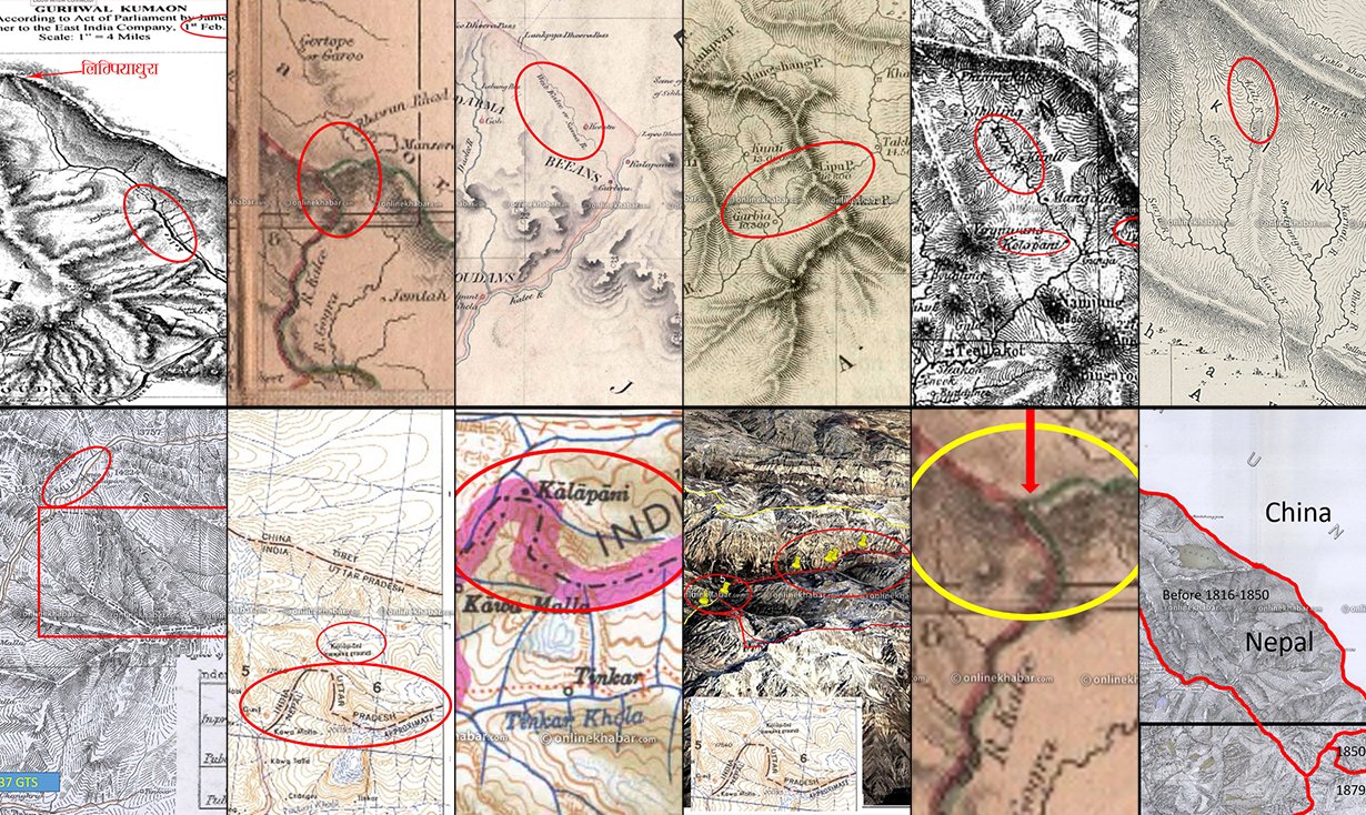
The story of encroachment in 11 maps
Maps published by the East India Company, the British and the Indian governments in various years show how the origin of the Kali has been manipulated to extend India’s territory beyond the Kali and into Nepal.
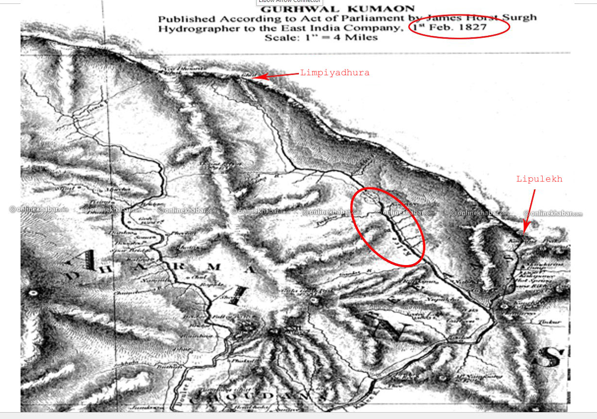
This map shows the source of the Kali River is Limpiyadhura. It also makes it clear that the villages of Gunji, Kuti and Nabi fall inside Nepal.
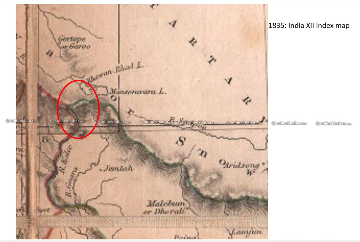
Similarly, a map made public by India in 1835 also clearly shows the source of the Kali River and depicts Nepal’s territories west of Lipulekh.
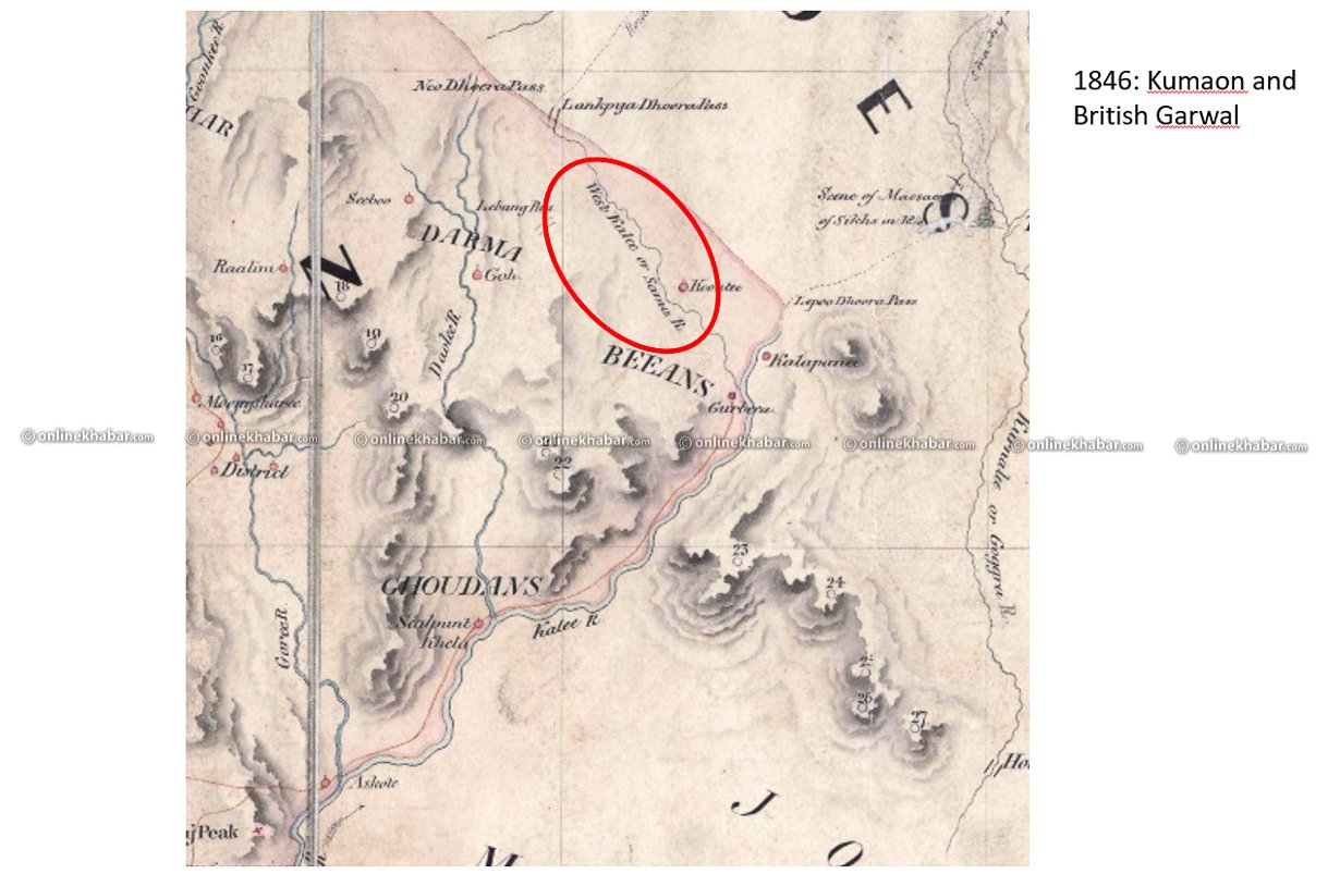
However, a map published by Kumaon and British Garwal changed the name of the Kali River. This, experts believe, was the first step towards the cartographic manipulation. The Kali was then named ‘West Kali/Sama River’. Even though the name was changed, the river’s origin was named Limpiyadhura.
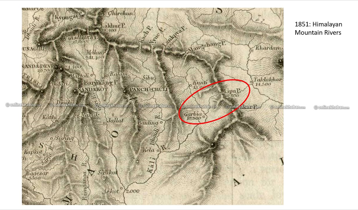
A map published in 1851 by Himalayan Mountain Reserve shows two rivers in the area. One is the Kali River, which starts from Limpiyadhura and the other one is Sharada, which starts from Lipulekh. The map, however, does not name the rivers.
Also read – Explainer: What is the Kalapani controversy between Nepal and India all about?
The map released by the British Survey of India in 1856 also shows that the source of the Kali River is indeed Limpiyadhura. The map, however, shows ‘Kalopani’ as an area west of the Kali River.

Many believe that this might be one of the reasons why Indian forces have set up camps in Kalapani, which lies east of the Kali River.

This map called ‘Nepal, Sikkim, Bhutan and Tibet’ published in 1857 also shows Limpiyadhura as the source of the Kali River. Another map published in 1859 also states the same.
Interestingly, a map issued in 1879, marks Lipulekh, further west of the Kali, as the origin of the river. This is what many believe, started the border dispute.

This isn’t it. The name of the Kali River has also been changed and called the ‘Kutiyangli’. However, ‘Kuti’ in the local language, translates to ‘Kali’ and ‘Yanli’ to ‘river’.
In the map above, the Indians changed the name of Lipu Khola and called it ‘Kali River’, and included the Kali River in their own map.

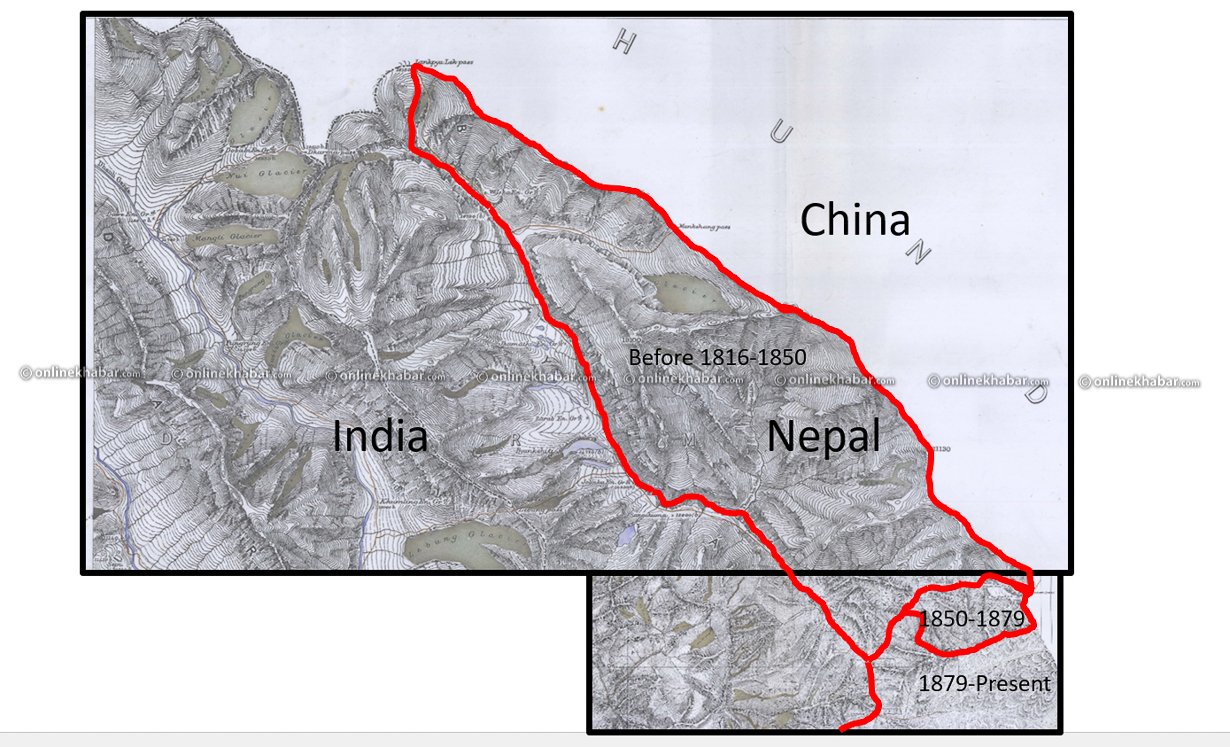
But a map released by the United Kingdom in 1967 shows that Kalapani is Nepal’s territory.

India, since then, has set up seven camps along the Lipu Khola. Out of the seven, three (#5, #6 and #7) are on Nepali land. Camps 1,2,3 and 4 are on the opposite banks of Lipu Khola, even if you take Lipu Khola, which originates from Lipulekh, as the border.
The map released by India recently recognises a stream as Kali River and has included Nepali land inside Indian territory.