Kathmandu, August 26:
A devastating flood that struck Rasuwa’s Bhote Koshi River on Wednesday morning is believed to have been triggered by a possible glacial lake outburst or a landslide in the Tibetan region of China, although the exact cause has yet to be scientifically confirmed.
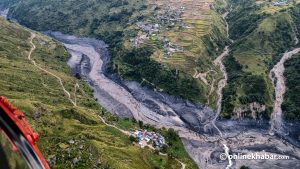
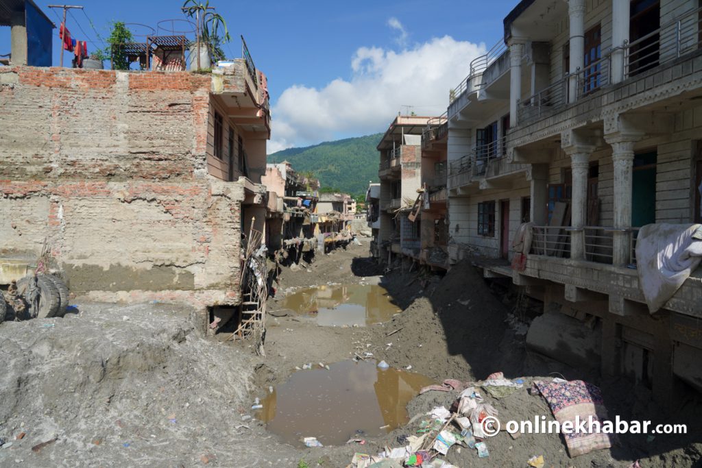
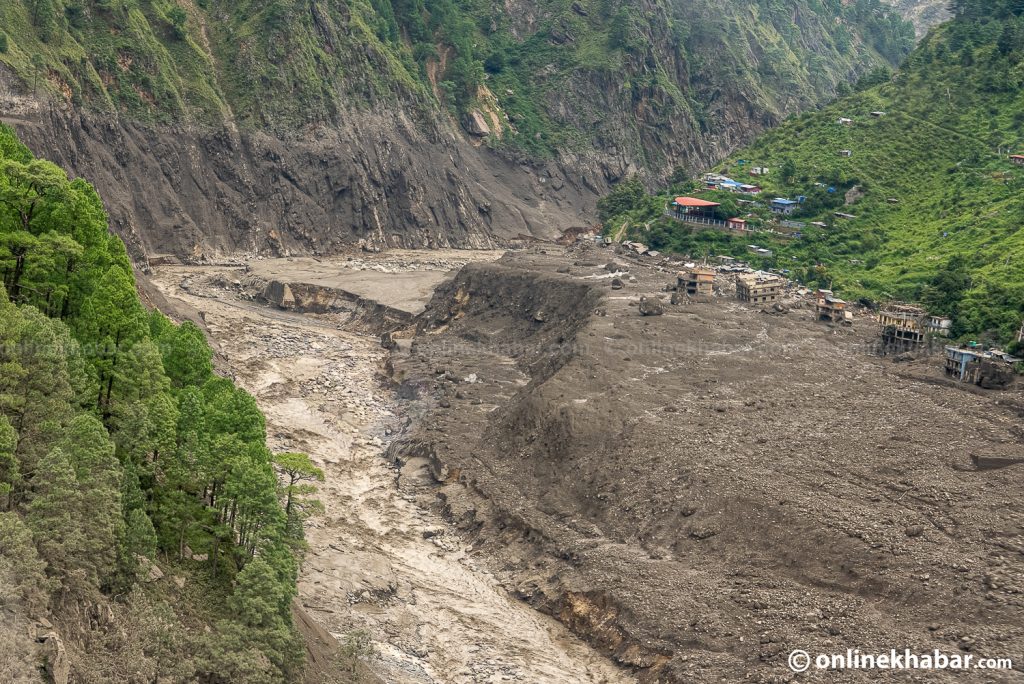
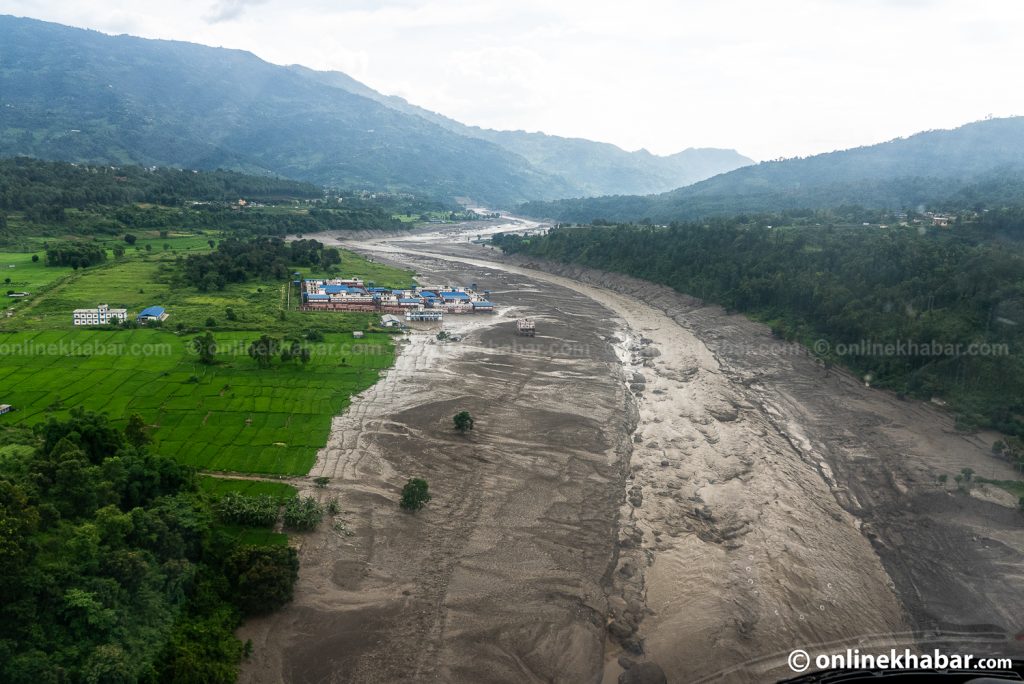
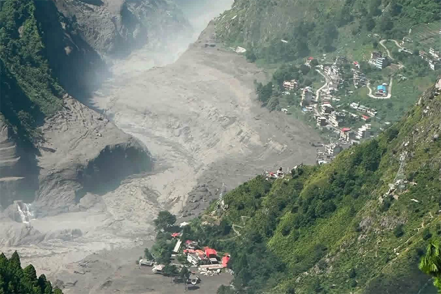
The flood hit Timure at around 8:30 am, causing extensive loss of life and destroying settlements and infrastructure along the Bhote Koshi and Trishuli rivers.
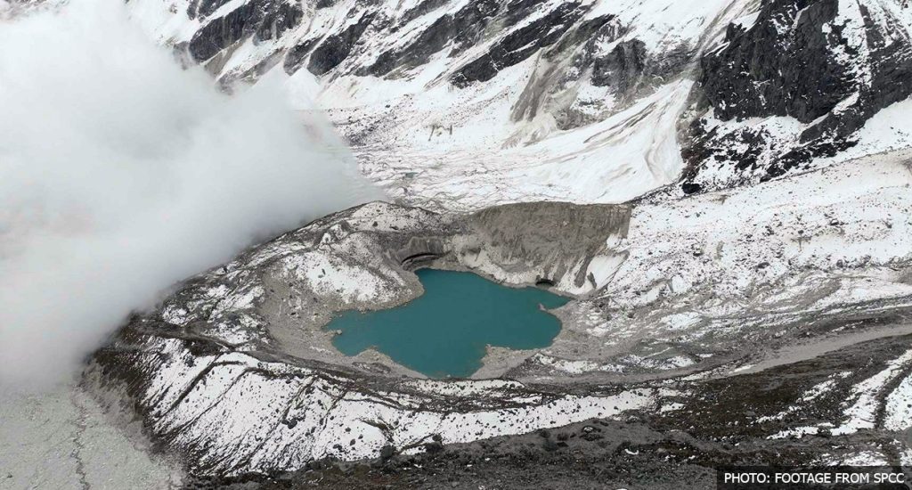
Experts estimate that the source of the flood may lie around 40–50 kilometres upstream from the Nepal-China border, where several potentially dangerous glacial lakes are located.
Some experts believe one or more of these lakes may have suddenly released a massive volume of water. Others suspect that a landslide or avalanche blocked the Lhende River, creating a temporary natural dam that subsequently burst.
Possible glacial lake outburst
Ranjan Kumar Dahal, a professor at Tribhuvan University’s Central Department of Geology, said a flood of this magnitude would be difficult to explain without a major avalanche and subsequent glacial lake outburst.
Dahal said three glacial lakes located close to each other in the upper Lhende River area could have been involved.
“We cannot say at this stage which lake failed or how,” Dahal told Onlinekhabar, adding that the lakes had previously been considered high-risk.
Researcher Amrit Thapa of the University of Alaska Fairbanks also believes an avalanche may have triggered the flood in the Lhende River. He said the assessment was based on preliminary discussions with scientists from Nepal and China.
The National Disaster Risk Reduction and Management Authority (NDRRMA) said a snow-and-rock landslide occurred around 20 kilometres northeast of the Rasuwagadhi border point, citing satellite imagery from Planet Labs.
According to the authority, the landslide caused a debris-laden flood in the Lhende River, which then flowed through Timure and entered the Trishuli River.
Experts divided over exact mechanism
Experts have not yet reached a consensus on whether the disaster should be classified as a glacial lake outburst flood (GLOF).
Some believe a glacial lake itself burst, while others argue that a snow-and-rock avalanche blocked the river before the resulting temporary dam collapsed.
Bishnu Maharjan, an academic working in geographical information systems (GIS) and remote sensing, said the incident appeared to be linked to a GLOF but stressed that further scientific investigation was required before reaching a definitive conclusion.
When a lake formed on the surface of a glacier — known as a supraglacial lake — suddenly drains, a large volume of water, rocks, soil and debris can rush downstream within a short period, creating a highly destructive flood.
Small glacial lakes also pose a major risk
Experts have warned that even apparently small glacial lakes can contain significant volumes of water beneath or within glaciers.
Researcher Thapa said several small lakes in the Tibetan region near Rasuwa had merged in recent years to form larger water bodies. He also said satellite studies conducted after last year’s flood showed significant changes in the area.
The International Centre for Integrated Mountain Development (ICIMOD) has previously identified 47 potentially dangerous glacial lakes that could affect Nepal.
Experts say rising temperatures and changes in glaciers are increasing the risks associated with such lakes. Thapa said the underlying cause of these increasingly unstable glacial systems is climate change.
Was an earthquake responsible?
Foreign Minister Shishir Khanal told Parliament earlier on Wednesday that preliminary information suggested an earthquake at around 8:37 a.m. may have triggered an avalanche, which in turn caused the flood.
However, he stressed that the information still needed to be verified.
The US Geological Survey (USGS) recorded a magnitude 4.4 earthquake in the Nepal-China border region. Some experts, however, have questioned whether an earthquake of that magnitude alone could have generated a flood of such scale.
The Department of Hydrology and Meteorology said there had been no particularly heavy rainfall in the Rasuwa area before the disaster.
Authorities and experts are continuing to investigate the exact source and mechanism of the flood, including through satellite imagery and coordination with Chinese authorities.