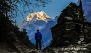
Every trekker who has walked the trails of Everest or Annapurna knows the feeling. Tea houses packed to the walls, permit queues snaking around corners, helicopters cutting through what should be silence. Nepal’s most celebrated trekking corridors have become victims of their own fame. But roughly 140 kilometres west, circling the world’s eighth-highest mountain through valleys that most trekking maps still treat as an afterthought, a different kind of Himalayan experience quietly waits.
Manaslu trekking has been part of my life for more than twenty years. I have crossed Larkya La with snow above my knees and shared tea with lodge owners in Samagaon whose children I have watched grow into adults. Every time I return, I remember why I started guiding. This mountain does not perform for you. It simply exists, and invites you to do the same. And unlike Everest or Annapurna, where the trail itself has become a kind of industry, Manaslu trekking still feels like something you discover rather than something you consume.
The tale of the untouched Manaslu trekking route
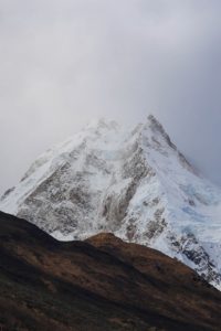
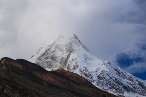
The trail loops completely around Mount Manaslu, the world’s eighth-highest peak at 8,163 meters, pulling you through deep river gorges carved by the Budhi Gandaki, dense rhododendron forests, high alpine meadows, and finally over the icy threshold of Larkya La Pass before dropping you into a different valley on the other side. Manaslu trekking is not about approaching the mountain and turning back. You walk all the way around it and earn every angle.
The entire route falls within the Manaslu Conservation Area, a protected landscape stretching across more than 1,663 square kilometres, and presses close enough to the Tibetan border that you feel it in the flat-roofed stone houses, the monastery doorways, the rows of prayer wheels, and the shift in the air itself. This is a restricted trekking region, meaning entry requires special government permits beyond the standard paperwork most Himalayan routes demand. That restriction is the single biggest reason Manaslu trekking still feels the way it does.
Why is the Manaslu trek popular among trekkers?
The most honest answer is silence. Near Samdo and below Larkya La, you can walk for half a day without passing another trekking group. On Everest and Annapurna, that kind of solitude simply does not exist anymore. Manaslu trekking offers genuinely less crowded trails, not as a selling point but as a reality that shapes every hour you spend on them.
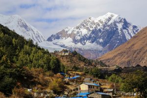
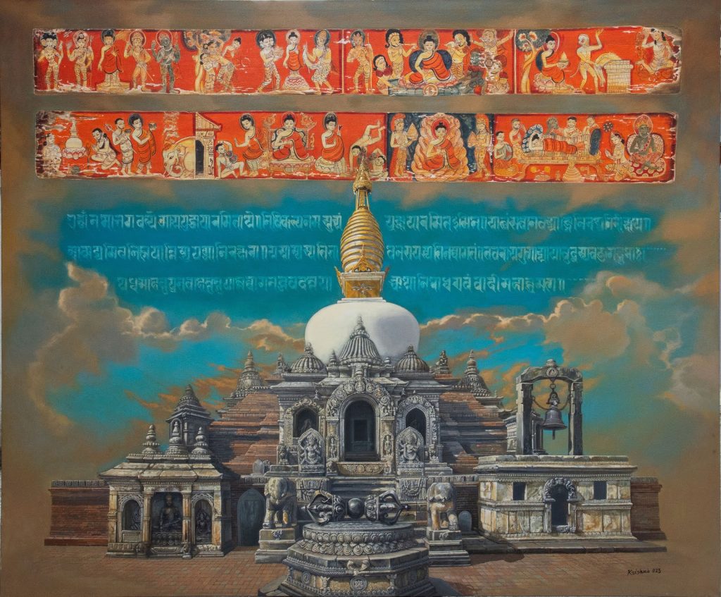
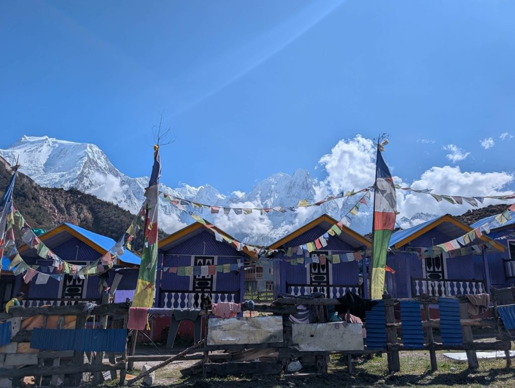
The culture along the trail is equally compelling. Villages like Samagaon carry an authentic Tibetan-influenced character that tourism has not touched or softened. The ancient monasteries above the village line, the prayer wheels lining the main paths, the mani walls built and rebuilt over centuries, the smell of butter lamps drifting through open doorways. It is all simply there, the way it has always been, with no performance attached to it.
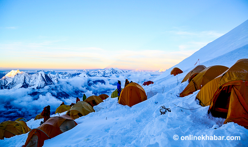
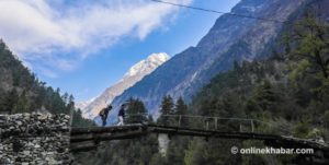
The landscape shifts dramatically as you gain altitude. One day of Manaslu trekking can take you from a subtropical river gorge to the foot of a glacier. The suspension bridges over the Budhi Gandaki are a highlight that never gets old, no matter how many times I cross them. They mark your passage deeper into the mountains in a way that feels both physical and psychological. And Larkya La Pass, at over 5,100 meters, is the kind of high mountain crossing that stays with a trekker for the rest of their life. In twenty years on this route, I have never once had a client reach the top and feel anything other than completely undone by what they are looking at.
Major highlights of the Manaslu trek
Manaslu trekking puts some of the most extraordinary experiences in the Himalayas within reach of any trekker willing to make the journey. These are the moments and places that stay with you long after you are back in Kathmandu.
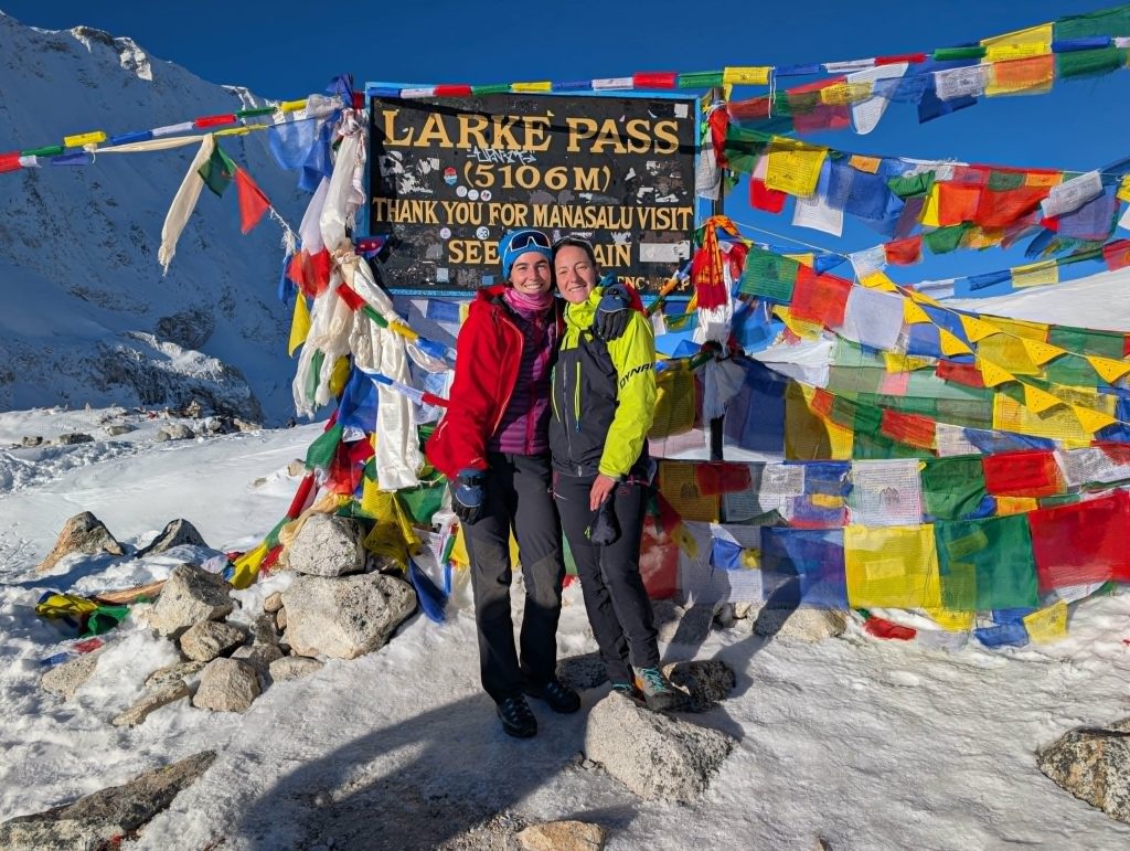
- Larkya La Pass at over 5,100 meters is the moment the entire trek builds toward. Every step before it is preparation. Every step after it is memory.
- Samagaon is where the mountain finally shows itself properly. Sit here for a day, walk up to Pungen Gompa, and let the altitude and the view do what they are supposed to do.
- Samdo is the last village before the pass and one of my favourite places on the entire route. Close to the Tibetan border, quiet, and completely honest about what it is.
- Manaslu Base Camp is a side trip most trekkers skip, and almost all of them regret skipping. Just you, the glacier, and the mountain.
- Buddhist monasteries and mani walls line the upper valley not as attractions but as a way of life that has been here long before trekkers arrived and will be here long after.
- Suspension bridges over the Budhi Gandaki never get old. Each one pulls you a little deeper into the mountains and a little further from everything familiar.
- Tsum Valley is the hidden extension that turns a great trek into an unforgettable one. Closed to outsiders until 2008, it still carries a quietness that the main trail is slowly losing.
When to trek: Best seasons for Manaslu trekking
Timing on a Manaslu trek is not something to leave to chance. The journey typically takes between 13 and 18 days to complete, depending on acclimatisation pace and whether side trips to Manaslu Base Camp or Pungen Gompa are included. I always recommend building in the extra days. The mountain rewards patience and punishes rushing.
Autumn, from late September through November, is the season I trust most for Manaslu trekking. The monsoon has cleared, the sky holds a clarity that photographers chase their whole careers, and the Larkya La crossing is at its most reliable. October is the sweet spot.
Spring, from March through May, brings rhododendron forests erupting in colour and sharpening mountain views. March and April are strong months. May can still work, but requires more attention to weather windows near the pass.
Winter and monsoon are seasons I do not recommend for the Manaslu trek. Heavy snow makes the pass dangerous between December and February, and the monsoon between June and August brings landslide risk on the lower sections and near-zero visibility in the high country. The mountain is not going anywhere. There is no good reason to fight the calendar.
The four permits you need for the Manaslu trekking
Manaslu trekking requires four separate permits before you set foot on the trail. Arrange all of them in Kathmandu through a registered trekking agency before departure.
- Manaslu Restricted Area Permit (MRAP) is the most important document on the list, controlling how many people enter the route each season. Fees vary by season, with higher costs during peak spring and autumn months. Required because the region borders Tibet and passes through restricted high-altitude terrain.
- The Manaslu Conservation Area Permit (MCAP) covers your movement through the protected landscape that the entire route passes through. The current fee is NPR 3,000 per person. Funds go toward wildlife protection, trail maintenance, and community development inside the conservation zone.
- Annapurna Conservation Area Permit (ACAP) applies to the final section near Dharapani, where the Manaslu trekking route crosses into Annapurna territory to complete the loop. The current fee is NPR 3,000 per person. Many trekkers are surprised by this one, but it is a legal requirement at the standard exit point.
- The Chumnubri Rural Municipality Entrance Permit is the one most trekkers and even some agencies miss entirely. Covers the major settlements along the upper route, including Jagat, Deng, Namrung, and Samagaon. The fee is NPR 1,000 per person and goes directly to the local government body managing these communities, making it one of the most direct ways your money reaches the villages you actually walk through.
Permit fees are subject to revision each season. Always confirm current rates with your trekking agency before departure.
What makes a local guide irreplaceable on a Manaslu trek?
The Manaslu Trek is a remote, high-altitude route that passes through culturally sensitive, restricted territory. The weather on Larkya La can shift from clear to dangerous within hours. Acclimatisation decisions made without experience have serious consequences at these elevations. A licensed guide is not a formality. They are the difference between a successful crossing and a helicopter evacuation.
Beyond safety, there is a cultural argument. The communities along this trail deserve to be engaged with respectfully and knowledgeably. A good local guide is not just navigating the trail. They are opening doors, translating contexts, and ensuring the relationship between trekkers and mountain communities remains a genuine exchange rather than passing consumption. The guides I have worked with from Gorkha District over two decades are among the most capable mountain professionals I know. Hiring locally here is not a bureaucratic obligation. It is the right way to walk through someone else’s home.
How to get there and the route to the Manaslu trek?
Most trekkers begin from Soti Khola or Machha Khola, accessible by road from Kathmandu in roughly eight to nine hours. Some begin from Arughat Bazaar, which adds a day of walking but gives a gentler entry into the lower valley. I prefer this option for groups without prior high-altitude experience. The classic circuit follows a clockwise direction around the massif over 14 to 18 days.
Day 1: Arrival in Kathmandu (1,400m). Our Team representative will meet you at the airport and transfer you to your hotel in Thamel. Use the rest of the day to recover from travel and get your bearings.
Day 2: Permit preparation and trek briefing in Kathmandu. Your guide will meet you after breakfast to walk through the full Manaslu trekking itinerary, collect your documents, and sort your restricted area permits. Bring your passport, passport photos, and travel insurance. The afternoon is yours to pick up any last-minute gear.
Day 3: Drive from Kathmandu to Machha Khola (890m), nine to ten hours. An early start from Kathmandu takes you west along the Trishuli River through Dhading Besi and Arughat Bazaar before the road turns rough for the final stretch into Machha Khola, a quiet village sitting along the Budhi Gandaki. Rest well tonight. Tomorrow the trail begins.
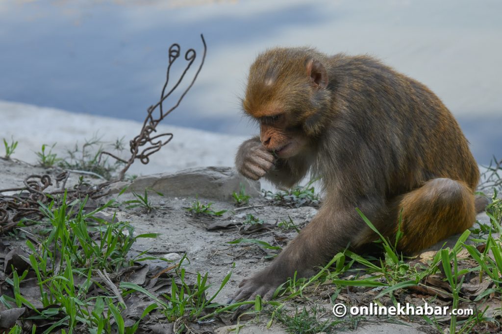
Day 4: Machha Khola to Jagat (1,340m), seven to eight hours. The trail follows the Budhi Gandaki River through Khorlabesi, past the hot springs at Tatopani, and through the settlements of Doban and Yaru Bagar before reaching Jagat. This is where you register your permits at the conservation area checkpoint and officially enter the Manaslu Conservation Area. Watch for langur monkeys in the forest sections.
Day 5: Jagat to Deng (1,860m), six to seven hours. The trail crosses a stony ridge with early views of Sringi Himal before moving through Salleri, Sirdibas, and the Gurung settlement of Philim. After crossing the Budhi Gandaki twice over suspension bridges, you arrive in Deng, a quiet village where the Tibetan cultural character of the route begins to assert itself.
Day 6: Deng to Namrung (2,630m), six to seven hours. Leaving Deng, the trail climbs steadily through forests and past mani stones toward Ghap, then continues via Ghapsya with views of Shringi Himal before ascending through forest and river crossings to Namrung. The villages here carry a Tibetan soul, something most trekkers never expect to find this deep inside Nepal.
Day 7: Namrung to Lho (3,180m), four to five hours. A shorter day through forested trails with views of Saula Himal, Kutang Himal, and Pangbuche Himal opening up around you. By the time you reach Lho and Manaslu appears above the rooftops for the first time, most trekkers stop walking mid-step without quite meaning to. I have never seen anyone walk past that view without stopping.
Day 8: Lho to Samagaon (3,520m), three to four hours. A short climb through Shyala village brings you into Samagaon, the cultural heart of the upper Manaslu trekking route. The mountain sits directly above the village and makes its presence felt immediately. After lunch, you can walk up to Pungen Gompa or out to Birendra Lake, a freshwater glacial lake about three kilometres from the village. Both are worth the effort.
Day 9: Acclimatisation day at Samagaon. This day is not optional. Your body needs time at this altitude before the pass, and the options for spending it well are genuinely good. Manaslu Base Camp sits at 4,800 meters, roughly six kilometres from the village, and offers a view of the mountain that almost no one else is standing in front of on any given day. Pungen Gompa, above the village, is shorter and equally rewarding. Try to visit at least two of the three options available, including Birendra Lake, before returning to Samagaon for the evening.
Day 10: Samagaon to Samdo (3,860m), three to four hours. The trail climbs steadily along the Budhi Gandaki through rhododendron, juniper, and birch forest before the valley widens near Kermo Kharka and the white Kani Gateway comes into view. Samdo sits just four kilometres from the Tibetan border and carries that proximity in everything from its architecture to the faces of the people who live here. Views of Manaslu, Simnang Himal, and Ngadi Chuli open up across the valley.
Day 11: Samdo to Dharamsala (4,460m), three to four hours. A short day by distance, but an important one for acclimatisation. The trail crosses hills and wooden bridges over the Budhi Gandaki, passes the Larkya Glacier, and arrives at Dharamsala, the high camp below the pass. Basic shelter, early dinner, and an early sleep. The alarm goes off well before dawn.
Day 12: Dharamsala over Larkya La Pass to Bimthang (3,720m), eight to nine hours. The day the entire Manaslu trekking experience is built around. Departure at 4 am under stars, a long steady climb to Larkya La at 5,106 meters, and then the panorama at the top that includes Himlung, Cheo, Gyagi Kung, Kang Koru, and Annapurna II spread across the horizon. I have crossed this pass more times than I can count, and it has never once felt routine. The descent to Bimthang is long and demanding across moraines and glacial terrain, but the valley that opens below you earns every step.
Day 13: Bimthang to Tilje (2,560m), five to six hours. The final trekking day descends through high grazing grassland, rhododendron woodland, and the Dudh Khola valley with views of Manaslu, Lamjung Himal, and Himlung Himal accompanying you down. The trail passes through Hampuk, Yak Kharka, Gho Village, and finally arrives at Tilje, where the Manaslu trekking route winds down quietly and the lower world starts coming back into view.
Day 14: Drive from Tilje to Kathmandu or Pokhara, nine to ten hours. A shared jeep to Besi Sahar connects with bus transport back to Kathmandu or Pokhara. Roughly 220 kilometres and a full day of travel, but enough time to sit with the mountains in your memory before the city arrives again.
The communities that make up the trail
I cannot write honestly about the Manaslu Circuit without writing about the people who built it into what it is.
This route does not run on Kathmandu-based tourism infrastructure. It runs on local families who cleared land for lodges, learned to cook for strangers passing through, and created a hospitality economy in one of the most remote corners of Nepal. I have been a guest in these homes and lodges for twenty years, and the relationship between the trekking economy and village life on this circuit is one of the most direct and transparent I have seen anywhere in Nepal.
Women-led tea houses have become a defining feature of the upper Manaslu trail in recent years. With male family members often away during certain seasons for trade or labour, women have taken over lodge management, cooking, and the daily rhythm of mountain hospitality. One woman I have known for over a decade, who runs a tea house in Samagaon with her daughter, put it plainly when I last visited: “Before the trekkers came regularly, the young people had no reason to stay here. Now my children work beside me. That has changed everything.”
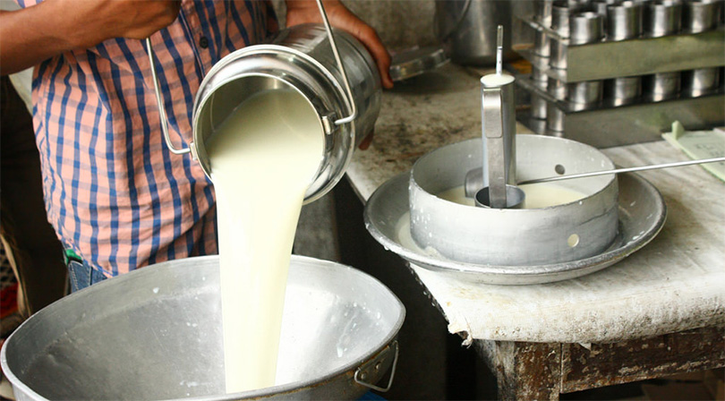
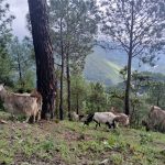
Yak farming remains the backbone of upper village economies, and the intersection of traditional livelihood and modern tourism has produced something genuinely interesting. Yak cheese, yak butter tea, and locally prepared dried meats appear on lodge menus as both practical food and as a connection to the pastoral culture that existed in these valleys long before any trekking route was mapped through them.
Younger community members are increasingly finding their place in mountain tourism as trained guides and high-altitude porters, specifically positioning themselves to lead groups through terrain they have known since childhood. I make a point of hiring locally on every Manaslu trip I lead. Not as a gesture, but because it produces a better outcome for everyone involved.
Community-based conservation initiatives, some run in partnership with the Manaslu Conservation Area Project, are also taking root across the upper villages. Forest management committees, waste collection programs, and trail maintenance efforts are being led by people who understand better than anyone that the mountain environment is the foundation of everything the tourism economy rests on.
Challenges facing the Manaslu region
The Manaslu trek is under pressure from several directions simultaneously, and it would not be honest to write about this route without naming them directly.
Climate change is visible in ways that require no expertise to read. Glaciers that I used as reference points fifteen years ago have retreated significantly. Larkya La conditions are less predictable than they were when I first crossed it. Local herders in the upper villages describe seasons that no longer arrive on schedule. This is not a future concern on the Manaslu Circuit. It is a present reality.
Road expansion is moving faster than most people outside the region realise. Motor roads are pushing further into the Gorkha valleys, shortening the trekking sections of the route and reducing the time and money trekkers spend in villages. The development logic is understandable. The consequences for trekking-dependent communities are real and not yet fully accounted for.
Waste management along the trail remains an ongoing failure. Single-use plastic that enters the circuit via supply chains does not reliably leave via responsible disposal. Local committees are managing this with almost no outside support. Trekker volumes, even at current levels, are producing an environmental load that community systems were not designed to absorb.
And the subtler pressure of cultural preservation sits underneath all of it. The Tibetan-influenced character of the upper Manaslu communities is precisely what makes this route distinctive. It faces the same forces of homogenization that have quietly altered village culture across every major trekking corridor in Nepal.
Suggestions to the Nepal government: What this route needs now
I have spent more than two decades on this trekking route. I have watched policy decisions made in Kathmandu ripple through village life in ways that the decision-makers often never see. The following comes from that experience, not from theory.
The restricted permit system should be maintained, and its enforcement made more consistent. It is one of the most effective tools Nepal has for managing trekker volume on a fragile route. Any revision to permit costs or quota structures should put environmental carrying capacity ahead of revenue targets. More trekkers do not automatically mean more benefit to local communities, and the Manaslu Conservation Area has limits that the permit system exists to respect.
Waste management infrastructure needs real investment. Community collection points, porter-accessible carry-out systems, and mandatory deposits on single-use packaging brought into the restricted area would all make a concrete difference. The communities along this trail are managing a problem created partly by the tourism industry, and they are doing it without adequate support. That needs to change.
The local guide mandate is one of the better regulations on the books and should be protected, not diluted. What needs to accompany it is a structured training and certification program that can be accessed from within Gorkha District, rather than requiring young people to travel to Kathmandu to qualify. The guides I have worked with from these villages are exceptional. The formal pathways to recognition need to be brought closer to where they live.
Road expansion planning in the Gorkha valleys needs to include trekking communities at the table from the beginning, not inform them after decisions are made. When a motor road replaces a walking section of the circuit, the villages along that section lose footfall income directly and immediately. A development framework that does not account for this is not complete.
The women-led lodges and small tea house operators along the Manaslu trail should be recognised and supported through Nepal’s tourism development funds. These operators have kept this route functioning through pandemic years, difficult seasons, and the uncertainties of restricted-area tourism. Low-interest business support, formal inclusion in tourism development planning, and recognition of their contribution to conservation would do more for the long-term health of this circuit than almost anything else the government could choose to do.
A place worth the effort of protecting
Every season, I come back to the Manaslu Trekking hoping it stays a little longer as it is. I know that is not a realistic hope in its simplest form. The numbers will grow. The infrastructure will change. The trail will evolve in ways I cannot predict.
But the communities along this route are resilient, the landscape is extraordinary, and the experience of circling an 8,163-meter mountain through valleys that still feel genuinely remote is something very few places on earth can offer.
As Nepal’s famous trekking routes become increasingly crowded, the Manaslu trekking trails remain one of the few places where travelers can still experience the Himalayas in their raw and authentic form while directly supporting local mountain communities. That combination is worth protecting. I have spent twenty years believing that. I have no intention of stopping now.