

Kathmandu, November 1
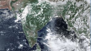
As the impact of Cyclone Arnab continues to weaken, another low-pressure system has developed over the Bay of Bengal. However, the new system is expected to be weaker than Arnab.
According to the India Meteorological Department (IMD), the system had been moving west-northwestwards at a speed of 22 kilometres per hour as of October 3. At 11:30 pm Indian Standard Time on October 31, its centre was located over the southeast Bay of Bengal at 10.9 degrees north latitude and 87.5 degrees east longitude.
At that time, the system was approximately 830 kilometres east-southeast of Chennai, 880 kilometres south-southeast of Visakhapatnam, 900 kilometres southeast of Machilipatnam and 950 kilometres east-southeast of Ongole.
According to the IMD forecast, the system is likely to intensify into a deep depression over the southwest Bay of Bengal and adjoining southeast Bay of Bengal by the afternoon of November 1. It is expected to develop into a cyclonic storm by midnight on November 1 and further intensify into a severe cyclonic storm over the west-central Bay of Bengal on November 2.
The storm is forecast to approach the south Andhra Pradesh coast early on the morning of November 3 and make landfall between Nellore and Narsapur later that morning.
The department has forecast wind speeds of 100 to 110 kilometres per hour at the time of landfall, with gusts reaching up to 120 kilometres per hour.
An earlier bulletin issued at 5:30 pm Indian Standard Time on October 31 had reported that the system had moved west-northwestwards at a speed of 30 kilometres per hour over the preceding six hours. At that time, its centre was located at 10.5 degrees north latitude and 88.6 degrees east longitude.
The latest update shows that the system’s centre has shifted west-northwestwards, changing its position. The department said it was continuously monitoring the system’s development and projected track.
Weaker than Arnab
The current low-pressure system is weaker than Cyclone Arnab. It took Cyclone Arnab seven days to travel from the Bay of Bengal to land. During that period, it gathered large amounts of moisture-laden air, which strengthened the cyclone.
However, the current system is expected to reach land within three days and has therefore accumulated less moisture than Arnab, according to Skymet, a private Indian weather and climate analysis agency.
As a result, the system is not expected to bring as much rainfall as Cyclone Arnab, the agency has assessed.
Will it affect Nepal?
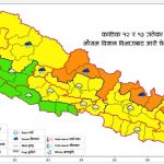
The impact of Cyclone Arnab brought rainfall and snowfall to Nepal on October 29, 30 and 31. However, it is not yet certain when or whether the new system will affect Nepal.
Indian meteorologists have said its effects are likely to extend as far as Bihar, a northern Indian state bordering Nepal.
Meteorologists at the Weather Forecasting Division of Nepal’s Department of Hydrology and Meteorology said they were closely monitoring the latest weather system. They believe it is unlikely to have any significant impact on Nepal.
“It does not appear likely to have much impact. Such systems keep developing. It does not seem likely to have a major impact,” said David Dhakal, a meteorologist at the division.