

Kathmandu, September 3
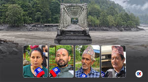
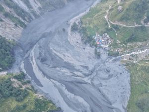
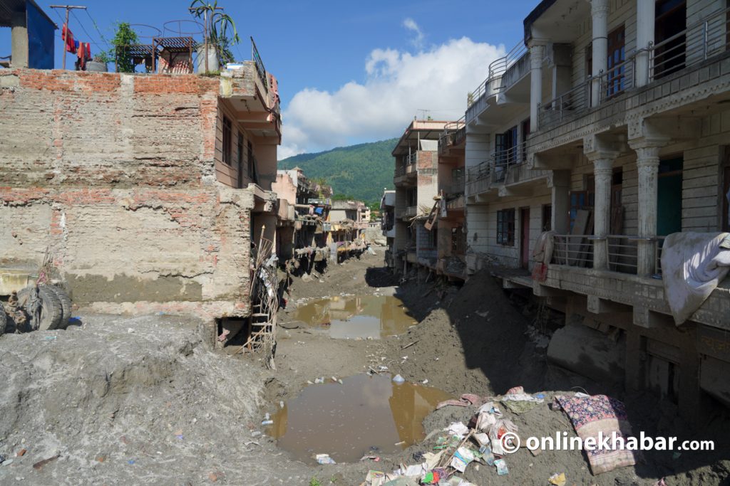
The devastating flood in the Bhotekoshi River, which entered Nepal through the Rasuwagadhi border point on August 26, damaged at least 41 motorable bridges as it swept downstream. It completely washed away 35 of them.
The road connecting Betrawati in Rasuwa to Mailung, Syafrubesi and Rasuwagadhi has been destroyed. With 40 kilometres of road in Rasuwa alone completely damaged, the entire district has been cut off from the road network. Although an alternative road has been opened, it is not effective. Nuwakot, on the other side of the Trishuli River, is also currently deprived of direct road access.
As many as three dozen bridges had been built along the 85-kilometre Galchhi-Rasuwagadhi road section. Former government secretary Keshav Sharma said the flood had shown that many bridges should not be built with inadequate preparation in every settlement.
He said another lesson from the disaster was that infrastructure development should be planned based on the geography of the entire river basin, rather than being confined by the political boundaries of districts or local governments.
According to Sharma, bridge construction should now be planned at specific intervals. Such bridges should be climate-resilient and incorporate appropriate measures to withstand strong river currents. Instead of building numerous bridges over short distances, he suggested constructing strategic bridges and developing roads on both sides to connect them with settlements.
Former acting chief executive of the National Disaster Risk Reduction and Management Authority, Anil Pokharel, said the flood had sent a clear message that existing bridge construction standards need to be revised. “Until now, we built low-profile bridges, but it has become clear that such bridges cannot withstand floods in geography like ours,” he said. “We now need to reconsider the standards themselves.”
Among the bridges between the Miteri Bridge at Rasuwagadhi and Muglin, the arch bridge at Muglin appears to have survived the flood most safely. Although the bridge is relatively new and the flood had already lost some of its force by the time it reached Muglin, its design also helped protect it from debris and other materials carried by the floodwaters. “We now have to account for not just water but also debris. Since floods originating in the Himalayan region have a different character, this shows that infrastructure must be built accordingly,” Pokharel said.
He said the Bhotekoshi flood carried a greater volume of debris and other materials than water, and that when such materials move with the water, they generate enormous force that conventional infrastructure cannot withstand. Pokharel said the fact that some washed-away bridges remained floating on the surface rather than sinking underwater also indicated that the flood carried a large amount of debris relative to the volume of water. He agreed that bridge construction should not be treated as a casual political agenda.
A flood beyond bridge design standards
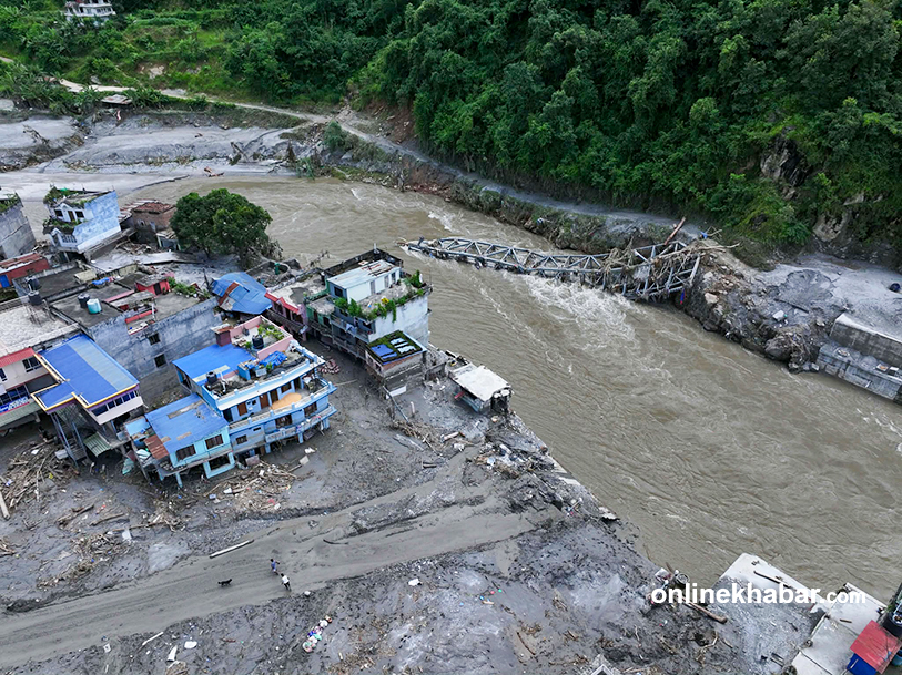
According to the Department of Roads, the level of flooding the infrastructure had to withstand in the Bhotekoshi River had not been envisaged by any existing standard.
Director General of the Department of Roads, Dr Bijay Jaisi, said bridges are generally built according to established standards. However, the existing standards did not anticipate flooding of this magnitude. “We will have to study how many hundreds of years it has been since a flood of this scale occurred,” he said. “Our standards were not designed for structures to withstand flooding of this magnitude. Instead, we need another study to determine why some of the bridges survived.”
Opportunity to shift to taller, longer bridges
Jaisi said the flood had at least demonstrated the need for the state to make adequate investments in strategic bridges. Bridges can be built to any size, he said, but larger structures cost more.
He said the disaster had made it clear that bridges should be classified according to their importance and that strategically important bridges should be built to higher standards so that vital transportation links can remain operational even during major natural disasters. At the very least, he said, bridges along highways connecting district headquarters should be longer and taller.
The department will formulate standards accordingly, he said. “Such events could occur again in other rivers as well. This flood has shown that we need to develop our standards accordingly.” Experts said the disaster had also highlighted the need for countries in the Himalayan region to build infrastructure suited to a changing climate and work to reduce potential risks.
According to Jaisi, the arch-design bridge built at Muglin will not be adopted for strategic roads as a standard design in the future. The department will develop standards accordingly. Decisions on rebuilding bridges over the Bhotekoshi and Trishuli rivers will also be made only after technical studies.
For the immediate reopening of roads, however, the government is preparing to install Bailey bridges at three locations. The first is planned at the site where the Tadi Khola bridge over the Trishuli River at Devighat was washed away. The second is planned at the site of the old bridge in Trishuli Bazaar. The third will be installed at Betrawati, connecting Nuwakot and Rasuwa. “Once Bailey bridges are installed at these three locations, the main highway will resume operation,” Jaisi said. “The remaining bridges will then be rebuilt as permanent structures based on technical studies and necessity.”
Former secretary Sharma said that infrastructure along rivers and in steep terrain should not be designed solely on the basis of the standards and expertise of a single field. According to him, alongside structural engineering, studies should also cover interconnected aspects such as the area’s geology, geotechnical engineering, hydrology, river morphology and the characteristics of glacial rivers. He said infrastructure projects should also follow the recommendations of experts in the relevant fields.
He said roads, bridges and dams along Nepal’s rivers are currently designed based on the average flood history of the past 100 years. This standard has been in effect only since fiscal year 2018/19; previously, designs were based on a 50-year flood history. Sharma suggested that the standards should be revised again to address changing patterns of cloudbursts, abnormally heavy rainfall concentrated in a particular location, as well as debris flows and sediment transport. He also called for revisions to standards governing high flood levels, additional clearance above those levels and impact indices.