The Nepali public has almost forgotten the economic block that was imposed by India and protestors from Madesh in 2015. However, the shift in the national economy after this six-month-long economic crisis has impacted many lives.
There was a shift from Indian to Chinese trade in 2015, which led to the construction of multiple road networks connecting Nepal to China. One of those actions by the Government of Nepal during the 2015 economic blockade was letting the Nepal Army open a 180 km road linking China to Benighat via Gorkha’s Sama Gaun. Another stretch of the same track passed through Chekampar village of TSUM, leading to China’s Border. That’s two roads to the Border of China, less than 50 km apart.
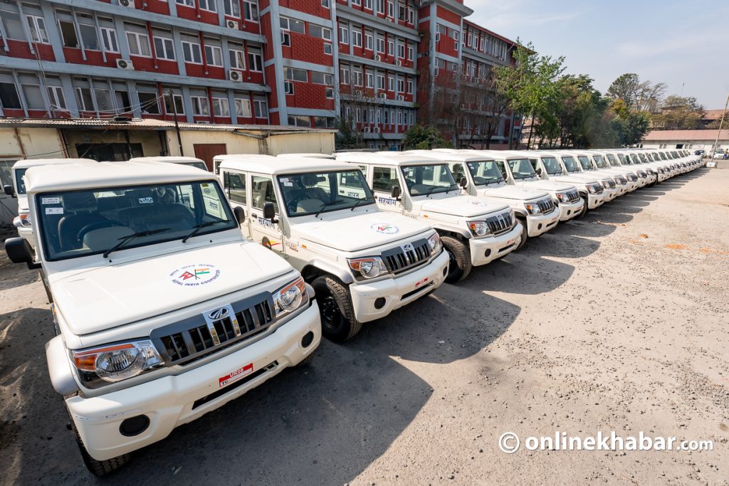
The construction project of the Benighat-China road was approved in January 2015, and the lower section from Benighat to Hawa Dada was done by the Departments of Road. The responsibility of a 120 km road section from Hawa Dada to the border was then handed over to the Nepal Army.
According to the Defence Ministry of that time, the army received Rs 35 million for opening the track back in 2017; after that, the army started the work. The construction was supposed to be completed in 2027.
Importance of Benighat- China Road
The long-due project of Benighat connecting the Border of Tibet opens a new trading route that is closer to Kathmandu Valley, Pokhara, and Chitwan, Nepal’s three largest cities. The road goes via Samdo village of Darchre Rural Municipality directly into the Ruila Naka of Tibet.
Currently, the 108 km Araniko highway that connects Kathmandu to Kodak is the major trading route from Kathmandu to the world’s major economy, China. Several factors, such as heavy traffic, poor road maintenance, landslides, political disputes at the Border, and many other factors, often cause trade to be blocked between Nepal and Tibet when we rely on the Araniko Highway only.
Thus, the need for a new highway connecting Nepal to Tibet, especially in the Western zone, closer to other large cities such as Pokhara and Chitwan, is going to play a big role in the import/ export business of Nepal and China. And this project is going to open up some new trade prospects.
Challenges along the road
The Nepali army commenced the construction of a 60-kilometre road in 2017. In five years, the army successfully opened an 18-kilometre-long section and handed it over to the Benighat-Arughat-Larkebhanjyang Road Construction Task Force. Another 18.5 km of road track was also almost ready at the end of 2022.
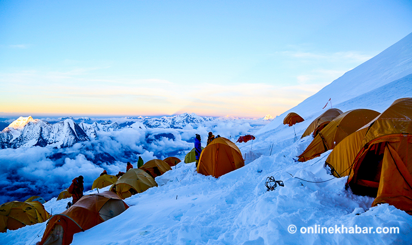
Reports suggest that the road goes via the Ngula Dhajen Pass at a height of 5,093 m (16,709 ft), making it among the highest-altitude roads in Nepal. As the road section will be covered in thick snow for more than half of the year, construction is not easy.
Considering the remoteness of the Samagoan and TUSM area, logistical and engineering issues for cutting off such large cliffs and buildings through a narrow gorge are going to take a lot of work. Although the Nepal Army was supposed to complete the construction by 2027, it might take a few additional years before they are ready to hand over the complete road.
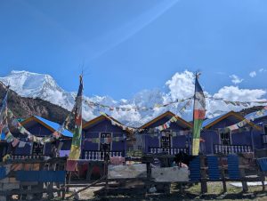
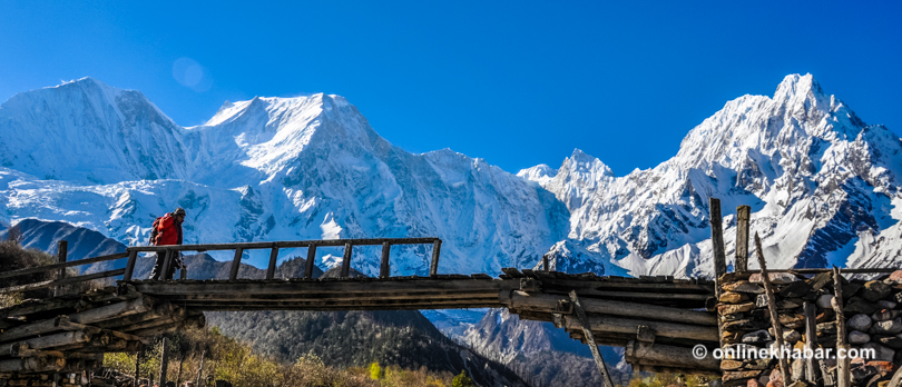
Road and life of Manaslu/ TSUM Valley
TSUM valley is one of the sacred valleys that Guru Rinpoche (also called Padmasambhava) created and named Beyul. In Buddhism, Beyul is a holy place where there will never be war among people, and everyone lives in perfect harmony with nature. Understanding the significance of such a holy place, the government of Nepal has kept TSUM valley as the restricted land of Nepal in an attempt to protect the traditions and culture of this pristine land.
For so many years, even a helicopter could not land in Manaslu without a special permit. So, having such a road network is going to greatly shift people’s lifestyles.
Along with a national highway, many financial and social benefits come to the connecting villages. As a well-paved gravel road crosses the pristine TSUM valley, the locals have better access to trade, schools, hospitals, jobs, and more.
However, the locals are worried that it will be difficult to preserve the cultural and traditional values of the TSUM area after such exposure.
A local of Chhokung Paro village, Penarapsing, said, “We were never consulted if we wanted a highway to pass through our villages. They came up with a measuring tape, cut through our land, and ran dozers right next to our holy Monastery. How will we pray right next to the highway with continuous noise? The community’s free, prior, and informed consent was not acknowledged while they planned the construction, and the villagers are not happy with it.”
Another big concern is its impact on the trek tourism incomes of Manaslu and TSUM. Manaslu Trek is currently the third most crowded hiking route in Nepal, right after Everest and Annapurna. Now, as this road passes through the traditional trekking route, the tourism industry here is at severe risk. The dirt, noise, and pollution along the way will surely end Manaslu’s tourism shortly.
The local government should start planning to build an alternative trekking route to the villages of Samagaun and TSUM Valley as soon as possible. However, even after an alternative trekking route, the tourists are likely to reduce the duration of the trek. The previously popular Annapurna Circuit Trekking Trail’s deserted villages reflect the future of Jagat, Deng, Chumling and more. A long-term sustainable plan must be made to protect the culture and trekking tourism industry of TSUM before bulldozers and heavy trucks start to walk through these “Beyul“.