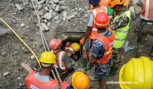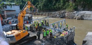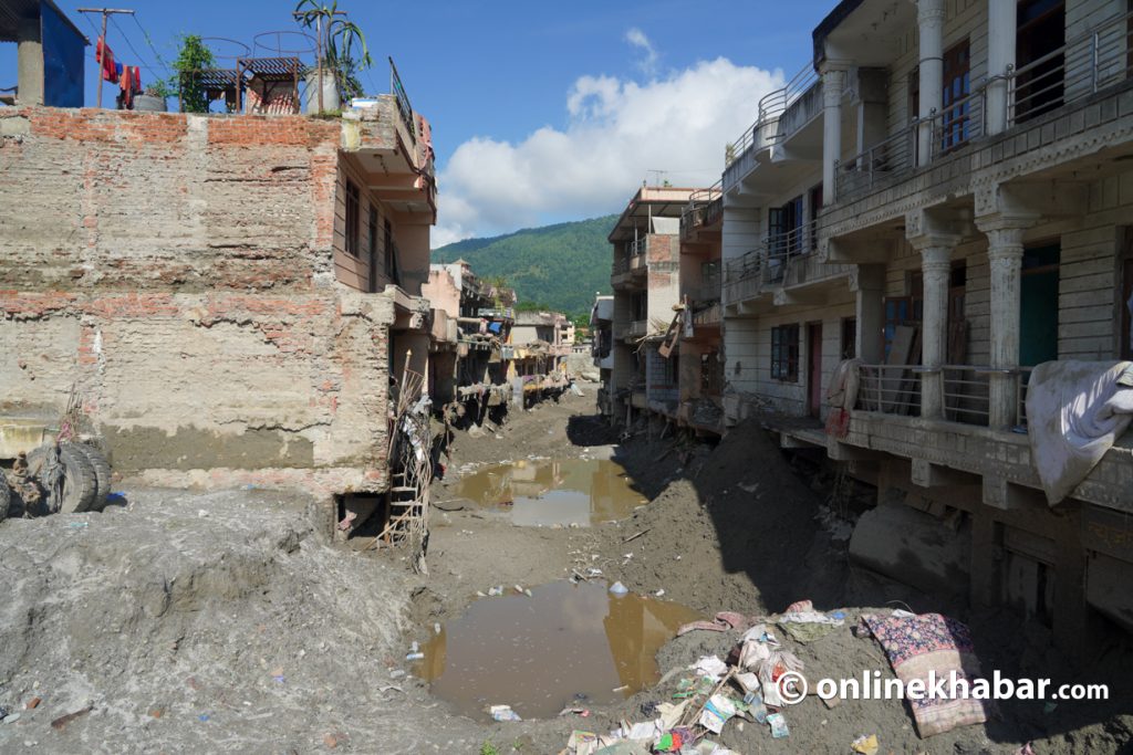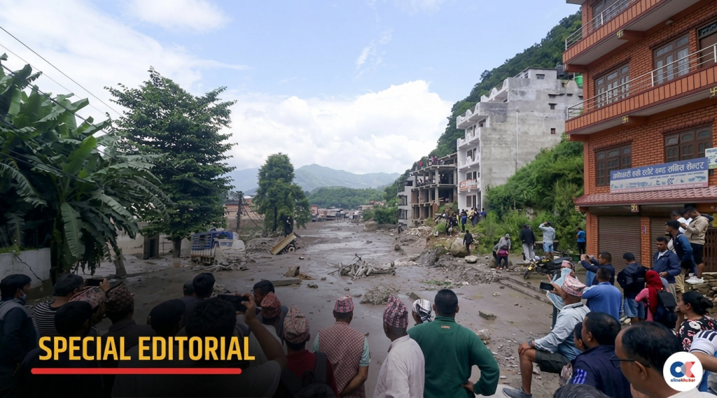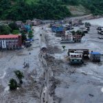



The catastrophic flood which took place in the Bhote Koshi–Trishuli river area in August 26 has left Nepal facing one of the worst mountain disasters in recent times. Starting in the glacierized Himalayan region, the situation quickly turned into a destructive sequence involving ice, rock, debris and water, which moved downstream through Rasuwa and then into Nuwakot, Dhading, Gorkha, Chitwan, Tanahun and Nawalparasi. As a result of the disaster, settlements, bridges, roads, hydropower facilities and the Rasuwagadhi–Kerung trade route were destroyed, together with a huge loss of human life and livelihoods.
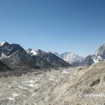
The incident was caused by a major failure of an ice-and-rock mass in the upper Lhende Khola catchment, north of the Langtang-Lirung peak. Analysis using satellite data indicates that an area of about 2.10 square kilometres of glacier and the surrounding land from 5,200 m elevation have collapsed, with an additional 3.05 square kilometres being greatly eroded at an elevation of about 3,800 m, part of which is debris-covered glacier. The total estimated volume of ice, rock, sediment and debris that was moved could have exceeded 74.43 million cubic metres, though these figures need to be confirmed by further studies.
This is unlike a typical monsoon flood or even a glacial lake outburst flood in that the Bhote Koshi event seems to have developed very quickly, with little or no heavy rainfall having occurred previously in the immediate source area, the northern side of the Langtang-Lirung Peak. The steep terrain of the Himalayas sped up the flow of ice, rock and water, thus giving rise to a highly powerful flood wave.
The effects have been huge. As of writing this articl , there had been 1,410 confirmed deaths, some 6,145 people missing and nearly 93,000 people affected. Initial estimates by NDRRMA suggested that the total damage amounted to about USD 2695.33 million, comprising 1,812.01 million in physical damage and 883.32 million in economic losses. The cost of reconstruction would be 4,774.99 million USD. It was reported that fourteen hydropower projects, 68 bridges and approximately 40 to 45 kilometres of major roads had been damaged or destroyed. Additionally, the disaster disrupted electricity generation and the main northern trade route with China.
The Bhote Koshi disaster, starting in the high mountains of Nepal, the ice-and-rock failure and the flood wave it caused had a catastrophic impact on the area near the Nepal-China border around Rasuwagadhi–Kerung and then continued down through Nepal. What initially was a high-altitude cryospheric hazard eventually became a large-scale cascading disaster, influencing the populations and critical infrastructure in Rasuwa, Nuwakot, Dhading, Gorkha and in several local municipalities downstream in the Bhote Koshi–Trishuli river system. This incident serves as a clear indication that mountain hazards do not respect political boundaries and that effective disaster risk reduction in the Himalayan region must include stronger cross-border monitoring, the sharing of information, early warning systems and coordinated emergency preparedness between neighbouring countries.
The increase in temperature in recent years in Nepal’s high Himalayas has led to major changes in its glaciers, snow and permafrost. The rapid warming is accelerating the retreat of glaciers, greater melting, degradation of the frozen ground and the destabilisation of mountain slopes. On the other hand, extreme precipitation and other hydro-meteorological events are becoming increasingly important parts of disaster risk. Climate change is modifying the environmental conditions in which these hazards take place; glacier retreat and the degradation of permafrost can reduce previously stable slopes, while changes in precipitation can increase the chance of extreme runoff, landslides and debris flows.
The direct cause of the Bhote Koshi incident seems to have been a large ice-and-rock failure rather than a typical flood triggered by rainfall or breach of glacial lakes. There is a broader interaction between warming, glacier retreat, slope instability, snow and ice conditions, river processes, and exposure downstream. These interactions are capable of causing a series of hazards, one process setting off another and, in the end, resulting in an effect much greater than that of the original event.
Nepal has for a long time suffered from floods, landslides, debris flows, avalanches, earthquakes, droughts, forest fires and glacial lake outburst floods; what is becoming more worrying is the idea that these hazards might interact. The fact that the 2021 Melamchi disaster, the repeated floods and landslides that have occurred all over the country, the more recent hazards associated with glaciers and rainfall, and the flooding in the same Bhote Koshi area in 2025 show that mountain hazards can occur again and change quickly is contrasted by the 2026 disaster, which brings out a different aspect: a high-altitude cryospheric failure can cause a devastating flood many tens of kilometres downstream, putting at risk communities and infrastructure which may not at first seem to be directly affected by a glacier hazard.
The growing extent of Nepal’s infrastructure is at the same time altering the level of possible losses. Increasingly, roads, hydroelectric power stations, transmission lines, settlements, tourism facilities and trade infrastructure are situated in the narrow river valleys. Although these areas are of economic importance, they also serve as natural routes for floods, debris flows and landslides. As seen in the Bhote Koshi flood, one extreme event can at the same time cause a humanitarian, energy, transport, trade and environmental crisis.
Nepal is trying to strengthen disaster preparedness, climate adaptation, hydrometeorological monitoring and early warning systems, but in the high mountain area these measures are still generally insufficient because of the rapidly changing cryospheric and geological conditions which are causing hazards that are becoming more complex and interconnected. There is an urgent need for the government to give greater attention, make more investment and improve institutional coordination if sustained high-altitude monitoring through university research, early warning is to be strengthened, and community preparedness is to be enhanced, and if infrastructure development is to be based on risk assessments that take account of climate conditions and hazards.
The key lesson from Bhote Koshi is that merely rebuilding what has been destroyed is not sufficient; if roads, bridges, hydropower projects, settlements and public facilities are reconstructed in the same dangerous locations and built to the same standards, then it will just end up with the same conditions that led to the previous disaster.
Future development in the Himalayan region must therefore be based on risk assessment and be resilient to the effects of climate change. Hazard assessments should be made a mandatory part of major infrastructure planning, especially in the high mountain river valleys. Glacier, permafrost, snow, glacial lake, landslide and river monitoring should all be incorporated into a national mountain hazard observatory. Continuous monitoring and rapid assessment can be supported by the use of satellite imagery, UAV surveys, numerical modelling and artificial intelligence, greatly backed by field measurements.
Hazards do not regard political boundaries. Nepal, China, India and the other countries of the Himalayas need more effective mechanisms for sharing real-time information on glacier movement, avalanches, glacial lakes, rainfall, river discharge and newly emerging hazards. The information sharing should be linked to action at institutional and community levels. Early warning should lead to early action by means of timely and locally understandable alerts, regular evacuation drills, safe evacuation routes, designated shelters, and site-specific emergency plans for communities, schools, hydropower projects, transport operators and local governments.
The Bhote Koshi disaster is therefore not merely a tragic incident in the sequence of Nepal’s disasters; it is a message coming from a Himalaya that is changing rapidly. While climate change is not causing all the hazards in the Himalayas, it is altering the conditions in which glaciers, snow, permafrost, slopes and rivers interact. As temperatures continue to rise, disasters may become less predictable, more interconnected and more destructive.
The Bhote Koshi flood shows how important it is to carry out continuous monitoring of glaciers, glacial lakes, slopes, and river systems, especially in high-mountain regions where observations are still limited. Research should be directed at understanding the connections between climate change, instability of glaciers and permafrost, cascading hazards, and the effects of floods downstream, using field observations, remote sensing, and modelling. Disaster risk reduction has to improve multi-hazard early warning systems, the sharing of real-time data, risk mapping, and the clear communication that goes from warning to early action. Most important of all, the results of monitoring and research must be turned into practical preparedness measures, evacuation planning, resilient infrastructure, and regular community-organised disaster drills.