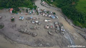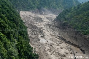


We have policies for dead-body management. We have plans for search and rescue. We have flood forecasts, early-warning systems, hazard maps and disaster institutions. But perhaps we have not yet designed our development system for the scale and speed of disasters that are now becoming possible.
The devastation that unfolded along the Bhote Koshi–Trishuli river system on August 26 should force Nepal to ask a difficult question:
Are we actually reducing disaster risk — or are we becoming increasingly efficient at responding to disasters after they have already happened?
The distinction matters, and the numbers now emerging make it impossible to avoid.
What we now know
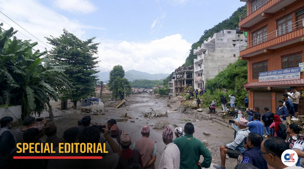
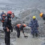
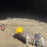
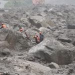
As of Saturday (August 29), four days after the event, Nepal Police had confirmed 669 deaths, while a provisional count put the number of people still unaccounted for at more than 2,500. NDRRMA’s own tally put the number of missing at 977 as of Thursday, illustrating how fluid—and contested—even the basic casualty picture remains this early in the response. By then, police had deployed more than 4,300 personnel and reported rescuing over 1,500 people, including hundreds from Rasuwa and Nuwakot.
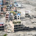
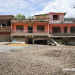
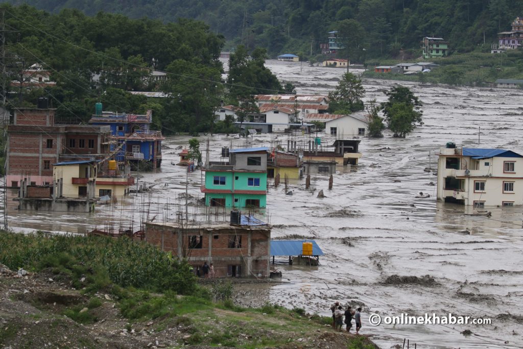
This was not a conventional monsoon flood. Satellite imagery examined by scientists showed that the lower section of a glacier at roughly 5,200 metres elevation collapsed, falling about 1,200 metres onto the valley floor and entraining rock and sediment along the way. NDRRMA identified the event as an ice-rock avalanche on the Lhende River, about 20 kilometres northeast of the Rasuwagadhi border crossing. The avalanche generated a debris-laden surge that tore through the Bhote Koshi and Trishuli river systems. ICIMOD monitoring showed the river at Galchhi rising by as much as nine metres in just 30 minutes.
The surge did not remain contained to the mountains. It carried sediment and boulders all the way into the Narayani River, with bodies later recovered as far downstream as Chitwan. Twelve operating power projects, representing 431 MW of installed capacity—including a 25 MW solar plant—were damaged, out of 901 MW of energy infrastructure affected along the corridor. At the Upper Trishuli Hydropower Project alone, the Nepali Army rescued 350 workers and residents trapped inside a tunnel, with others still being searched for.
High alert remains in place across Rasuwa, Nuwakot, Dhading, Gorkha and Chitwan. The Prime Minister’s Office has confirmed major impacts in the first four districts, while the disaster has also crossed the border, with a mudslide reported in Gyirong county, Tibet, and casualties reported among trekkers and pilgrims travelling towards Kailash.
These are not just statistics for a news cycle. They are the data Nepal must now use to decide what needs to change.
The Melamchi lesson: we have already seen this movie
Nepal does not have to look very far back for a warning it failed to heed.
The 2021 Melamchi disaster demonstrated how a mountain catchment can suddenly transform into a destructive debris-flow system. It changed river morphology, destroyed settlements and infrastructure, and proved that downstream communities can be devastated by processes originating far upstream, out of sight and out of mind.
Five years later, the question is not what reports were written, how many meetings were held, or how many policies were approved. It is:
- Which settlements were moved?
- Which river corridors were protected?
- Which infrastructure designs were changed?
- Which extraction activities were stopped?
- Which early-warning thresholds were revised?
- Which communities were repeatedly drilled?
- Which development approvals were refused because of unacceptable risk?
DHM continues to maintain hydrological monitoring infrastructure around the Melamchi system. But a sensor is not resilience. A sensor that produces information which does not reach a person in danger, in a form they understand, with a clear instruction about what to do, is not yet an effective early-warning system — and the nine-metre rise in thirty minutes at Galchhi this week is the clearest possible proof of that gap.
The riverbank settlement debate is not as simple as “people refuse to move”
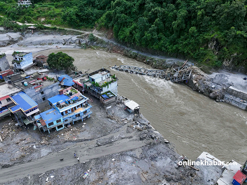
Whenever a flood destroys riverbank settlements, the immediate response is often: “Why were people living there?”
That question is incomplete. For many families, the riverbank is ancestral land — where fathers and grandfathers lived, where social networks, temples, schools, markets and livelihoods developed. Relocation does not just cost a house; for many, it costs an entire social and economic system.
There is also an uncomfortable economic reality. Roads follow river valleys because they offer the easiest gradients. Markets follow roads. Hotels follow markets. Sand and aggregate extraction creates jobs. River-based tourism and hydropower depend directly on the same corridor. The result is a political economy that runs:
river → land → road → market → extraction → construction → employment → local revenue → provincial revenue → national economy
Disaster risk sits quietly inside that entire chain, all the way from Rasuwagadhi’s trading routes to the hydropower intakes that were damaged this week.
Who benefits today, and who pays tomorrow?
A local government may earn revenue from extraction. A business may benefit from a roadside location. A household may earn its livelihood from river-based activity. A contractor benefits from road construction. A municipality collects taxes. A province benefits from economic activity. The federal government benefits from national infrastructure and energy generation.
But when the river changes course and destroys the settlement, bridge, road or hydropower project it made possible, the family loses its home, the municipality loses infrastructure, the province requests support, the federal government mobilises the army and helicopters, and the national treasury pays for relief and reconstruction — as it is now doing across five districts and counting.
This is a classic case of risk externalisation: the benefit is decentralised and immediate; the cost is collective, delayed and enormous. Disaster risk cannot be addressed through awareness campaigns alone. It has to be addressed through fiscal policy, land-use planning, infrastructure regulation, environmental governance and accountability.
Climate change has changed the equation

Climate change does not care about administrative boundaries, ownership of a road, the age of a settlement, or who collects revenue from sand and gravel. It does not wait for the next five-year plan.
Warming is destabilising high-mountain environments. Glaciers are losing mass, slopes are becoming less stable, and cascading hazards — from ice or rock collapse, to debris flow, to river flooding — now have to be built into Nepal’s risk thinking as a single connected chain rather than separate hazards. That is precisely the sequence that unfolded on 26 August: a glacial collapse at 5,200 metres becoming a debris flood sixty kilometres downstream within hours.
The lesson is not that every riverbank settlement must disappear immediately. The lesson is that the historical behaviour of a river can no longer be treated as a guarantee of its future behaviour. A place that remained safe for a hundred years can become unsafe because the upstream system has changed — invisibly, and often irreversibly.
From “warning” to “action”
Nepal already has flood forecasting and monitoring infrastructure. DHM’s Flood Forecasting Division maintains real-time data. NDRRMA maintains national disaster information, alerts and coordination systems. Those systems functioned this week — Nepal Police and the Flood Forecasting Division did issue an urgent warning for communities along the Bhote Koshi, Trishuli and Narayani corridors, and high alert was declared for Rasuwa and Nuwakot.
The question is no longer “do we have an early-warning system?” It is:
- Did the warning reach the right person, early enough?
- Did they know exactly where to go?
- Did the hydropower operator have an independent emergency protocol — the kind that got 350 people out of a tunnel alive at Upper Trishuli?
- Did the trekking hub of Syabrubesi, full of transient tourists and pilgrims, have any evacuation register at all?
- Did the warning automatically trigger action, or did it require another meeting first?
Nine metres of river rise in thirty minutes leaves no room for the second option.
What should change now
1. From hazard mapping to enforceable risk zoning. Flood-risk, debris-flow, GLOF and landslide-susceptibility maps must become development-control instruments that shape building permits, settlement expansion, road alignment, extraction permits, hotels, schools, hospitals and hydropower siting — not documents that sit inside a report.
2. River-corridor planning across government levels. A river ignores municipal boundaries. Local governments should manage land use and community preparedness; provinces should coordinate inter-municipal infrastructure and river corridors; the federal government should set national standards, run hydrological and glacial monitoring, and coordinate transboundary response with China and India, both of which were drawn into this week’s disaster.
3. Resettlement must mean livelihood relocation, not just housing relocation. A new house without new employment, markets, schools and access to services will not hold; people will drift back to the river corridor.
4. Make the economics of sand and gravel transparent. No revenue should count as “development revenue” if extracting it systematically raises disaster risk beyond acceptable limits.
5. Re-engineer infrastructure for cascading hazards. The 431 MW of hydropower capacity damaged this week shows that the design question can no longer be “will this survive the design flood?” It must be “what happens to the whole network if this single asset fails?” — water, rock, ice, sediment and debris together, not water alone.
6. Build a genuine last-mile early-warning architecture, combining rainfall sensors, river gauges, satellite data, glacier and lake monitoring, sirens, SMS/cell broadcast, police communication, hotel and tourism networks, and school registers — with every warning answering three questions: what is happening, who is at risk, and what must you do right now.
7. Drill the people who actually have to act, not only officials in a meeting room, and measure how many minutes it takes and how many people actually move.
8. Establish a national “safe settlement” programme with a transparent risk–cost–benefit framework: some settlements need relocation, some need in-situ protection, some need a hard stop on further expansion.
9. Change how preparedness is measured — not by how many plans exist, but by how many people can be evacuated within fifteen minutes, and how many critical facilities have independent emergency power and communication.
10. Make every reconstruction a risk-reduction opportunity. Rebuilding what was destroyed, in exactly the same place and the same way, is preparation for the next disaster, not recovery from this one.
Rethinking what we mean by “natural disaster”
The glacial collapse may be natural. The rainfall may be natural. But the scale of a disaster is shaped by human decisions — where we build, where we allow roads, where we extract, where we approve hotels and hospitals, how we design bridges, whether we enforce land-use rules, whether people trust a warning, and whether that warning becomes action in time.
So the question after Bhote Koshi–Trishuli should not simply be “what caused the flood?” It should be “what turned the hazard into a catastrophe of this scale?” That question moves us from meteorology to governance, from rainfall to land use, from glaciers to infrastructure, from policy to implementation, and from early warning to early action.
The real test of Nepal’s disaster governance
Nepal already has the institutions, the policies, the plans, the early-warning technology and the legislation. What it needs now is the political and administrative courage to connect them.
A disaster-management system is not successful because NDRRMA has an alert portal. It is successful when a mother in a riverbank settlement receives a warning, understands it, trusts it, and has enough time to take her children to safety before the river rises nine metres.
It is not successful because DHM produces an accurate forecast. It is successful when that forecast becomes an evacuation order before the water arrives.
And it is not successful because search-and-rescue teams can recover bodies efficiently, however necessary and courageous that work is right now across Rasuwa, Nuwakot, Dhading, Gorkha and Chitwan. Our ultimate measure of preparedness should be how many bodies we did not have to recover.
The Bhote Koshi–Trishuli catastrophe should become more than a tragedy to mourn. It should become a policy turning point — because climate change is not asking Nepal whether it is ready. It is already testing the answer.