

Kathmandu, October 2
The government has begun preliminary work to implement the Kathmandu Valley Urban Transport System Master Plan, a long-term strategy aimed at addressing traffic congestion, road safety, air pollution and inadequate public transport in Kathmandu, Lalitpur and Bhaktapur.
As part of the initial process, the Ministry of Physical Infrastructure and Transport has prepared a Strategic Environmental Assessment (SEA) report for the master plan.
The plan has been prepared with technical assistance from the Japan International Cooperation Agency (JICA) and sets out a long-term transport strategy for the Kathmandu Valley through 2050.
The government expects the plan to help transform Kathmandu Valley’s transport system by improving public transportation, upgrading roads and strengthening traffic management.
Traffic congestion and air pollution among key concerns
The master plan comes amid growing pressure on the Valley’s transport infrastructure.
Rapid urbanisation, a growing number of vehicles and the physical limitations of the historic city have made large-scale road expansion increasingly difficult.
The government says the strategy therefore focuses not only on road improvements but also on strengthening public transport and institutional capacity.
Air pollution is another major concern. Kathmandu’s air quality frequently deteriorates to hazardous levels, particularly during winter and before the onset of the monsoon. Vehicle emissions are considered one of the major sources of air pollution in the Valley.
Noise pollution, unsafe roads and inadequate public transport have also been identified as major problems.
The proposed improvements are expected to reduce traffic congestion and travel times while improving road safety and access to employment, education and public services.
According to the latest census, Kathmandu’s population stands at around 2.94 million. The master plan has been developed based on projections that the population could exceed 4.2 million by 2050.
Fourth transport master plan in three decades
This is the fourth major transport master plan prepared for the Kathmandu Valley.
Similar plans were prepared in 1993, 2012 and 2017, but previous plans were not fully implemented.
The latest master plan is estimated to require an investment of more than Rs 200 billion for implementation.
The strategy aims to establish a transport system that is safer, more inclusive, climate-resilient and capable of supporting the Valley’s economic growth.
Stronger road network across the Valley

The plan proposes strengthening east-west connectivity between Kathmandu, Lalitpur and Bhaktapur.
It also seeks to improve the efficiency of the inner and outer ring road systems and upgrade transport links in heavily congested northeastern parts of the Valley.
Since constructing large roads through the central areas of Kathmandu is difficult, the plan proposes shifting commuters from private vehicles to high-capacity public transport.
Implementation has been divided into three phases, with targets set for 2032, 2040 and 2050.
Junction upgrades and new road infrastructure
The master plan proposes several measures to reduce existing bottlenecks and improve road safety.
These include upgrading major intersections and introducing a coordinated traffic signal system.
New river crossings are also proposed, while elevated or semi-underground roads could be developed along corridors where road expansion is severely constrained.
The plan also calls for completing missing links in the inner ring road and upgrading river corridors.
An emergency road network is proposed to improve the Valley’s ability to respond to disasters and other emergencies.
Historic and tourist areas such as Thamel and Kathmandu Durbar Square are also proposed as potential no-vehicle zones.
Public transport to become the backbone
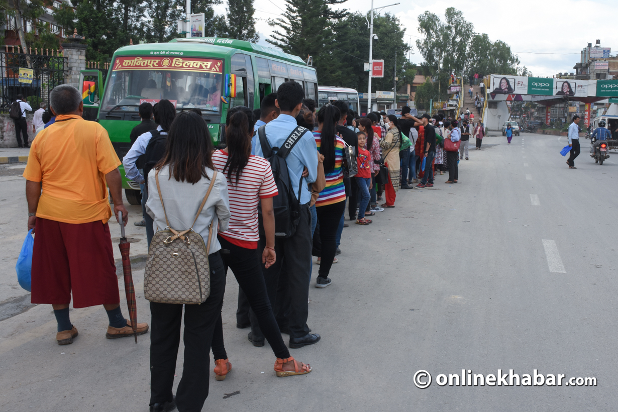
The master plan identifies buses as the primary mode of public transport for the Valley.
It proposes restructuring and integrating bus operators to improve operational efficiency and accountability.
Bus routes would also be reorganised to reduce congestion in central areas and improve connectivity across the network.
Bus parks, terminals and bus stops would be upgraded, with designated operating zones and clearer passenger information.
On high-demand corridors, the plan proposes measures such as dedicated bus lanes, Bus Rapid Transit (BRT) and Public Transport Priority Systems (PTPS).
The strategy also includes gradual vehicle replacement, improved vehicle maintenance standards, expanded driver training and GPS-based fleet management.
Real-time passenger information systems and information and communication technology infrastructure would also be developed to support an integrated transport system.
Metro rail proposed for Ratnapark–Bhaktapur corridor
The master plan recognises that buses alone may not be sufficient to meet the Valley’s long-term transport demand.
It therefore proposes developing higher-capacity transport systems, including BRT, Mass Rapid Transit and Automated Guideway Transit.
Three potential high-capacity public transport corridors have been identified — a ring corridor, a north-south corridor and an east-west corridor.
Among these, the Ratnapark–Bhaktapur east-west corridor has been prioritised for a pre-feasibility study for metro rail.
The proposed metro would be integrated with BRT services at various locations to create a more accessible and efficient public transport network.
The plan also proposes underground sections in parts of the inner city and the Jadibuti-Koteshwor area.
The proposed metro route would be approximately 14.6 kilometres long.
Major infrastructure projects proposed
The master plan includes a number of major road and transport infrastructure projects.
Maharajgunj underpass
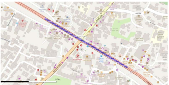
An underpass has been proposed at Maharajgunj to ease traffic congestion at the busy junction.
Chabahil–Gaushala underground tunnel
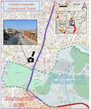
The Chabahil–Gaushala section is considered one of the most challenging parts of the proposed ring road expansion because of the Pashupati area, which is part of the UNESCO World Heritage Site.
With limited options for surface-level road expansion, the master plan proposes a two-level underground tunnel with four lanes of road capacity.
Chabahil–Bagmati elevated highway
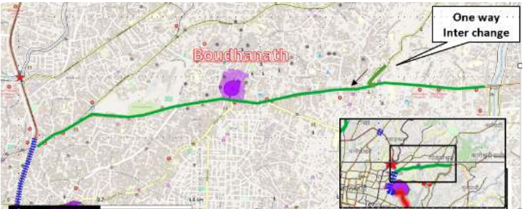
A two-lane elevated road has been proposed along the busy Chabahil–Bagmati corridor.
The area includes important heritage sites, including the Boudhanath Stupa. The plan also proposes redesigning Chabahil junction and introducing improved traffic signal systems.
Bishnumati River elevated highway
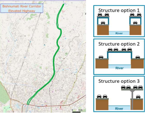
A four-lane elevated road has been proposed along the Bishnumati River corridor, connecting it with the Ring Road.
Three design options have been proposed, with the project expected to help ease traffic pressure in northwestern Kathmandu.
Gausala–Tinkune Ring Road expansion
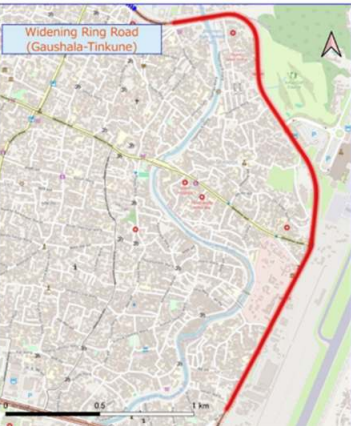
The Gausala–Tinkune section, which serves as an important gateway to Tribhuvan International Airport, has also been included in the proposed Ring Road expansion.
The master plan identifies the expansion as necessary to prevent additional bottlenecks arising from other projects around Koteshwor.
Thapathali–Tripureshwor river corridor
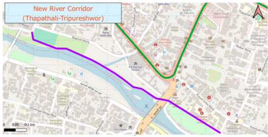
The plan proposes developing the Thapathali–Tripureshwor section of the river corridor to connect the remaining gap with the existing Bagmati River corridor.
New bridges and utility corridors
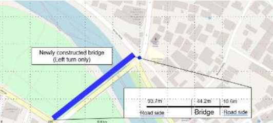
The plan also proposes new bridges at several locations.
A new bridge is proposed near the existing UN Park bridge, which has been identified as a major traffic bottleneck.
Additional bridges have been proposed around the New Bus Park area and across the Bishnumati, Dhobikhola, Karmanasa and Bagmati rivers.
The master plan also proposes developing utility corridors alongside roads to accommodate infrastructure such as underground services.
Historic areas of Kathmandu and Lalitpur are proposed to be developed as car-free zones, while cycling lanes would also form part of the transport strategy.
Existing traffic signal systems would be restructured, and additional parking capacity would be developed in congested areas.
The plan also proposes restructuring the bus industry as part of the broader effort to create a more integrated and efficient public transport system by 2050.