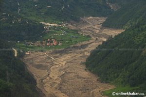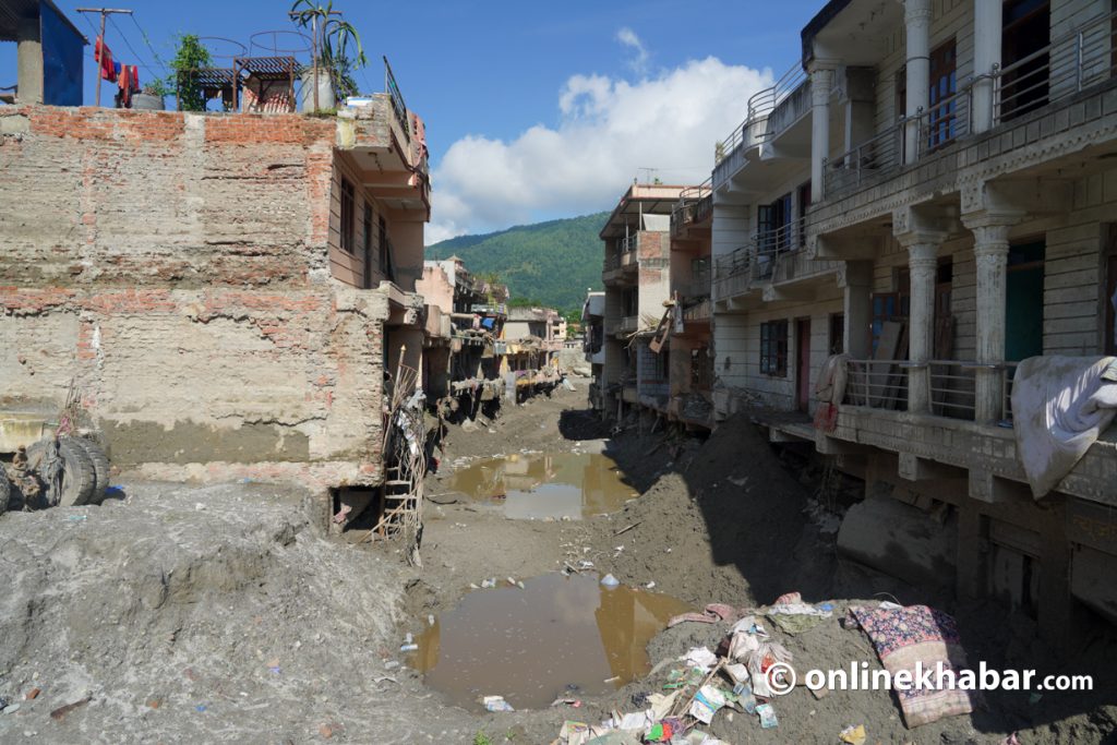

The devastating flood that swept through Rasuwa on August 26 has raised questions about whether such a disaster could have been anticipated.
Experts say it is generally impossible to predict the exact date, location or scale of many mountain disasters. But decades of research have shown that risks in Nepal’s high mountains can be identified, assessed and monitored.
One of the key areas of research has been glacial lake outburst floods (GLOFs)—a major hazard for communities and infrastructure downstream of the high mountains.
Studies have identified potentially dangerous glacial lakes, assessed the number of people and infrastructure that could be exposed, and called for regular monitoring and early-warning systems. The purpose is not to predict exactly when a lake will burst, but to identify where the potential for a destructive flood exists and use that information to reduce the risks.
The Rasuwa disaster, however, has highlighted another important question: whether monitoring glacial lakes alone is enough to understand the full range of hazards developing in the high mountains.
What experts had warned about
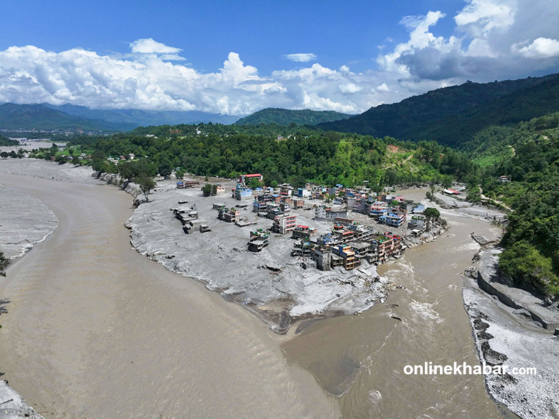
Environmental journalist Ramesh Bhusal says recent disasters across Nepal and the wider Himalayan region show that extreme mountain events can no longer simply be treated as unforeseeable.
Floods and debris-flow disasters have occurred in places including the Seti River in Pokhara, Melamchi, Roshi and Thame, as well as in other parts of the Himalayan region, including Uttarakhand, Pakistan and northeastern India.
“When similar events occur three times within five years, calling them unimaginable simply means we failed to anticipate them,” Bhusal says.
Experts estimate that around 83 percent of Nepal’s mountainous and hilly areas are exposed to risks associated with landslides and glacial lake outburst floods.
Disaster forecasting has evolved significantly over time. Researchers use rainfall and river-gauge data, satellite imagery, remote sensing, geological studies and other technologies to identify areas exposed to different hazards. Artificial intelligence is also increasingly being explored as a tool for forecasting and risk assessment.
But identifying a hazard is different from predicting the exact moment it will turn into a disaster.
Why glacial lakes are monitored
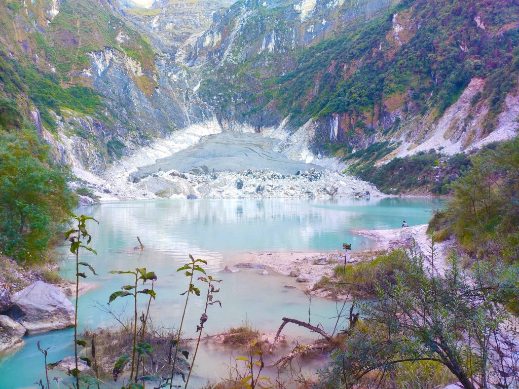
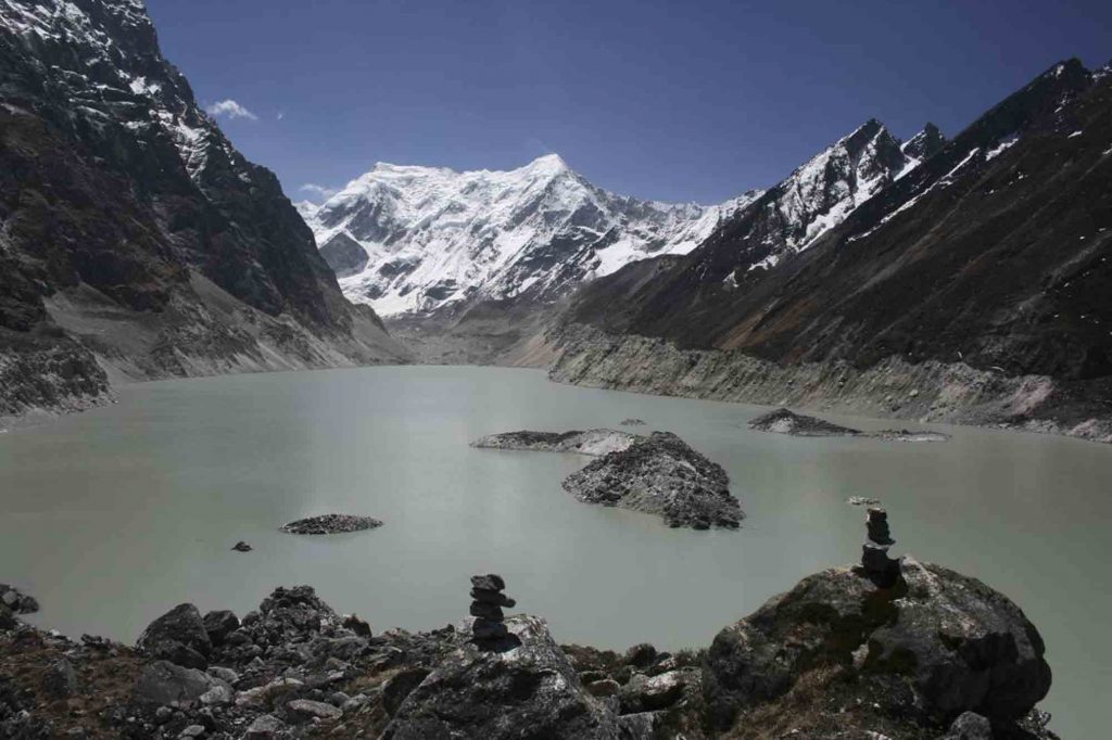
A glacial lake forms when water accumulates in or around a glacier, often behind a natural dam made of ice, rock or debris.
If that natural dam fails, a large volume of water can suddenly move downstream. This is known as a glacial lake outburst flood, or GLOF.
GLOFs are a particularly important concern for people living in mountainous regions because glacial lakes often develop at high elevations. If an outburst occurs, the resulting flood can travel considerable distances downstream, carrying rocks, sediment and debris and causing severe damage to settlements, roads, bridges, hydropower projects and other infrastructure.
This is why identifying potentially dangerous glacial lakes is an important part of GLOF risk management.
Geography professor Dr Narendra Raj Khanal, who has studied glacial lakes and floods, says researchers have repeatedly highlighted the need for regular glacier monitoring and functioning early-warning systems.
“We may not be able to say that a particular glacial lake will burst on a particular date or that a landslide will occur at a particular location,” Khanal says. “But based on our studies, we have consistently said that regular monitoring of glaciers and the establishment and operation of early warning systems are essential.”
The goal, therefore, is not necessarily to forecast the exact day of a GLOF. It is to understand which lakes pose a greater potential danger, what areas could be affected and how those risks can be reduced.
Which glacial lakes pose a risk?
A study by professors Narendra Raj Khanal, Pradeep Kumar Mool, Arun Bhakta Shrestha, Golam Rasul, Pawan Kumar Ghimire, Rajendra Bahadur Shrestha and Sharad Prasad Joshi assessed the potential human impact of glacial lake outburst floods.
According to an article published in the International Journal of Water Resources Development, a GLOF from Lumuchimi in the Bhote Koshi basin could potentially affect 16,313 people.
The study estimated that an outburst from Imja in the Dudh Koshi basin could affect 7,762 people, while an outburst from Tsho Rolpa in the Tamakoshi basin could affect 5,183 people.
Such assessments are important because the danger posed by a glacial lake does not end at the lake itself. A large flood generated at high altitude can move through mountain valleys and affect communities and infrastructure much farther downstream.
A separate study by the International Centre for Integrated Mountain Development (ICIMOD) and the United Nations Development Programme (UNDP) also highlighted the potential danger posed by glacial lakes to downstream communities and infrastructure.
“Glacial lake outburst floods are an important problem for people living in the Himalayan region,” the 2020 report said, noting that lakes at high elevations can generate floods capable of travelling long distances downstream.
The report identified potentially dangerous glacial lakes as an important target for risk-reduction planning.
47 potentially dangerous lakes identified
The ICIMOD-UNDP study assessed 3,624 glacial lakes across Nepal’s Koshi, Gandaki and Karnali river basins and identified 47 as potentially dangerous.
Of these, 25 are in China, 21 in Nepal and one in India. The Koshi basin accounts for 42 of the potentially dangerous lakes, while three are in the Gandaki basin and two in the Karnali basin.
In Nepal, the potentially dangerous lakes are spread across several river systems, including four in the Tamor basin, five in the Arun, nine in the Dudh Koshi, one in the Trishuli, one in Mugu and one in the Tamakoshi basin.
In China, 13 are located in the Arun basin, seven in the Tamakoshi, four in the Sunkoshi and one in the Trishuli basin. The remaining lake is located in India’s Kali (Mahakali) basin.
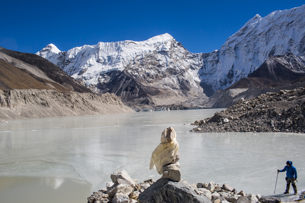
The study identified six lakes as being at particularly high risk: Tsho Rolpa, Lower Barun, Imja Tsho, Lumding, West Chamjang and Dona (Thulagi).
The findings illustrate an important principle of mountain disaster management: identifying potentially dangerous lakes allows authorities and researchers to determine where risk-reduction measures, monitoring and early-warning systems are most needed.
But the Rasuwa flood may not have been a GLOF
The Rasuwa disaster has complicated that picture.
Experts now say the Rasuwa flood was not a conventional glacial lake outburst flood.
According to Education Minister Sasmit Pokharel, who is also the government spokesperson, glaciers appear to have collapsed, causing water to surge downstream while carrying large amounts of sediment.
Experts believe the flooding in the Bhote Koshi was triggered by the collapse of an ice-rock formation near the Lhende River, which flows from China.
This distinction matters.
A GLOF involves the sudden release of water stored in a glacial lake. An ice-rock or glacier collapse can generate a different sequence of events, potentially involving water, ice, rock and sediment moving rapidly downstream.
The warning signs and the type of monitoring required can therefore also be different.
Professor Khanal says the Rasuwa disaster has demonstrated that focusing only on glacial lakes leaves an important gap in understanding high-mountain hazards.
“The Rasuwa flood has sent a message that studying only glacial lakes is not sufficient,” Khanal says. “It appears that forecasting such risks requires detailed study of glaciers, snow and ice alongside glacial lakes.”
Why glaciers, snow and ice matter
Glacial lakes are only one component of a much larger mountain system.
Changes in glaciers, snow and ice can affect the stability of slopes and river systems. A collapse involving ice and rock can generate a sudden surge of water, sediment and debris even when there is no glacial lake outburst.
This means that assessing mountain risk requires looking at the entire system—not only the lakes that may burst, but also the glaciers and ice that may collapse, the slopes that may fail and the rivers that carry the resulting material downstream.
In this sense, the Rasuwa disaster does not necessarily undermine decades of GLOF research. Instead, it shows why risk assessment needs to evolve alongside the hazards being observed in the mountains.
Can scientists predict exactly when a disaster will happen?
Not usually.
Scientists can identify hazards, assess their potential impacts, monitor changes and estimate which communities and infrastructure could be exposed.
But that is different from predicting that a particular glacier will collapse on a particular day or that a particular landslide will occur at a precise location.
This distinction is particularly important in the Himalayas, where terrain is difficult to access and mountain conditions can change rapidly.
The objective of monitoring and early-warning systems is therefore not necessarily to predict every disaster with certainty.
It is to identify dangerous conditions, understand the potential consequences and provide enough information and time to reduce exposure and prepare for an event.
Monsoon can amplify mountain hazards
Glacial and ice-related hazards can become particularly dangerous during Nepal’s monsoon season.
Nepal’s monsoon generally begins around June 13 and continues until October 2, bringing around 80 percent of the country’s annual rainfall.
Heavy rainfall can increase river levels and destabilise slopes. When intense rainfall coincides with water released from a glacial lake, glacier collapse or another high-mountain event, the resulting flood or debris flow can become significantly more destructive.
Historical records show that glacial lake outburst floods have occurred between March and September, with nearly two dozen events causing significant damage in the wider Himalayan region.
Have warnings been turned into action?
Climate analyst Dr Ngamindra Dahal says studies have repeatedly identified the risks associated with glacial lakes and high-mountain hazards, but implementation has remained limited.
“We know there is a risk. Plans have also been prepared. But those plans have not been turned into projects,” he says.
A National Disaster Risk Reduction and Management Authority official, however, says implementing every recommendation immediately is difficult.
“Not all the glacial lakes that can affect us are within Nepal,” the official says. “Implementation requires a large amount of money, which is not easy to secure.”
The cross-border nature of many Himalayan hazards adds another layer of complexity.
Several potentially dangerous glacial lakes lie outside Nepal, meaning effective risk reduction can require cooperation between countries as well as monitoring within Nepal.
What the Rasuwa disaster has taught us
The Rasuwa flood does not necessarily show that scientists should have been able to predict the exact event.
It instead highlights the difference between predicting a disaster and understanding disaster risk.
For decades, researchers have identified potentially dangerous glacial lakes, assessed the number of people and infrastructure that could be affected and called for monitoring, risk-reduction measures and early-warning systems.
That work remains important because GLOFs can originate at high elevations and travel long distances, potentially causing severe damage far downstream.
But the Rasuwa event has also exposed a limitation in viewing mountain hazards through the GLOF lens alone.
The focus now needs to extend beyond glacial lakes to the wider high-mountain environment: glaciers, snow, ice, unstable slopes and rivers, and the ways in which these hazards can interact.
The challenge for Nepal is therefore not simply to predict the next disaster.
It is to identify where dangerous conditions are developing, understand how far their impacts could travel, determine who and what lies downstream, and turn that knowledge into continuous monitoring, effective early warnings and practical risk-reduction measures.
The exact timing of the next mountain disaster may remain impossible to predict. But the risks developing in the mountains—and the people and infrastructure exposed to them—can be studied, identified and planned for.