

Kathmandu, November 1
The government has moved ahead with a plan to spend more than Rs 7 billion to lower the water levels of four high-risk glacial lakes and expand flood early warning systems across four major river basins.
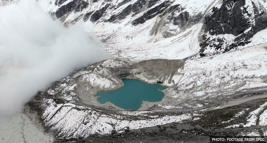
As climate change increases the risk of glacial lake outburst floods (GLOFs), avalanches and landslides in the Himalayan region, the government has proposed lowering the water levels of four glacial lakes in Manang, Sankhuwasabha and Solukhumbu districts.
The lakes identified for the project are Thulagi in Manang, Lower Barun in Sankhuwasabha, and Lumding Tsho and Hongu-2 in Solukhumbu. All four are on the list of high-risk glacial lakes.
According to a study conducted by the United Nations Development Programme (UNDP) and the International Centre for Integrated Mountain Development (ICIMOD), 21 glacial lakes in Nepal are classified as extremely high-risk.
Water levels in Tsho Rolpa Lake in Dolakha, ranked first on the list, were lowered by three metres in 2000. Similarly, the water level in Imja Lake in Solukhumbu, ranked second, was lowered by 3.4 metres in 2016 with the support of the Nepal Army.
The government has now proposed lowering the water levels of Thulagi, Lower Barun, Lumding Tsho and Hongu-2, which also feature prominently on the risk-priority list.
Dr Rajan Bhattarai, deputy executive director and spokesperson for the Hydrology and Water Resources Research Centre under the Ministry of Energy, Water Resources and Irrigation, said the preliminary plan was to lower the water level of Hongu-2 by one metre and those of the remaining three lakes by around three metres each.
Flood early warning systems to be installed
According to Dr Bhattarai, all four glacial lakes selected for water-level reduction are located above 5,000 metres.
Flood early warning systems will also be installed in the major river basins downstream of these lakes. The plan covers the Lower Barun, Arun, Dudhkoshi and Marsyangdi river corridors.
“We are planning to extend flood early warning systems downstream across these river basins,” said Dr Bhattarai, spokesperson for the Hydrology and Water Resources Research Centre.
The estimated cost of this component is USD 7.54 million.
The objective is to provide round-the-clock flood forecasting and early warning services. Timely information is expected to help relocate residents to safer areas, prepare for rescue and relief operations, and minimise potential loss of life and property.
“Since water flowing from glacial lakes reaches downstream areas through different river systems, we have recognised the need for early warning systems along the respective river corridors. The aim is to ensure that people living downstream receive timely warnings in the event of a glacial lake outburst,” Bhattarai said.
‘Sanjivani GLOF’ project
The project to lower water levels in the four glacial lakes and expand flood early warning systems across the four major river basins has been named the ‘Sanjivani GLOF’ project.
A sudden flood caused by the breaching of a glacial lake is known as a glacial lake outburst flood (GLOF).
The project is scheduled to begin in 2026 and be completed by 2033. The seven-year project is estimated to cost around USD 49.9 million, equivalent to approximately Rs 7.5 billion.
Of the total amount, USD 36 million, or around Rs 5.5 billion, will be provided by the Green Climate Fund. The UNDP will contribute USD 2 million, equivalent to around Rs 300 million, while the remaining cost will be borne by the Nepal government.
Meanwhile, the centre is currently implementing the ‘Priority River Basins Flood Risk Management Project’, which runs from 2022 to 2028.
The centre has also announced plans to develop new flood forecasting models for the Karnali and Narayani river basins in the current fiscal year and establish community-based flood early warning systems under the Bagmati River Basin Improvement Project.
When will work begin to lower glacial lake water levels?
According to the centre, preparations to lower water levels in the selected glacial lakes are currently at the preliminary study stage.
The study and design process is expected to take another year, after which fieldwork will begin.
“We will remain occupied with studies and design work until 2027. Fieldwork is likely to begin only from the following year. The study, appointment of consultants and design work will proceed in phases,” said Bhattarai.
Lowering water levels alone is not enough
Arun Bhakta Shrestha, an adviser to ICIMOD, considers the plan to lower water levels in high-risk glacial lakes a positive step. However, he said attention should also be given to other glacial lakes and glacial ponds that are not on the risk list, as Nepal has experienced floods caused by the breaching of their natural dams and the collapse of snow-covered rocky terrain.
The 2024 flood in Thame, Solukhumbu, triggered by the breach of a glacial pond that had not been identified as a high-risk site, and the Bhotekoshi-Trishuli floods on August 26, caused by the collapse of part of a glacier and surrounding rocky terrain, are examples of such disasters.
“We have examples of floods caused by the collapse of snow-retaining rocky slopes and the breaching of natural dams of glacial lakes or ponds that were not included on the risk list. These sites also need to be studied, and measures should be adopted to minimise potential damage,” Shrestha said.
Bhotekoshi and Budhigandaki floods highlight growing risks
Nepal is highly vulnerable to natural disasters, including floods, landslides, inundation, glacial lake outburst floods, forest fires and lightning strikes, due to climate change, unplanned land use and increasing human activities.
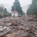
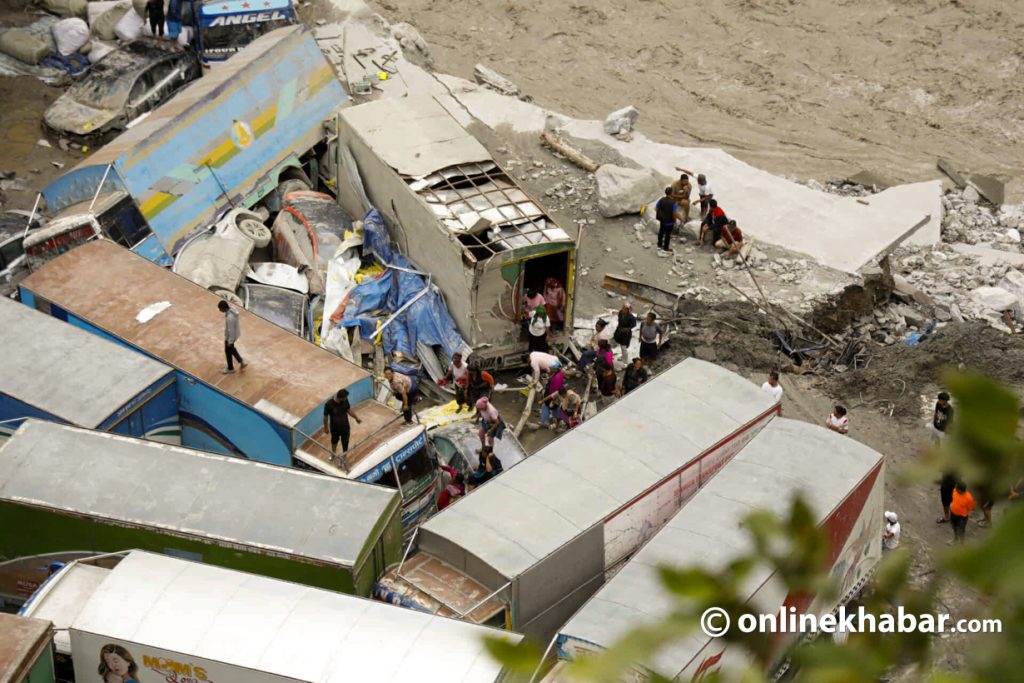
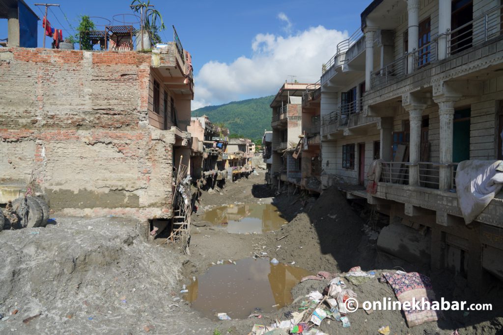
On August 26, a devastating flood struck the Bhotekoshi-Trishuli river system. Similarly, another devastating flood hit the Budhigandaki River on October 25.
The August 26 disaster originated in the Lhende River, which flows through China’s Tibet region before entering the Bhotekoshi-Trishuli river system. According to experts, the flood was triggered by the collapse of a glacier and rocky terrain at an altitude of around 5,200 metres on the northern side of Langtang Lirung, north of Rasuwa district.
According to a report by the National Disaster Risk Reduction and Management Authority (NDRRMA), at least 1,455 people died and 5,745 went missing in the disaster.
The flood also damaged 14 hydropower projects with a combined capacity of 759 megawatts, five solar plants with a total capacity of 24 megawatts, a substation, transmission lines and distribution systems in the affected river basin.
Exactly 45 days after the flood in the Lhende-Bhotekoshi-Trishuli river basin, another sudden flood carrying black sludge struck the Budhigandaki River on October 25.
According to the NDRRMA, the flood originated at around 4:20 am from the upper reaches of the Ungdilung stream, located between Chamar Himal and Syerangi Himal in Chumnubri Rural Municipality-6.
At an altitude of around 2,000 metres, snow- and debris-laden floodwaters rose approximately 300 metres along both banks of the Ungdilung stream before flowing southwards through the Syar stream and joining the Budhigandaki River.
Six people, including two women and four men from Ungilung village in Chumchet, Chumnubri Rural Municipality-6 of Gorkha, remain missing following the flood.
With such incidents becoming increasingly frequent in recent years, the need for effective early warning systems has grown to ensure timely communication and minimise loss of life and property.
Earlier floods in Melamchi and Thame had also caused significant human and material losses.
Limitations of existing early warning systems
An ICIMOD report on the Langtang Lirung (Bhotekoshi) disaster has highlighted the limitations of existing early warning systems.
The report concludes that monitoring systems based on rainfall and river water levels cannot adequately detect sudden mountain collapses, falling rocks and ice, or the risk of rapidly developing floods triggered by such events.
During the Langtang Lirung disaster, floodwaters reached the border area within approximately seven minutes of the mountain collapse. However, an early warning message was issued through SMS only after the flood had already affected the area.
Similarly, during the Budhigandaki flood, government agencies issued a flood alert approximately one hour after residents had started broadcasting the incident live on Facebook.
Experts say that improving early warning systems for such disasters requires the integration of satellite data, seismic monitoring, glacier and snow-cover surveillance, rainfall measurements and hydrological data.
Changes needed in monitoring technology and warning messages
Anup Khanal, an engineer involved in the installation and operation of early warning systems, has stressed the need to change flood monitoring methods, data transmission intervals and warning message formats to provide timely alerts for sudden floods such as the one in the Bhotekoshi.
According to him, most existing flood monitoring stations are installed at relatively low heights above river levels, making them vulnerable to being swept away during major or sudden floods.
He has suggested installing flood monitoring equipment at considerably higher and safer elevations using specialised suspension cables.
Similarly, Khanal said the existing practice of measuring river levels every 10 minutes should be replaced with continuous monitoring at intervals of three to five seconds.
If five consecutive readings cross a predetermined risk threshold, an alert could immediately be transmitted to the central server, automatically triggering sirens.
According to him, this would help detect rapidly rising floodwaters in time while also reducing the possibility of false alarms.
Khanal also emphasised the need to use modern technologies alongside conventional flood monitoring equipment to improve early warning systems for sudden floods.
High-resolution cameras capable of capturing clear images over long distances could be used to monitor flood conditions continuously from safe locations.
Likewise, seismic monitoring devices such as seismometers and geophones could provide information about potential landslides and debris flows.
However, he said reliable, high-capacity communication infrastructure would be essential to transmit data and images generated by these technologies in real time.
Khanal also called for changes in the format of warning messages issued during disasters.
Instead of general messages such as “A flood is approaching; please take necessary precautions”, he suggested using sirens capable of broadcasting voice alerts that clearly explain the actual flood situation, potential risks and safety measures people should take, including messages in local languages.
This, he said, would help communities at risk understand the severity of the threat and take appropriate protective measures in time.