The ‘Lake City’ Pokhara never tires me although I have been to this beautiful city for the umpteen times . . . and the sight of Seti River gorge never ceases to haunt me every time I see it.
What is so amazing about Seti is its bizarre journey across the city of Pokhara. The mystery deepens when the wide boisterous river enters a dark gaping hole in the face of a hill at the K. I. Singh Bridge, vanishes, appears again into narrow gorges, suddenly disappears and after a brief journey into the subterranean, dramatically reappears to finally spill out into a raging full-blown river.
And the river cuts right through the city core, appearing like a dark abyss with no view of the bottom at most places. For years, I longed to explore the Seti river gorge from its mouth at the K.I. Singh Bridge and its mystical onward journey through the heart of Pokhara until its tail-end, but every time I visited the city, I missed out on it. In 2013, I finally did it.
The glacier-fed river Seti (Gandaki) that has dug deep subterranean tunnels into the city has long since mystified the people of Pokhara, too. Going by the local myth, the elders in Pokhara believe and fear that the entire city floats on the waters of the Seti.
 The porous underground, the maze of caves, chasms, and lakes which abound the Pokhara valley all adds to the mystery. More than that, the Seti flowing more than 50 meters deep (the deepest is estimated at 80m) below the street level also serves as a geological enigma.
Purna Bahadur Jwarchan, an environmental engineer from New Road, Pokhara shed light on a mysterious incident that took place some 10 years ago. “An entire truck, parked in a street a night before at Archal Bot (near the Bindyabasini temple) sank into a cavernous pit and was literally buried,” he said. “Cases of such subsidence have been recurrent in and around the city, some alarming. A few come to notice but most go unreported,” he further added.
The findings made by the Chinese contractors during the construction of the Nayapul, near Prithivi Chowk, were no less startling. The Seti had scoured out hollow spaces on its sides as deep as 250 meters at some places. “Statistics show that Pokhara has the highest precipitation (3,350 to 5,600mm/year) in the country. But even the heaviest rainfall doesn’t lend the Pokhara streets waterlogged for the water gets sucked below ground in no time,” Jwarchan added.
Geologists believe that Pokhara valley is nothing but a gravel-mass filling brought down by the catastrophic Seti flash floods, initially triggered off by an earthquake in the high Machhapuchare and Annapurna region. In its wake, the river is also said to have worked up extensive terraces, lakes (nine lakes listed in Ramsar Site, Kaski), caves and gorges in the valley.
And there is GLOF (Glacial Lake Outbursts Floods) to consider. A GLOF is said to have occurred 450 years ago with an area of 10 km2 located behind the Machhapuchare , an ice-cored moraine collapse that brought down 50-60m thick debris into the Pokhara basin( T. Yamada & C.K. Sharma).
Referring to the disastrous Seti floods of May 2012, Kunda Dixit in the Nepali Times wrote: “The Seti has seen much bigger floods in its history, one of them occurring about 800 years ago, which was of a biblical proportion and brought down a wall of debris 100m high to what is now Pokhara city.”
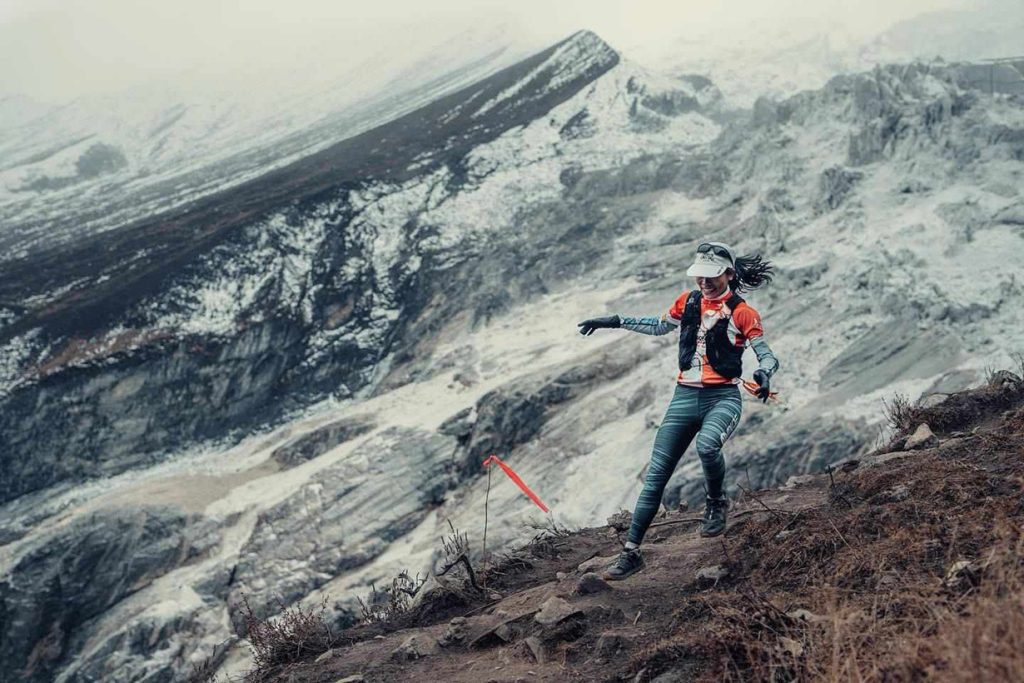
If you fancy exploring the trail of the Seti gorge, it is best done on foot or better still on a bicycle, as you can cover more ground in less time. I did it on a bicycle. Mountain bikes can be hired from quite a number of shops at the Lakeside (try Hallan Chowk).
The asking price then was 800 to 1000 rupees varying between shops. I got one for 700—it took a mulish haggling, though. If you plan to bicycle, ask for a helmet, an air-pump, and a lock, all included in the price.
If you happen to be in Pokhara in June/July, better carry a raincoat—just in case. There is no telling if you get caught up in one of those freaky shifts in Pokhara weather. I was. It was sunny, way too warm when I started but the afternoon suddenly took a mood swing—first I was hit by a dust storm and then a lashing downpour.

From Mahendra Pul, it took me 25 minutes to the K. I. Singh Bridge. With no traffic stress (times have changed today, though), almost zero exhaust fumes and dust I felt an incredible sense of relief. It was like riding in my own backyard! The dramatic journey of the Seti River begins at this gorge mouth through a dark narrow crevice on a rocky outcrop.
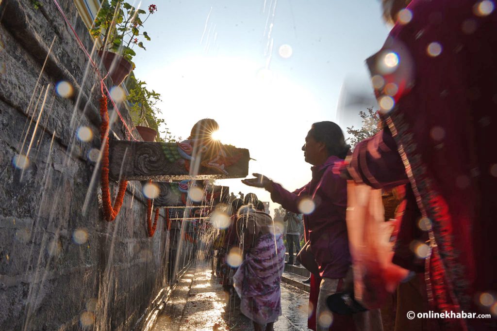
On my way to the K. I. Singh bridge, as I leisurely pedaled by Bhimsen Tole (street) to Bindyabasini (a Hindu shrine dedicated to Goddess Bhagwati located on top of a wooded knoll), much revered by the Pokhrelis (people of Pokhara), I noticed between rows of modern houses some very old ones too—reminding that the street must have been once a very old locality.
So it was; the history of Pokhara has it. Highly impressed by Kathmandu valley’s culturally rich and ornate architecture, the King of Kaski (then a Chaubise Rajya: a principality; now a district with Pokhara as headquarters), in 1752 AD, decided to invite ethnic Newar craftsmen and artisans from the Nepal Valley, cities of Kathmandu, Patan and Bhaktapur.
Most of those workers went back after doing their stint, but some took up permanent residence at Bhimsen Tole. Although languishing in obscurity and neglect amid burgeoning concrete structures, a handful of these old houses still retained the last vestiges of the borrowed Newari heritage and craftsmanship of the then Nepal valley. I have no idea if those houses still remain today . . . probably not.
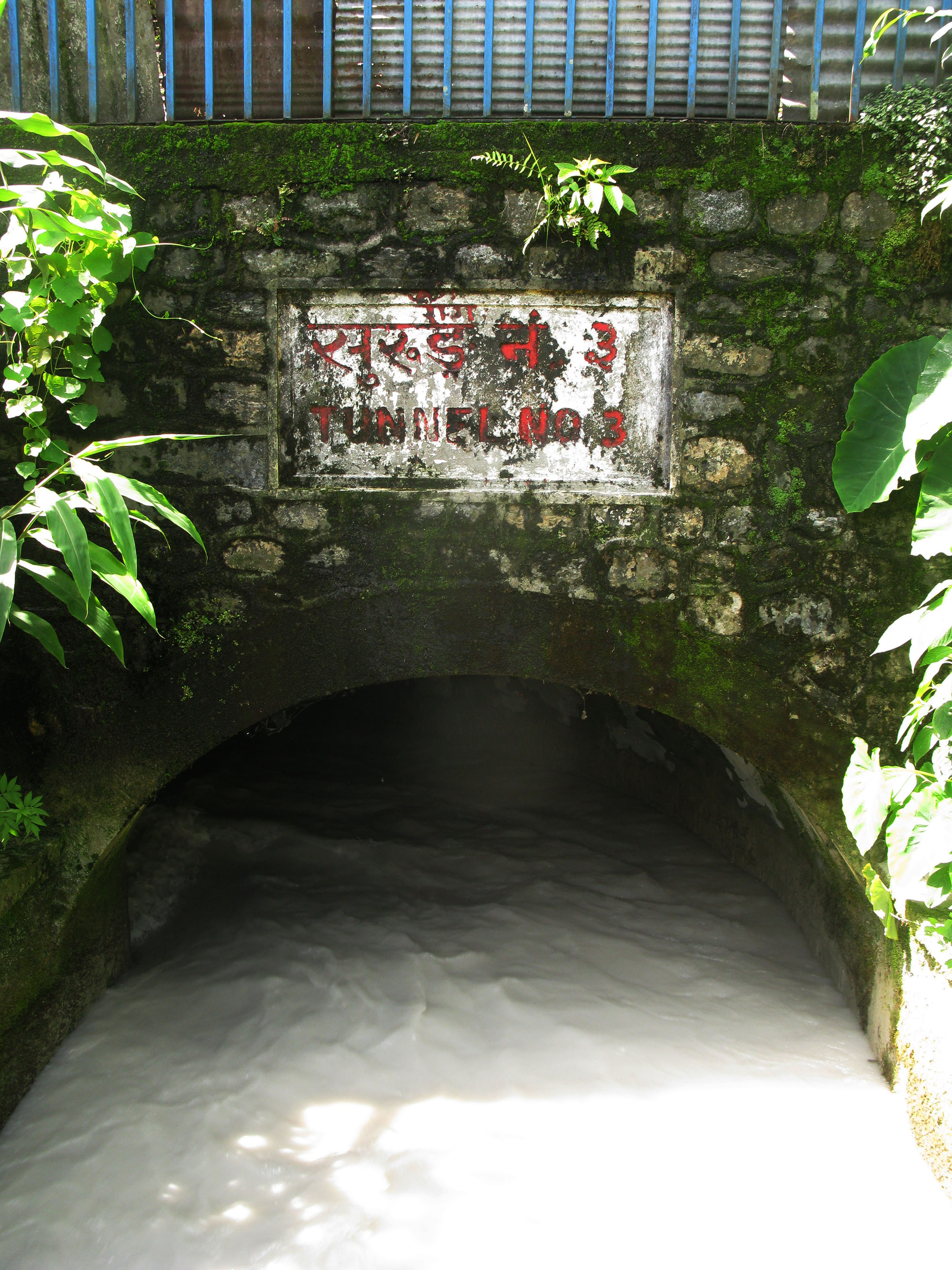
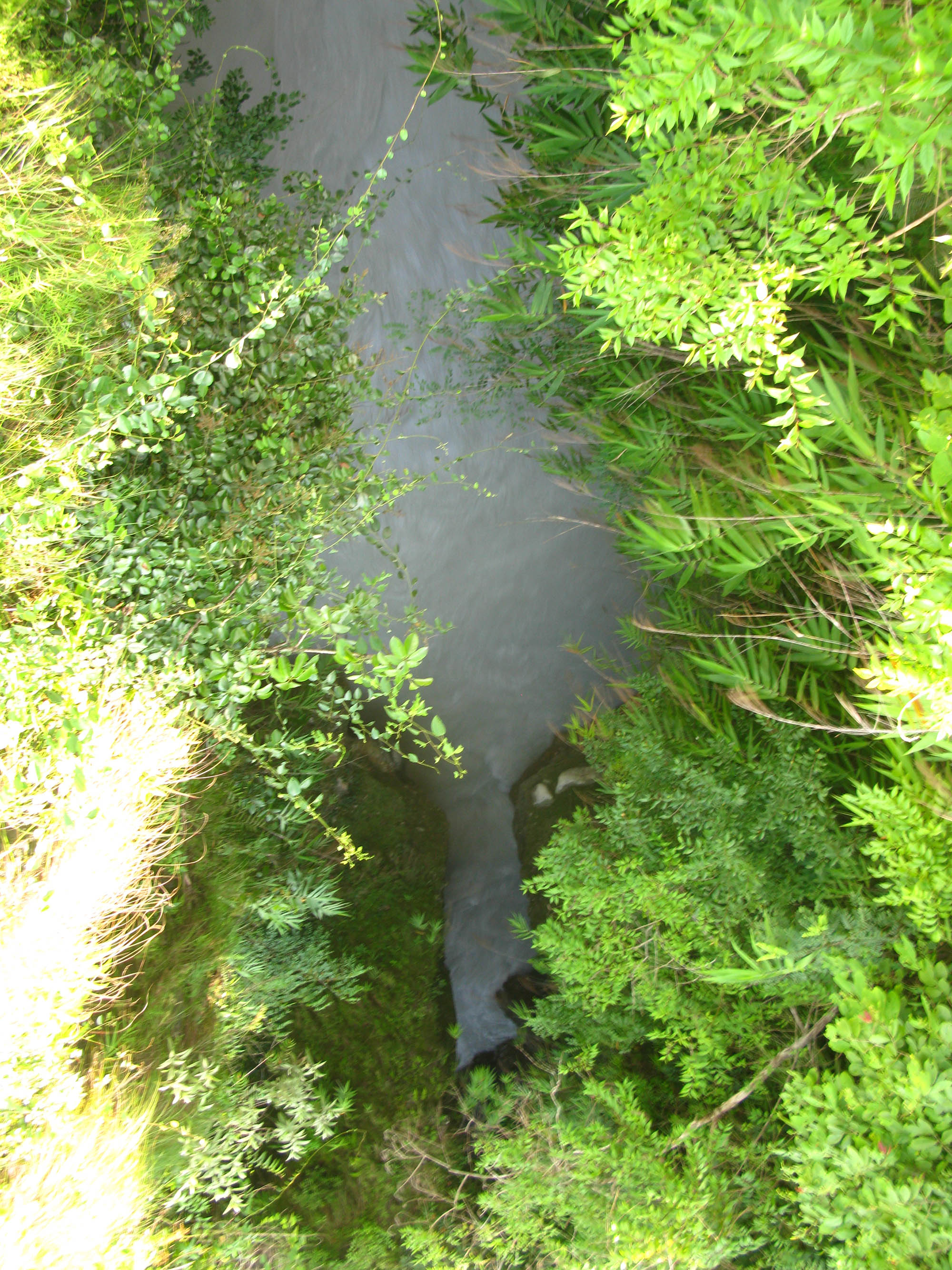
At the K. I. Singh Bridge, as I took the flight of steps down to a tiny park with benches around, the deep rumble of the gushing water hit my ears. A roughly 15m long bridge spanned the gorge; an irrigation canal ran right through the middle of the bridge and entered a tunnel before disappearing into the wooded hillside.
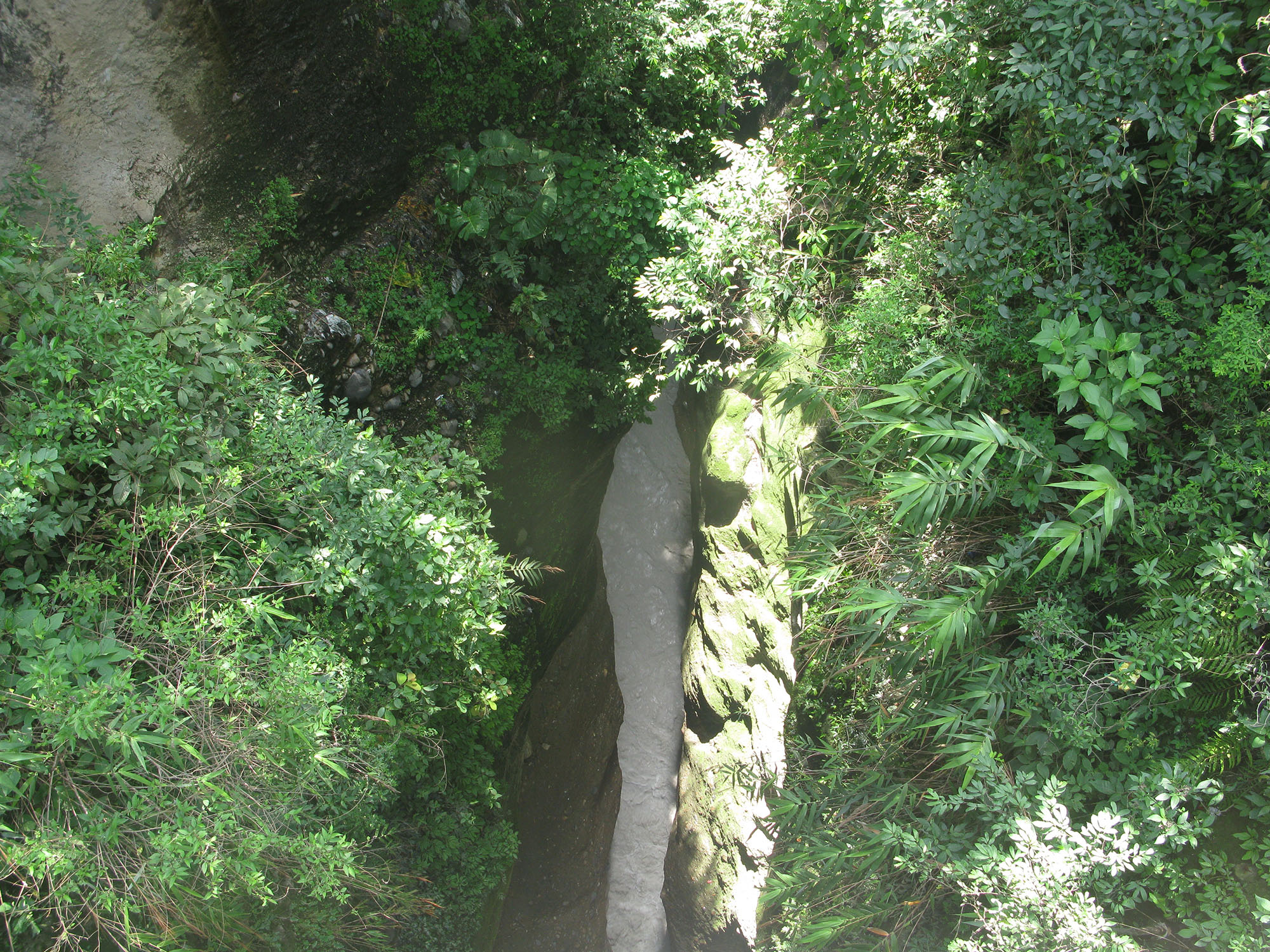
You could peer down from the bridge on both sides for a giddying view. With an overhanging brush, the steep side walls slide down some 40m into a gully of rushing water, which looks like milk being churned to make butter. Incredulous, I could not help wondering how come the river so big and wide only a few hundred feet north could squeeze through that crack a little over a meter wide—and disappear into the hills.
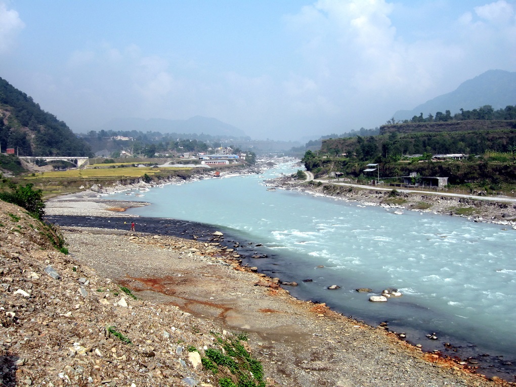
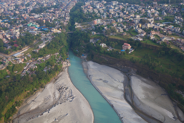
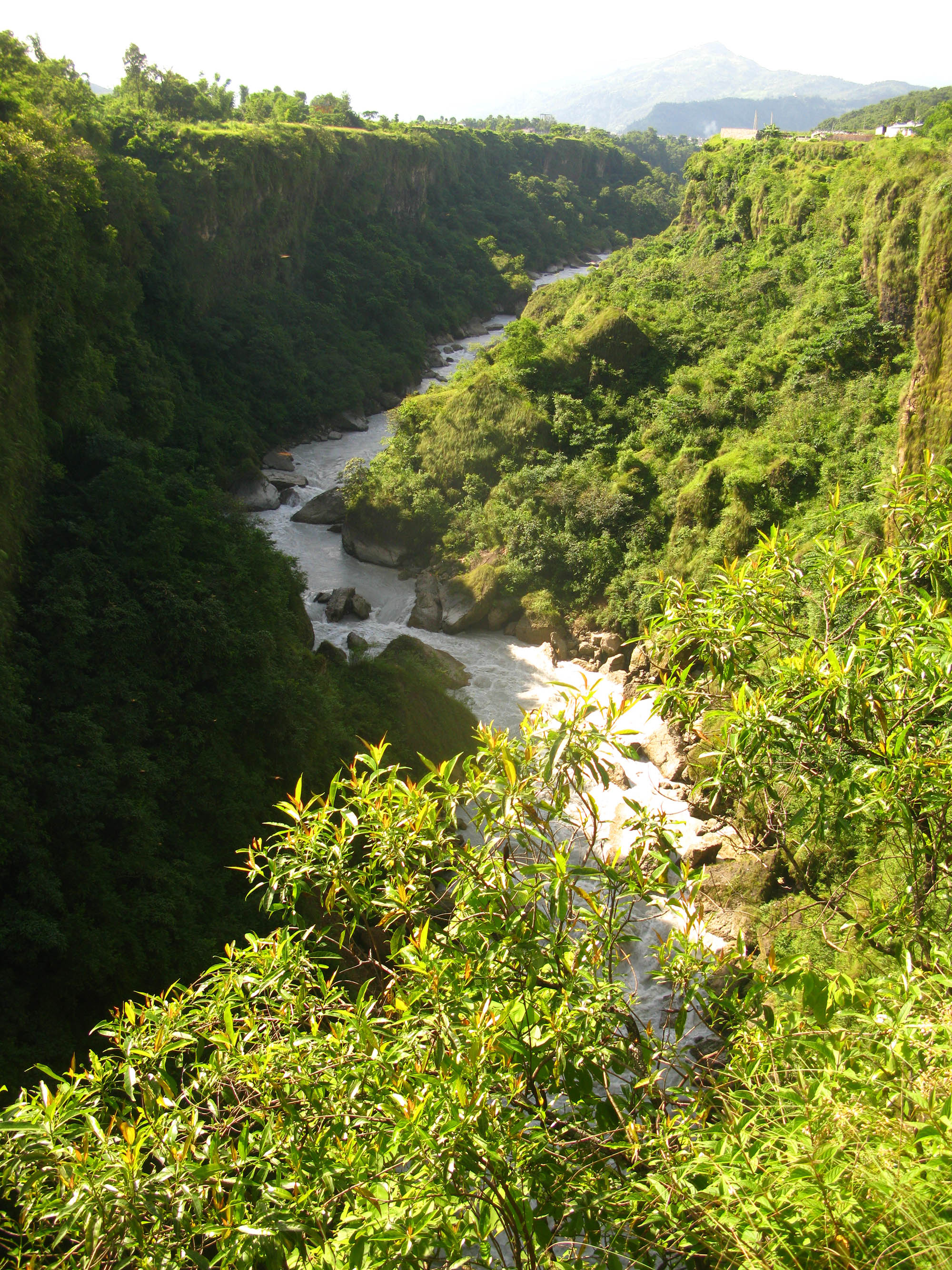
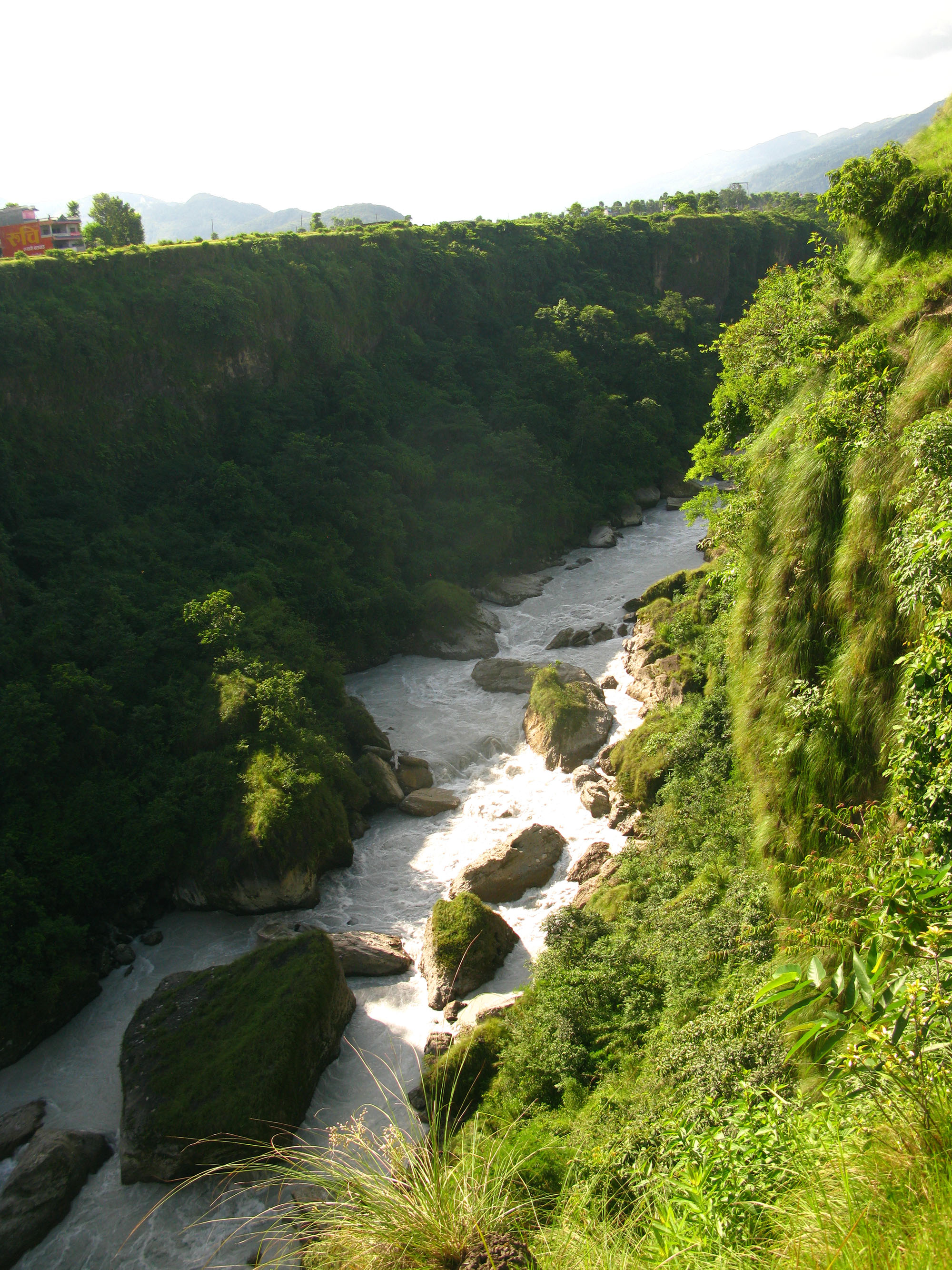
Next, I tried the Prithivi Narayan Campus, hardly ten minutes away from the K. I. Singh Bridge. As you go around the back of the campus premises, a complete change of scenery appears before your eyes—beautiful, if not spectacular. The Seti disappearing into a rocky cleft at the K.I. Singh Bridge, exits here at the base of a hill into an almost 400m wide canyon; more than 50 feet high embankments tower over the river.
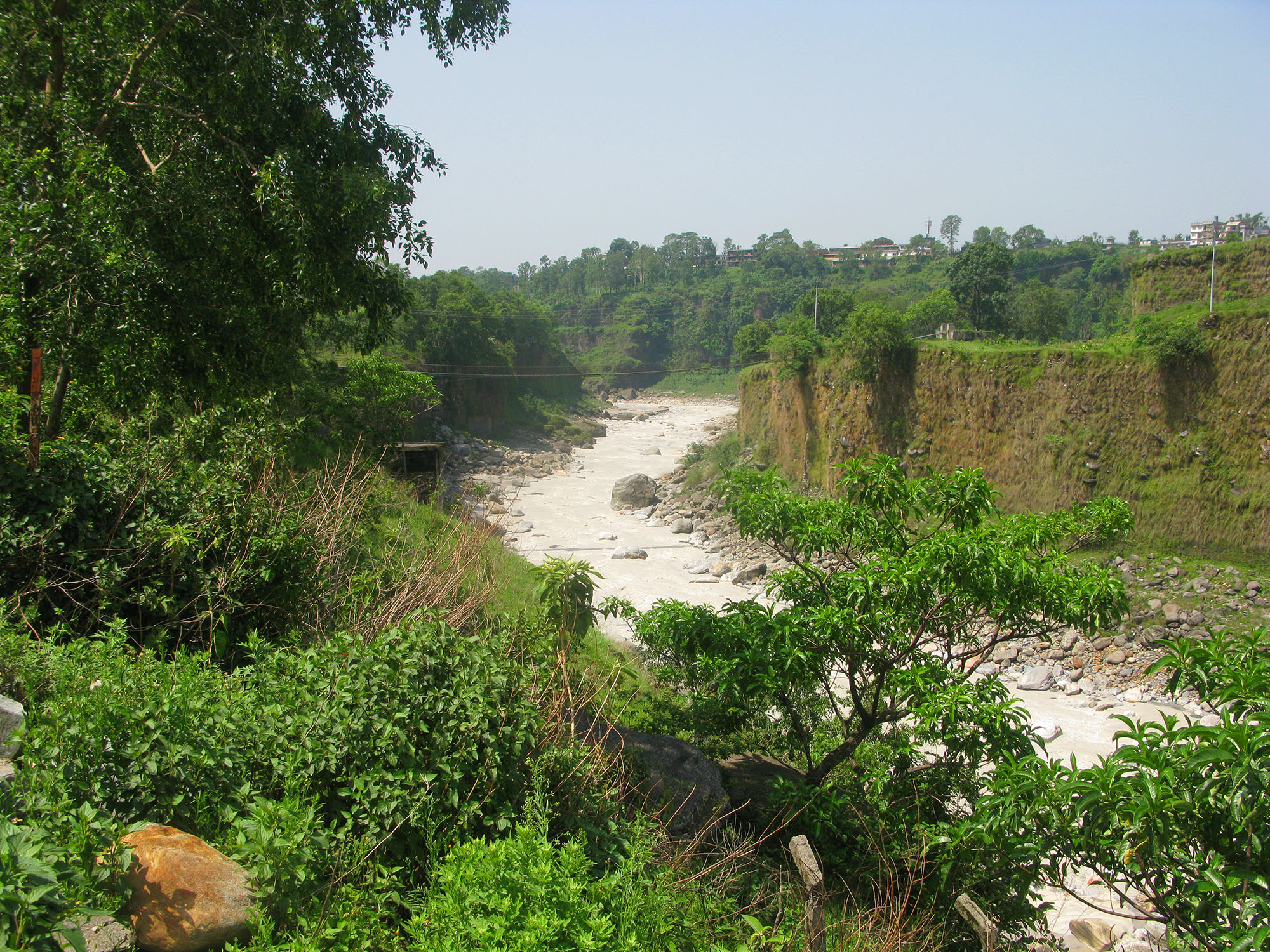
From the ridge, you can see way down a rivulet called Kali, which joins Seti at a foothill as the towering Kahun Danda(hill) soars into the eastern skies. On the other side of the ridge across a suspension bridge, you can make out a cluster of buildings: the Manipal Hospital. After crossing the suspension bridge a paved road parallel to the hospital’s compound goes north and a stony dirt road that goes down to the Seti-Kali river confluence.
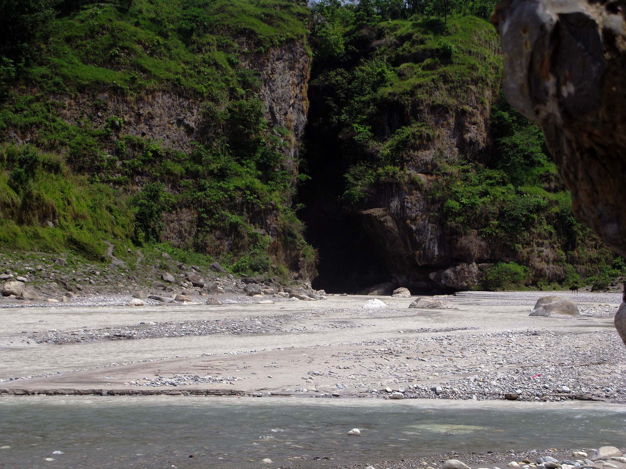
I decided to explore the confluence. If the Seti (in late June) water looked like milk coffee, the lesser Kali, which could be waded through, appeared light blue. The rivulet appeared busy: Men bathed, women washed clothes and kids frolicked in the cool clear water as the Seti surged out of a cavernous hole in the face of a hill with overhanging brushes. Curiously, it reminded me of the mystery cave entrance from my childhood favorite comic-book, Phantom: the Ghost Who Walks.
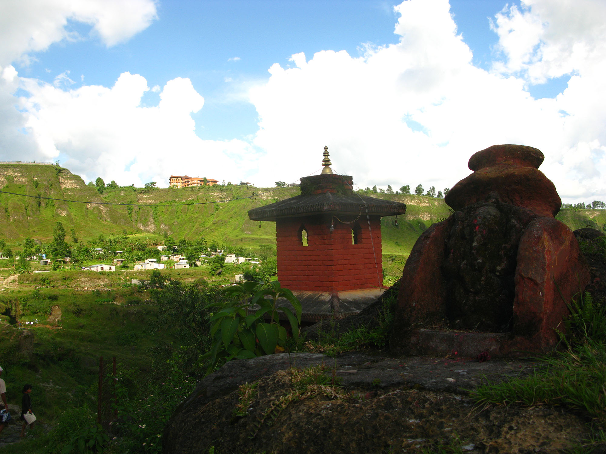
My next stop was at Fulbari. Seti here again confronts a wooded cliff. A flight of steps takes you down to the river. The opening in the hill resembles the one at the Seti-Kali confluence. A Narayan temple stands high up on the opposite embankment. The river disappears again into the hill with an intimidating roar.
Then, I headed towards the bustling Mahendra Pul(bridge), 20 minutes away on my bicycle. Here, most visitors to Pokhara get their first glimpse of the narrow Seti gorge. As you peer down to look at the Seti, you’ll shake your head apparently disapproving the piles of filth dumped in there.
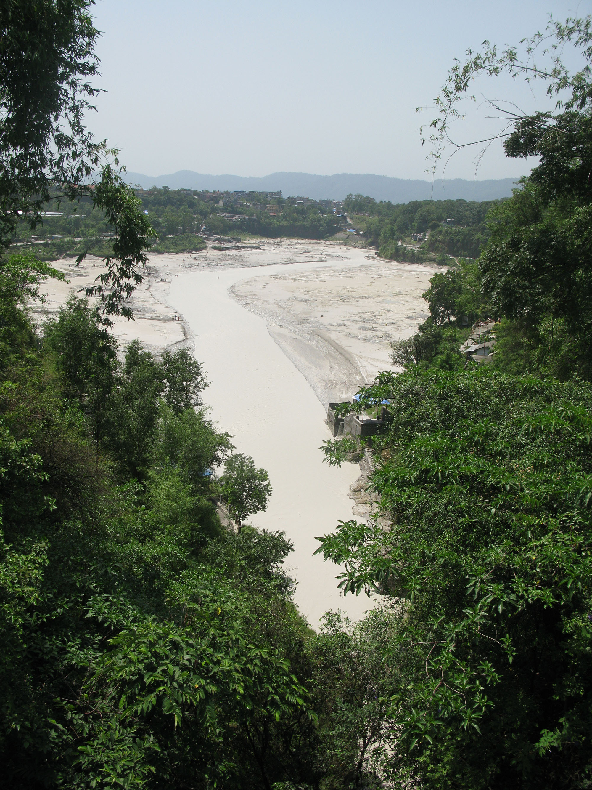
Subsequently, the Seti course took me to Ram Ghat, the cremation grounds of Pokhrelis. Due west of Mahendrapul and past a Ram temple, I crossed a bridge over the narrow Seti gorge for the third time. At the bridge, the Seti exits the fissure and bursts out into an amazingly wide expanse with vast sandbanks while high embankments flank the river. The Seti can be a frightening spectacle during the monsoon at Ramghat.
The river does not follow a strict pattern, however, and can turn most unpredictable—and devastating—monsoon or otherwise. Heavy rains, landslides, or snow avalanches in the high Annapurna region trigger off floods even in normally calm months.
The havoc and loss of lives caused by the May 5, 2012, Seti flash floods that unexpectedly hit the Pokhara valley bear testimony to this fact. At Ramghat, the Seti (in late June) was flanked by large sandbanks that stretched out to the footholds of the high embankments
For the third time, the Seti enters the gaping mouth of a hill here. During monsoon, the water level rises and covers almost the entire sandbanks.
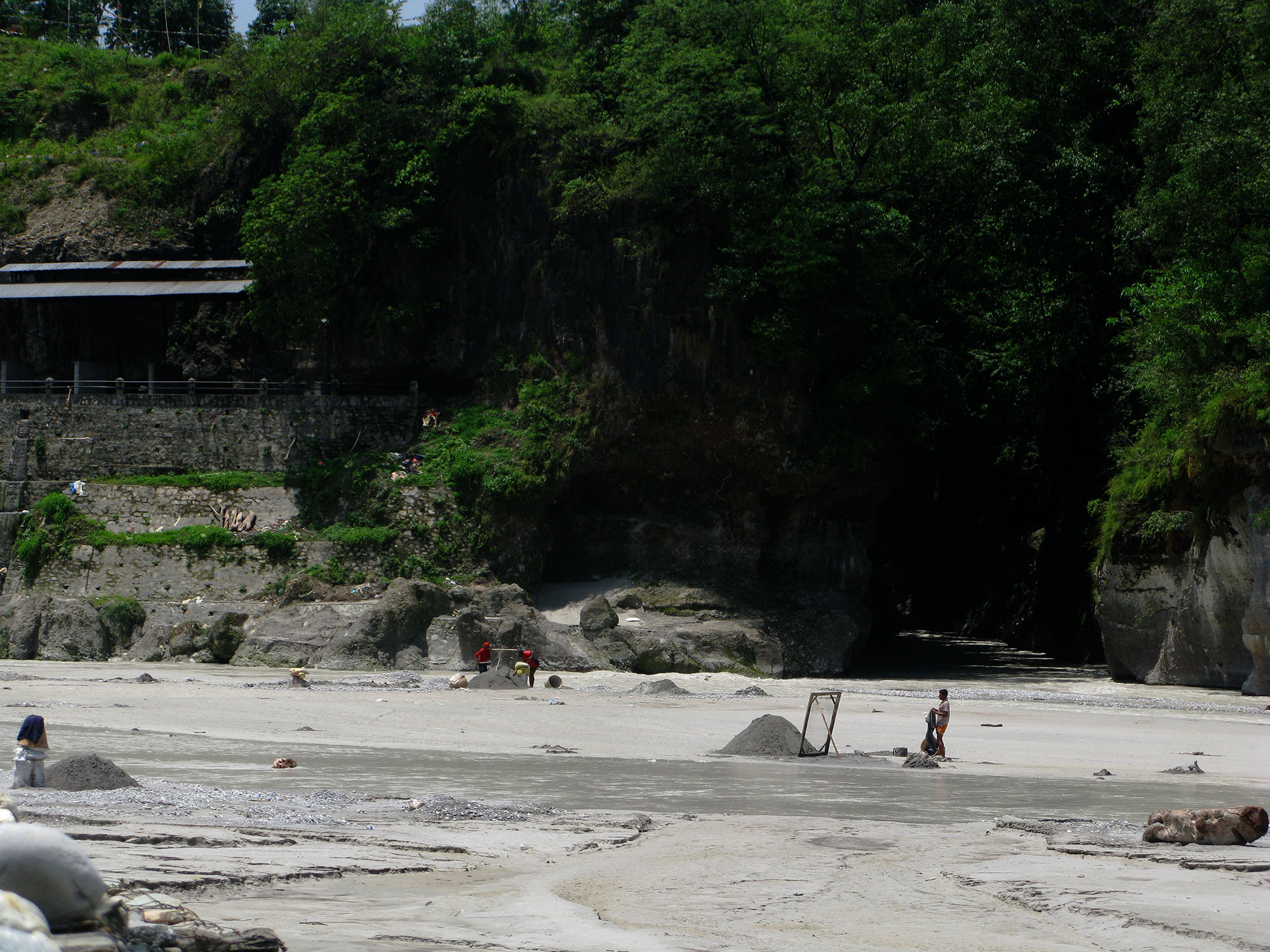
After Ramghat I caught the highway at Buddha Chowk, onwards to Prithivi Chowk, the busy intersection that reminded me of Kathmandu’s nasty gridlock. On the way, I stopped by the China Bridge or Naya Pul, as it’s called, and took a look down the narrow Seti gorge.
Now for the final leg, I pedaled south of the Bus Park at Prithivi Chowk on a gravel road into the outskirts. The road led down to a wooden bridge over the Seti, passable only for pedestrians and bicycles. With shrubs and dense undergrowth, the Seti water down the narrow gorge was hardly visible.
The river continued its journey through the chasm, to the southern ramparts of the Pokhara valley. As I proceeded on the paved road to Naya Gaun (literally, new village), I came to another bridge, a vehicular one this time. With newer settlements dotting the landscape, the pristine farther reaches of southern Pokhara valley too seemed encroached by human habitation.
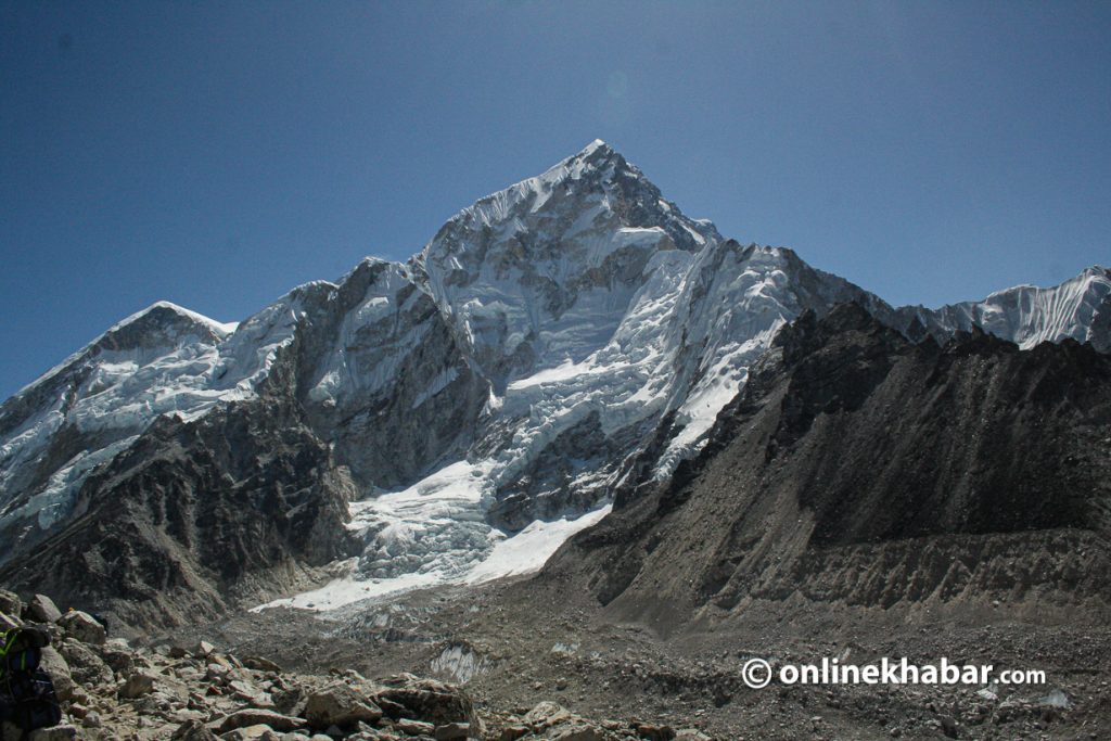
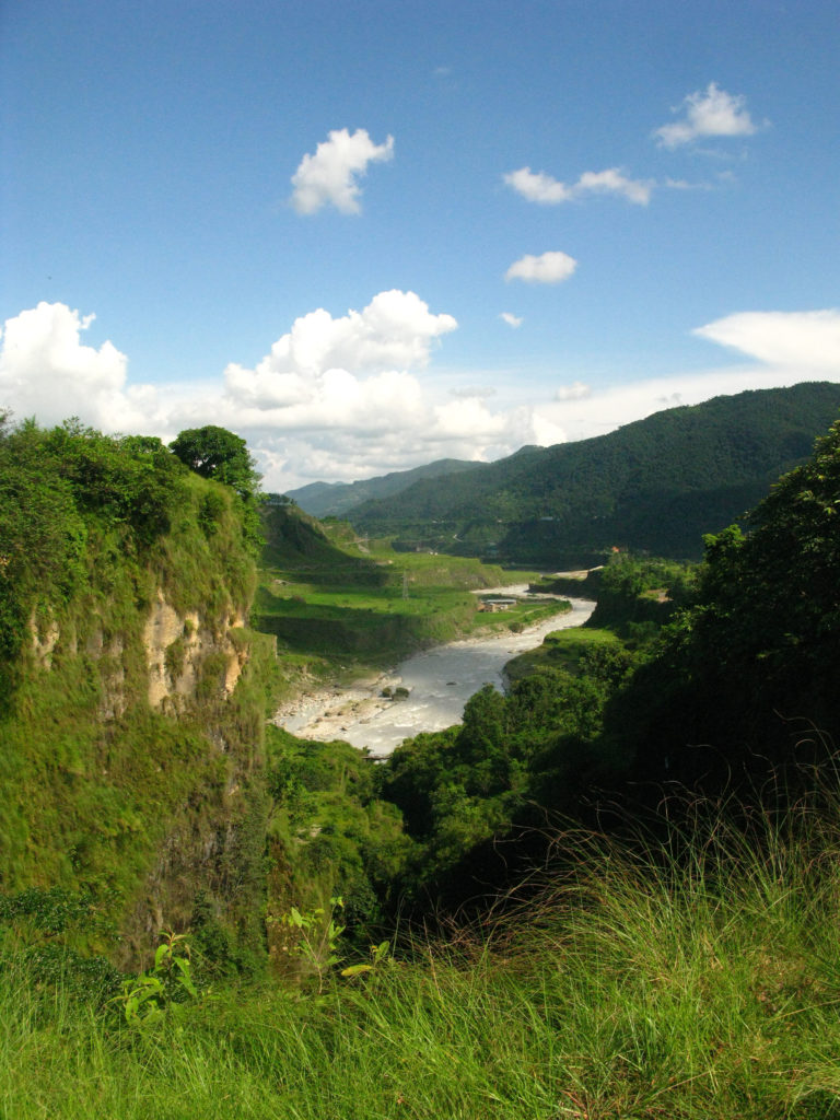
 After something like 20 minutes, I arrived at the IMM (International Mountain Museum), the place called Ratopahire or Gharipatan—a good vantage point that commanded a spectacular view in the north of the Machapuchare, the Annapurnas, Manasalu, Lamjung Himal and to the extreme left, the Dhaulagiri. The Seti, here, exited the chasm and wound its way down between boulders, getting steeper and rockier. I continued on the paved road till a bridge over Seti called Dhunge Sanghu (literally, a stone bridge). Here, the Seti for the last time entered the chasm with a deafening roar, the water churning white.
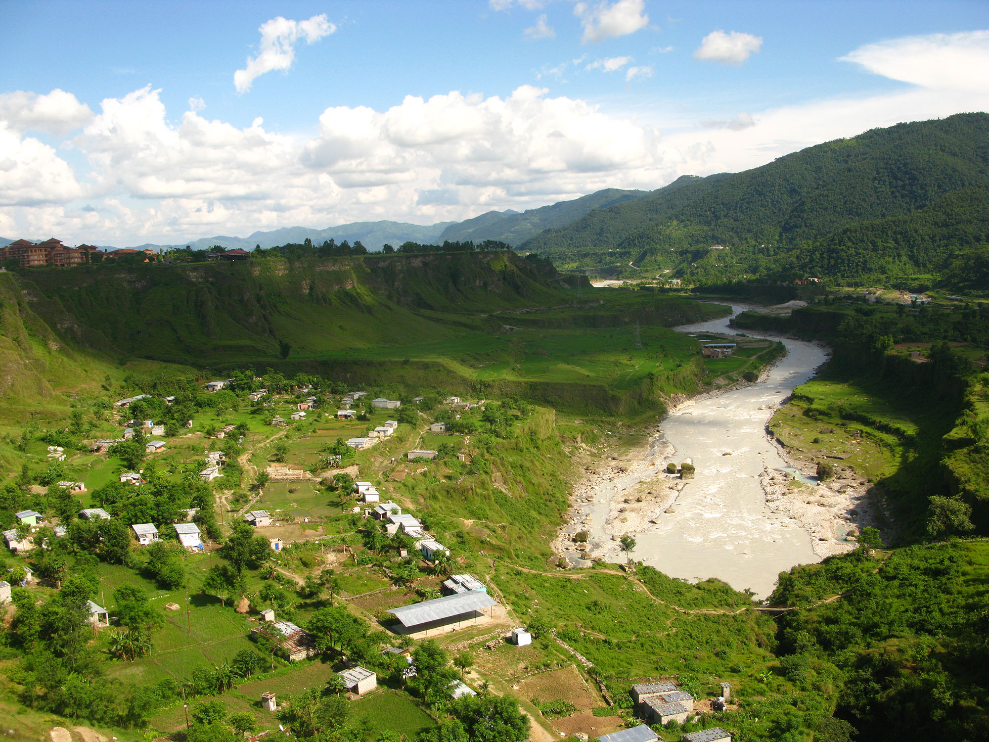
Dhunge Sanghu made a compelling view of the river and the surrounding countryside. Being on elevated land, I could make out the dark outline of the lushly wooded gorge from above as craggy walls with undergrowth flanked it. The eastern skyline, on the other hand, was dominated by the red building of the Fulbari Resort, perched high on a ridge.
 Some 200m down, I could make out a small bridge across the gorge. That was Sita Paila, beyond that the Seti spread out into a wide canyon, totally free, as it wound its way south and was lost on the horizon. A shrine of Shiva was located at the high banks of the river accessible by stone stairs.
My adventure ended there. Guess what, I had nearly covered the entire length of Pokhara city, crossed the Seti gorge no less than six times—and explored nothing short of a mystery trail. I pedaled back—happier and wiser.