Kathmandu, September 9
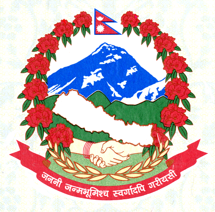
Following media reports about an error in manifestation of Nepal’s map in the national emblem as well as use of different unofficial maps, the government on Sunday has called on all stakeholders to make sure that the emblem and the map they use are verified by the Department of Survey.
Minister for Land Management, Cooperative and Poverty Alleviation, Padma Kumari Aryal, says she is issuing a circular to all government agencies against the use of unofficial emblem and maps.
Academic institutions and media houses have also been called to ensure the genuineness of the emblem and maps they use.
Organising a press conference in Kathmandu this morning, the Minister said she would also launch an investigation to find out how the errors surfaced in the emblem and map.
Meanwhile, the Ministry formed a monitoring committee to find out the status of use of unofficial emblem and maps and correct them. The committee also includes Foreign Secretary Shanker Das Bairagi as a member.
Aryal also announced that the government would provide official maps at zero or nominal price to make sure people’s easy access to the resources.
A broadsheet last week had reported that the map contained in the national emblem as used by many government offices has an erroneous map as it does not have Kalapani part on the northwestern side.